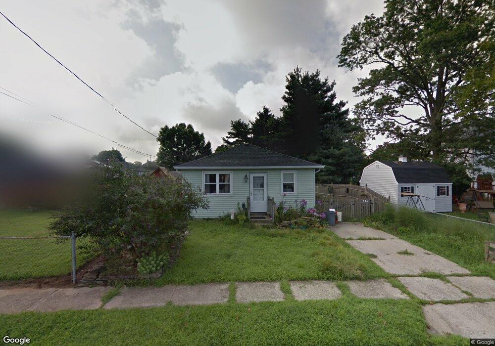
20 E New St Paulsboro, NJ 08066
Estimated Value: $199,000 - $247,000
3
Beds
2
Baths
1,100
Sq Ft
$201/Sq Ft
Est. Value
About This Home
This home is located at 20 E New St, Paulsboro, NJ 08066 and is currently estimated at $221,471, approximately $201 per square foot. 20 E New St is a home located in Gloucester County with nearby schools including Billingsport Elementary School, Loudenslager Elementary School, and Paulsboro High School.
Ownership History
Date
Name
Owned For
Owner Type
Purchase Details
Closed on
Oct 12, 2008
Sold by
Deutsche Bank National Trust Company
Bought by
Ormsby Cherie A
Current Estimated Value
Home Financials for this Owner
Home Financials are based on the most recent Mortgage that was taken out on this home.
Original Mortgage
$74,023
Interest Rate
6.11%
Mortgage Type
FHA
Purchase Details
Closed on
May 7, 2008
Sold by
Mclaughlin Gray Pamela
Bought by
Deutsche Bank National Trust Co and Morgan Stanley Loan Trust 2006 He4
Purchase Details
Closed on
Feb 10, 2006
Sold by
Bowdoin John A
Bought by
Mclaughlin-Gray Pamela and Mclaughlin Gray Pamela
Home Financials for this Owner
Home Financials are based on the most recent Mortgage that was taken out on this home.
Original Mortgage
$95,920
Interest Rate
6.17%
Mortgage Type
Purchase Money Mortgage
Create a Home Valuation Report for This Property
The Home Valuation Report is an in-depth analysis detailing your home's value as well as a comparison with similar homes in the area
Home Values in the Area
Average Home Value in this Area
Purchase History
| Date | Buyer | Sale Price | Title Company |
|---|---|---|---|
| Ormsby Cherie A | $75,000 | Group 21 Title Agency | |
| Deutsche Bank National Trust Co | -- | None Available | |
| Mclaughlin-Gray Pamela | $119,900 | -- |
Source: Public Records
Mortgage History
| Date | Status | Borrower | Loan Amount |
|---|---|---|---|
| Previous Owner | Ormsby Cherie A | $74,023 | |
| Previous Owner | Mclaughlin-Gray Pamela | $95,920 |
Source: Public Records
Tax History Compared to Growth
Tax History
| Year | Tax Paid | Tax Assessment Tax Assessment Total Assessment is a certain percentage of the fair market value that is determined by local assessors to be the total taxable value of land and additions on the property. | Land | Improvement |
|---|---|---|---|---|
| 2025 | $3,863 | $87,800 | $16,300 | $71,500 |
| 2024 | $3,860 | $87,800 | $16,300 | $71,500 |
| 2023 | $3,860 | $87,800 | $16,300 | $71,500 |
| 2022 | $3,789 | $87,800 | $16,300 | $71,500 |
| 2021 | $3,474 | $87,800 | $16,300 | $71,500 |
| 2020 | $3,693 | $87,800 | $16,300 | $71,500 |
| 2019 | $3,577 | $87,800 | $16,300 | $71,500 |
| 2018 | $3,372 | $87,800 | $16,300 | $71,500 |
| 2017 | $3,358 | $87,800 | $16,300 | $71,500 |
| 2016 | $3,199 | $87,800 | $16,300 | $71,500 |
| 2015 | $3,181 | $87,800 | $16,300 | $71,500 |
| 2014 | $3,082 | $91,500 | $18,800 | $72,700 |
Source: Public Records
Map
Nearby Homes
- 131 Jessup St
- 1519 Pine St
- 8 S Delaware St
- 1534 Pine St
- 28 E Adams St
- 106 E Adams St
- 11 W Washington St
- 27 29 E Adams St
- 122 W Washington St
- 21 W Adams St
- 212 E Jefferson St
- 129 W Washington St
- 28 W Jefferson St
- 227 W Buck St
- L8 Lodge Ave
- L5 Lodge Ave
- 0 Lodge Ave
- 269 W Broad St
- 140 142 W Jefferson St
- 1214 Walter Ave
- 1532 S Chestnut St
- 1528 S Chestnut St
- 1536 S Chestnut St
- 1525 S Delaware St
- 1519 S Delaware St
- 1540 S Chestnut St
- 23 E New St
- 1533 S Delaware St
- 21 E New St
- 25 E New St
- 1556 S Chestnut St
- 1541 S Delaware St
- 1515 S Delaware St
- 20 E Wood St
- 40 E New St
- 1543 S Delaware St
- 1509 S Delaware St
- 1530 S Delaware St
- 26 E Wood St
- 1547 S Delaware St