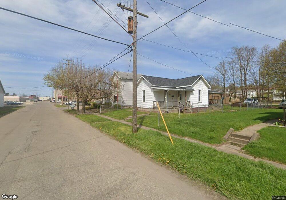
20 S Shawnee Ave Zanesville, OH 43701
Estimated Value: $269,037
3
Beds
1
Bath
2,719
Sq Ft
$99/Sq Ft
Est. Value
About This Home
This home is located at 20 S Shawnee Ave, Zanesville, OH 43701 and is currently estimated at $269,037, approximately $98 per square foot. 20 S Shawnee Ave is a home located in Muskingum County with nearby schools including Maysville Elementary School, Maysville Middle School, and Maysville High School.
Ownership History
Date
Name
Owned For
Owner Type
Purchase Details
Closed on
May 30, 2024
Sold by
Houston Diane
Bought by
20 S Shawnee Mission Llc
Current Estimated Value
Home Financials for this Owner
Home Financials are based on the most recent Mortgage that was taken out on this home.
Original Mortgage
$180,000
Outstanding Balance
$177,703
Interest Rate
7.02%
Mortgage Type
Credit Line Revolving
Estimated Equity
$91,334
Purchase Details
Closed on
Nov 16, 2023
Sold by
Buchanan Gloria S and Buchanan Joseph R
Bought by
Houston Diane
Purchase Details
Closed on
Aug 25, 2023
Sold by
Houston Diane
Bought by
Houston Diane and Buchanan Gloria S
Purchase Details
Closed on
Jul 28, 2015
Sold by
Houston Ernest & Diane
Bought by
Houston Diane
Home Financials for this Owner
Home Financials are based on the most recent Mortgage that was taken out on this home.
Interest Rate
4.04%
Create a Home Valuation Report for This Property
The Home Valuation Report is an in-depth analysis detailing your home's value as well as a comparison with similar homes in the area
Home Values in the Area
Average Home Value in this Area
Purchase History
| Date | Buyer | Sale Price | Title Company |
|---|---|---|---|
| 20 S Shawnee Mission Llc | $225,000 | None Listed On Document | |
| Houston Diane | -- | None Listed On Document | |
| Houston Diane | -- | None Listed On Document | |
| Houston Diane | -- | None Listed On Document | |
| Houston Diane | -- | -- |
Source: Public Records
Mortgage History
| Date | Status | Borrower | Loan Amount |
|---|---|---|---|
| Open | 20 S Shawnee Mission Llc | $180,000 | |
| Previous Owner | Houston Diane | -- |
Source: Public Records
Tax History Compared to Growth
Tax History
| Year | Tax Paid | Tax Assessment Tax Assessment Total Assessment is a certain percentage of the fair market value that is determined by local assessors to be the total taxable value of land and additions on the property. | Land | Improvement |
|---|---|---|---|---|
| 2024 | $1,670 | $42,455 | $3,430 | $39,025 |
| 2023 | $1,446 | $34,895 | $4,200 | $30,695 |
| 2022 | $1,410 | $34,895 | $4,200 | $30,695 |
| 2021 | $1,385 | $34,895 | $4,200 | $30,695 |
| 2020 | $1,423 | $34,895 | $4,200 | $30,695 |
| 2019 | $1,429 | $34,895 | $4,200 | $30,695 |
| 2018 | $725 | $34,895 | $4,200 | $30,695 |
| 2017 | $1,213 | $28,595 | $4,200 | $24,395 |
| 2016 | $1,225 | $28,600 | $4,200 | $24,400 |
| 2015 | $1,246 | $28,600 | $4,200 | $24,400 |
| 2013 | $1,302 | $28,600 | $4,200 | $24,400 |
Source: Public Records
Map
Nearby Homes
- 16 Beech Rock Dr
- 67 E King St
- 97 E Main St
- 72 N Pembroke Ave
- 72 E Berkley St
- 137 E King St
- 105 Rains Cir
- 108 N Montague Ave
- 77 Grandview Ave
- 2810 Maysville Pike
- 1705 Bradford Ave
- 211A E Main St
- 92 Beechrock Dr
- 1321 S Westwood Dr
- 2188 S River Rd
- 1119 Ellen Dr
- 108 Summit Dr
- 224 Searle St
- 109 Sherwood Dr
- 2945 Shaw Rd
- 24 S Shawnee Ave
- 28 S Shawnee Ave
- 32 S Shawnee Ave
- 31 S Shawnee Ave
- 24 E Main St
- 36 S Shawnee Ave
- 33 Kensington Ave
- 35 S Shawnee Ave
- 32 Kensington Ave
- 35 Kensington Ave
- 38 Kensington Ave
- 34 E Main St
- 48 S Shawnee Ave
- 40 Kensington Ave
- 40 E Main St
- 0 E Main St Unit 3917001
- 44 Kensington Ave
- 19 S Pembroke Ave
- 27 S Pembroke Ave
- 42 E Main St