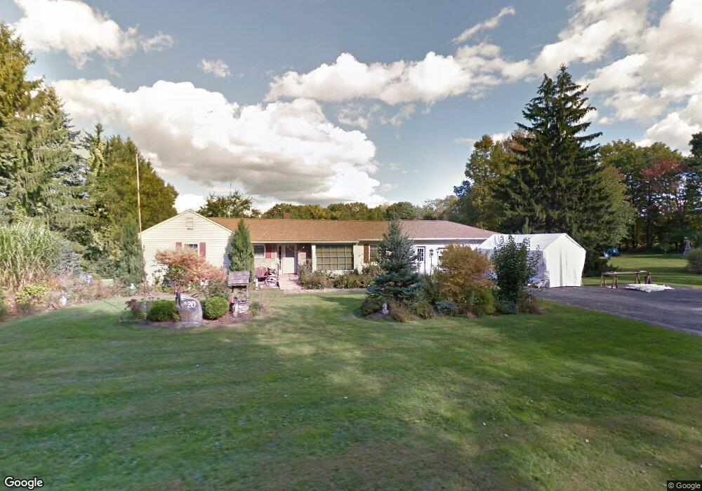
20 Whetstone Rd Harwinton, CT 06791
Estimated Value: $440,000 - $498,770
4
Beds
3
Baths
2,105
Sq Ft
$226/Sq Ft
Est. Value
About This Home
This home is located at 20 Whetstone Rd, Harwinton, CT 06791 and is currently estimated at $474,943, approximately $225 per square foot. 20 Whetstone Rd is a home located in Litchfield County with nearby schools including Harwinton Consolidated School, Har-Bur Middle School, and Lewis S. Mills High School.
Ownership History
Date
Name
Owned For
Owner Type
Purchase Details
Closed on
Oct 23, 2015
Sold by
Blanchette Dorothy J
Bought by
Blanchette Dorothy and Mcguffie Kimberly L
Current Estimated Value
Home Financials for this Owner
Home Financials are based on the most recent Mortgage that was taken out on this home.
Original Mortgage
$150,702
Outstanding Balance
$118,651
Interest Rate
3.9%
Estimated Equity
$356,292
Purchase Details
Closed on
Oct 23, 1998
Sold by
Griben George F and Griben Celine M
Bought by
Mcguffie Dorothy J and Blanchette Maurice E
Create a Home Valuation Report for This Property
The Home Valuation Report is an in-depth analysis detailing your home's value as well as a comparison with similar homes in the area
Home Values in the Area
Average Home Value in this Area
Purchase History
| Date | Buyer | Sale Price | Title Company |
|---|---|---|---|
| Blanchette Dorothy | $127,686 | -- | |
| Blanchette Dorothy J | $127,686 | -- | |
| Blanchette Dorothy | $127,686 | -- | |
| Mcguffie Dorothy J | $155,000 | -- | |
| Mcguffie Dorothy J | $155,000 | -- |
Source: Public Records
Mortgage History
| Date | Status | Borrower | Loan Amount |
|---|---|---|---|
| Open | Mcguffie Dorothy J | $75,000 | |
| Open | Mcguffie Dorothy J | $150,702 |
Source: Public Records
Tax History Compared to Growth
Tax History
| Year | Tax Paid | Tax Assessment Tax Assessment Total Assessment is a certain percentage of the fair market value that is determined by local assessors to be the total taxable value of land and additions on the property. | Land | Improvement |
|---|---|---|---|---|
| 2025 | $6,571 | $285,690 | $85,970 | $199,720 |
| 2024 | $6,542 | $285,690 | $85,970 | $199,720 |
| 2023 | $5,202 | $178,150 | $62,410 | $115,740 |
| 2022 | $5,077 | $178,150 | $62,410 | $115,740 |
| 2021 | $5,113 | $178,150 | $62,410 | $115,740 |
| 2020 | $4,988 | $178,150 | $62,410 | $115,740 |
| 2019 | $4,988 | $178,150 | $62,410 | $115,740 |
| 2018 | $5,416 | $193,430 | $78,030 | $115,400 |
| 2017 | $5,377 | $193,430 | $78,030 | $115,400 |
| 2016 | $5,377 | $193,430 | $78,030 | $115,400 |
| 2015 | $5,281 | $193,430 | $78,030 | $115,400 |
| 2014 | $5,203 | $193,430 | $78,030 | $115,400 |
Source: Public Records
Map
Nearby Homes
- 21 South Rd
- 164 Birge Park Rd
- 74 Pine Ridge Dr
- 39 Orchard Hill Rd
- 28 Lily Pond Rd
- 448 Litchfield Rd
- 183 Wildcat Hill Rd
- 25 Plymouth Rd
- 83 Shingle Mill Rd
- Lot 2 Birch Hill Rd
- 29 Branch Rd
- 544 Litchfield Rd
- 65 Oak Meadow Ln Unit 65
- 21 Oak Meadow Ln
- 73 Shirley Rd
- 172 Pierce St
- 0 Campville Hill Rd
- 29 Hannah Way
- 69 Sunrise Dr
- 528 Clearview Ave
- 14 Whetstone Rd
- 17 Whetstone Rd
- 153 Litchfield Rd
- 0 Whetstone Rd Unit 170043939
- 0 Whetstone Rd Unit G10178522
- 0 Whetstone Rd
- 00 Whetstone Rd
- 31 Whetstone Rd
- 145 Litchfield Rd
- 195 Litchfield Rd
- 8 Whetstone Rd
- 0 Davis Rd Unit G500037
- 0 Davis Rd Unit G538797
- 0 Davis Rd Unit L141236
- 0 Davis Rd Unit G646609
- 0 Davis Rd Unit G690496
- 0 Davis Rd Unit L10055297
- 0 Davis Rd Unit G10119436
- 0 Davis Rd Unit L10122493
- 0 Davis Rd Unit G10236462