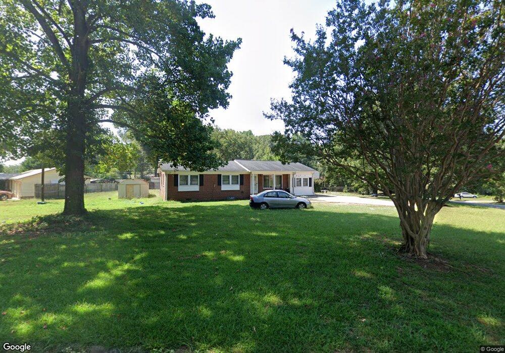
200 Beverly Ln Anderson, SC 29626
Estimated Value: $194,000 - $249,000
3
Beds
2
Baths
1,329
Sq Ft
$162/Sq Ft
Est. Value
About This Home
This home is located at 200 Beverly Ln, Anderson, SC 29626 and is currently estimated at $215,223, approximately $161 per square foot. 200 Beverly Ln is a home located in Anderson County with nearby schools including McLees Elementary School, Robert Anderson Middle School, and Westside High School.
Ownership History
Date
Name
Owned For
Owner Type
Purchase Details
Closed on
Feb 23, 2023
Sold by
Moore Carolyn Elizabeth S
Bought by
Moore Kayla
Current Estimated Value
Purchase Details
Closed on
Nov 21, 2018
Sold by
Hurt Deborah Carol and Moore Johnny Earl
Bought by
Moore Caroly E
Purchase Details
Closed on
Jun 14, 2013
Sold by
Estate Of John E Moore
Bought by
Moore Carolyn E and Hurt Deborah Carol
Create a Home Valuation Report for This Property
The Home Valuation Report is an in-depth analysis detailing your home's value as well as a comparison with similar homes in the area
Home Values in the Area
Average Home Value in this Area
Purchase History
| Date | Buyer | Sale Price | Title Company |
|---|---|---|---|
| Moore Kayla | -- | -- | |
| Moore Caroly E | -- | None Available | |
| Moore Carolyn E | -- | -- |
Source: Public Records
Tax History Compared to Growth
Tax History
| Year | Tax Paid | Tax Assessment Tax Assessment Total Assessment is a certain percentage of the fair market value that is determined by local assessors to be the total taxable value of land and additions on the property. | Land | Improvement |
|---|---|---|---|---|
| 2024 | $640 | $4,780 | $600 | $4,180 |
| 2023 | $640 | $3,590 | $600 | $2,990 |
| 2022 | $1,755 | $5,380 | $900 | $4,480 |
| 2021 | $1,620 | $4,830 | $900 | $3,930 |
| 2020 | $1,594 | $4,830 | $900 | $3,930 |
| 2019 | $1,594 | $4,830 | $900 | $3,930 |
| 2018 | $174 | $3,220 | $600 | $2,620 |
| 2017 | -- | $3,220 | $600 | $2,620 |
| 2016 | $161 | $3,050 | $480 | $2,570 |
| 2015 | $164 | $3,050 | $480 | $2,570 |
| 2014 | $164 | $3,050 | $480 | $2,570 |
Source: Public Records
Map
Nearby Homes
- 203 Fernwood Cir
- 318 Fretwell Dr
- 2403 Dobbins Bridge Rd
- 2501 Dobbins Bridge Rd
- 202 Hazelwood Ave
- 205 Hazelwood Ave Unit Lot 10 Block A
- 209 and 205 Hazelwood Ave Unit Lots 12 (209) & 10 (
- 209 Hazelwood Ave Unit Lot 12 Block A
- 2521 W Whitner St
- 109 Sunrise Ct
- 111 Sunrise Ct Unit SUN0006
- 111 Sunrise Ct
- 307 Beaty Square
- 113 Sunrise Ct
- 636 Jasmin Dr
- 417 Westwood Dr
- 1520 Pearman Dairy Rd
- 0000 Pearman Dairy Rd
- 00 Highway 24
- 211 Richey St
- 202 Beverly Ln
- 200 Fernwood Cir
- 205 Fernwood Cir
- 202 Fernwood Cir
- 204 Beverly Ln
- 203 Jasmin Dr
- 102 Fernwood Cir
- 205 Jasmin Dr
- 2201 Dobbins Bridge Rd
- 2105 Dobbins Bridge Rd
- 300 Auburn Ave
- 301 Jasmin Dr
- 100 Fernwood Cir
- 302 Auburn Ave
- 00 Jasmin Dr
- 304 Auburn Ave
- 300 Jasmin Dr
- 301 Auburn Ave
- 2007 Linda Dr
- 303 Auburn Ave