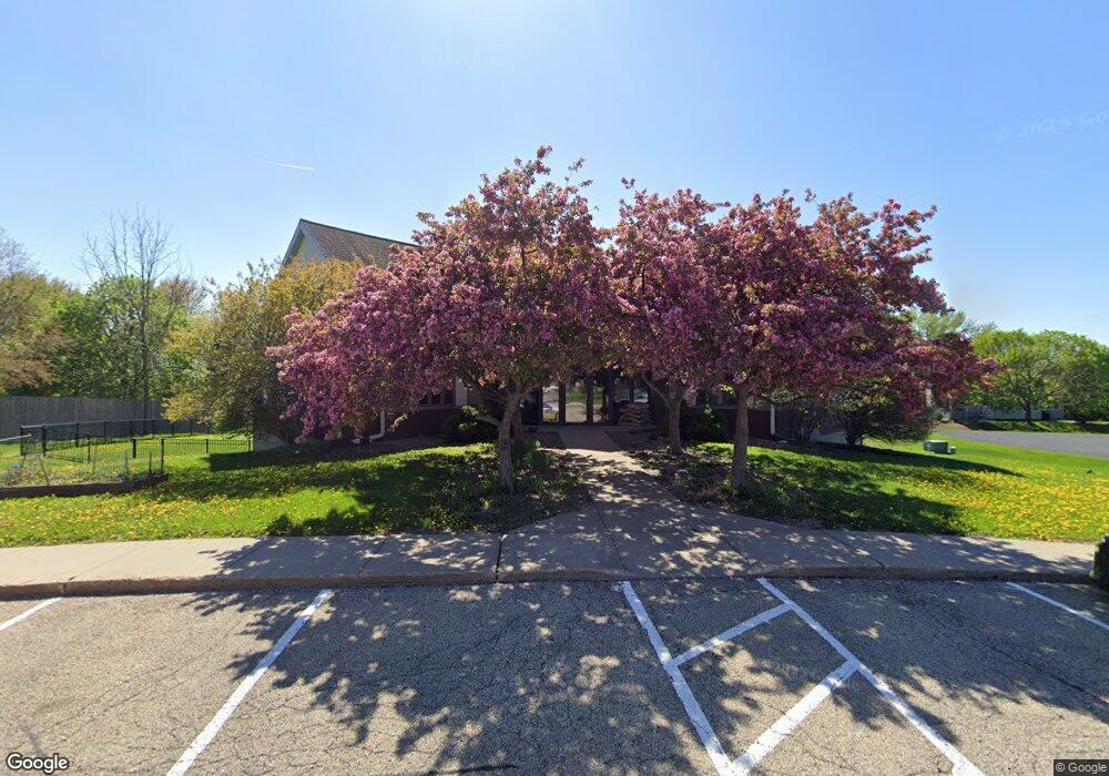
200 Enterprise Dr Verona, WI 53593
Estimated Value: $1,278,512
--
Bed
--
Bath
--
Sq Ft
0.92
Acres
About This Home
This home is located at 200 Enterprise Dr, Verona, WI 53593 and is currently estimated at $1,278,512. 200 Enterprise Dr is a home located in Dane County with nearby schools including Sugar Creek Elementary School, Badger Ridge Middle School, and Verona Area High School.
Ownership History
Date
Name
Owned For
Owner Type
Purchase Details
Closed on
Apr 29, 2015
Sold by
Carob Enterprises Llc
Bought by
Sherman & Stark Holdings Llc
Current Estimated Value
Home Financials for this Owner
Home Financials are based on the most recent Mortgage that was taken out on this home.
Original Mortgage
$577,000
Interest Rate
3.77%
Mortgage Type
Future Advance Clause Open End Mortgage
Create a Home Valuation Report for This Property
The Home Valuation Report is an in-depth analysis detailing your home's value as well as a comparison with similar homes in the area
Home Values in the Area
Average Home Value in this Area
Purchase History
| Date | Buyer | Sale Price | Title Company |
|---|---|---|---|
| Sherman & Stark Holdings Llc | $623,500 | None Available |
Source: Public Records
Mortgage History
| Date | Status | Borrower | Loan Amount |
|---|---|---|---|
| Closed | Sherman & Stark Holdings Llc | $577,000 |
Source: Public Records
Tax History Compared to Growth
Tax History
| Year | Tax Paid | Tax Assessment Tax Assessment Total Assessment is a certain percentage of the fair market value that is determined by local assessors to be the total taxable value of land and additions on the property. | Land | Improvement |
|---|---|---|---|---|
| 2024 | $13,819 | $863,100 | $336,200 | $526,900 |
| 2023 | $14,208 | $783,700 | $336,200 | $447,500 |
| 2021 | $14,591 | $749,600 | $326,700 | $422,900 |
| 2020 | $15,335 | $749,600 | $326,700 | $422,900 |
| 2019 | $13,318 | $563,600 | $254,400 | $309,200 |
| 2018 | $13,156 | $563,600 | $254,400 | $309,200 |
| 2017 | $12,722 | $563,600 | $254,400 | $309,200 |
| 2016 | $12,211 | $563,600 | $254,400 | $309,200 |
| 2015 | $12,215 | $563,600 | $254,400 | $309,200 |
| 2014 | $12,215 | $563,600 | $254,400 | $309,200 |
| 2013 | $12,726 | $563,600 | $254,400 | $309,200 |
Source: Public Records
Map
Nearby Homes
- 6435 County Highway M
- 554 Enterprise Dr
- 312 Schweitzer Dr
- 188 Depot Dr
- 803 N Main St
- 875 N Edge Trail
- 476 Basswood Ave
- 301 Barbara St
- 304 Barbara St
- 527 Linden Ct
- 833 Hemlock Dr Unit 833
- 885 Hemlock Dr Unit 885
- 909 Hemlock Dr Unit 909
- 511 Harvest Ln
- 1204 Enterprise Dr
- 143 Paoli St
- 959 Walnut St
- 633 Diana Dr
- 571 S Hillcrest Dr
- 6690 Grandview Rd
- 201 Noel Way
- 203 Noel Way
- 205 Noel Way
- 113 Noel Way
- 207 Noel Way
- 209 Noel Way
- 111 Noel Way
- 135 Enterprise Dr
- 230 Horizon Dr Unit 102
- 230 Horizon Dr Unit 100
- 211 Noel Way
- 109 Noel Way
- 202 Noel Way
- 204 Noel Way
- 200 Noel Way
- 206 Noel Way
- 110 Enterprise Dr Unit 204
- 110 Enterprise Dr Unit 203
- 110 Enterprise Dr Unit 202
- 110 Enterprise Dr Unit 201