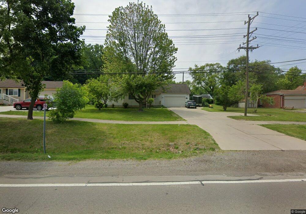
200 S Cass Lake Rd Waterford, MI 48328
Waterford Township NeighborhoodEstimated Value: $361,257 - $379,000
3
Beds
3
Baths
1,272
Sq Ft
$291/Sq Ft
Est. Value
About This Home
This home is located at 200 S Cass Lake Rd, Waterford, MI 48328 and is currently estimated at $369,814, approximately $290 per square foot. 200 S Cass Lake Rd is a home located in Oakland County with nearby schools including Donelson Hills Elementary School, Mason Middle School, and Waterford Mott High School.
Ownership History
Date
Name
Owned For
Owner Type
Purchase Details
Closed on
Jan 31, 2024
Sold by
Cheleuka Fai Tanil
Bought by
Cheleuka Fai Tanil
Current Estimated Value
Purchase Details
Closed on
Nov 3, 2023
Sold by
Cheleuka Fai Tanil
Bought by
Cheleuka Fai Tanil and Sanni Olayemi Olayinka
Purchase Details
Closed on
Oct 31, 2008
Sold by
Hunt Robert J and Hunt Gina C
Bought by
Majamanda Faines Tanil and Sanni Olayemi Olayinka
Home Financials for this Owner
Home Financials are based on the most recent Mortgage that was taken out on this home.
Original Mortgage
$160,876
Interest Rate
6.09%
Mortgage Type
FHA
Purchase Details
Closed on
Aug 1, 2000
Sold by
Hunt Robert J
Bought by
Hunt Robert
Purchase Details
Closed on
Aug 23, 1999
Sold by
Hunt Robert J
Bought by
Hunt Robert J
Create a Home Valuation Report for This Property
The Home Valuation Report is an in-depth analysis detailing your home's value as well as a comparison with similar homes in the area
Home Values in the Area
Average Home Value in this Area
Purchase History
| Date | Buyer | Sale Price | Title Company |
|---|---|---|---|
| Cheleuka Fai Tanil | -- | Land Title | |
| Cheleuka Fai Tanil | -- | Land Title | |
| Cheleuka Fai Tanil | -- | None Listed On Document | |
| Cheleuka Fai Tanil | -- | None Listed On Document | |
| Majamanda Faines Tanil | $163,000 | Eit Title | |
| Hunt Robert | -- | -- | |
| Hunt Robert J | -- | -- |
Source: Public Records
Mortgage History
| Date | Status | Borrower | Loan Amount |
|---|---|---|---|
| Previous Owner | Majamanda Faines Tanil | $160,876 |
Source: Public Records
Tax History Compared to Growth
Tax History
| Year | Tax Paid | Tax Assessment Tax Assessment Total Assessment is a certain percentage of the fair market value that is determined by local assessors to be the total taxable value of land and additions on the property. | Land | Improvement |
|---|---|---|---|---|
| 2024 | $7,083 | $180,050 | $0 | $0 |
| 2023 | $3,173 | $167,090 | $0 | $0 |
| 2022 | $3,964 | $152,080 | $0 | $0 |
| 2021 | $3,895 | $147,350 | $0 | $0 |
| 2020 | $2,780 | $153,440 | $0 | $0 |
| 2019 | $3,707 | $145,970 | $0 | $0 |
| 2018 | $3,709 | $123,340 | $0 | $0 |
| 2017 | $3,439 | $123,340 | $0 | $0 |
| 2016 | $3,424 | $106,750 | $0 | $0 |
| 2015 | -- | $85,880 | $0 | $0 |
| 2014 | -- | $65,660 | $0 | $0 |
| 2011 | -- | $76,950 | $0 | $0 |
Source: Public Records
Map
Nearby Homes
- 321 Beverly Estates Dr Unit 5
- 345 Beverly Island Dr
- The Dover Plan at Hogarth
- The Dawson Plan at Hogarth
- The Concord Plan at Hogarth
- The Everest Plan at Hogarth
- 433 Hogarth St
- 425 Hogarth St
- 424 Hogarth St
- 540 Lake Village Ave
- 126 S Roslyn Rd
- 581 S Winding Dr
- 445 Lakeside Dr
- 603 Woodingham Ave
- 3066 W Huron St
- 3014 Edgewater Dr
- 125 N Winding Dr
- 0 N Winding Dr
- 3860 Lawley Ave
- 87 N Roslyn Rd
- 200 S Cass Lake Rd
- 228 S Cass Lake Rd
- 3521 Brookdale Ln
- 3539 Brookdale Ln
- 3555 Brookdale Ln
- 191 S Cass Lake Rd
- 205 S Cass Lake Rd
- 219 S Cass Lake Rd
- 3569 Brookdale Ln
- 233 S Cass Lake Rd
- 3540 Oakshire Ave
- 141 S Cass Lake Rd
- 141 Cass Lake Rd
- 3556 Oakshire Ave
- 3522 Oakshire Ave
- 3522 Brookdale Ln
- 247 S Cass Lake Rd
- 3585 Brookdale Ln
- 3570 Oakshire Ave
- 3586 Oakshire Ave