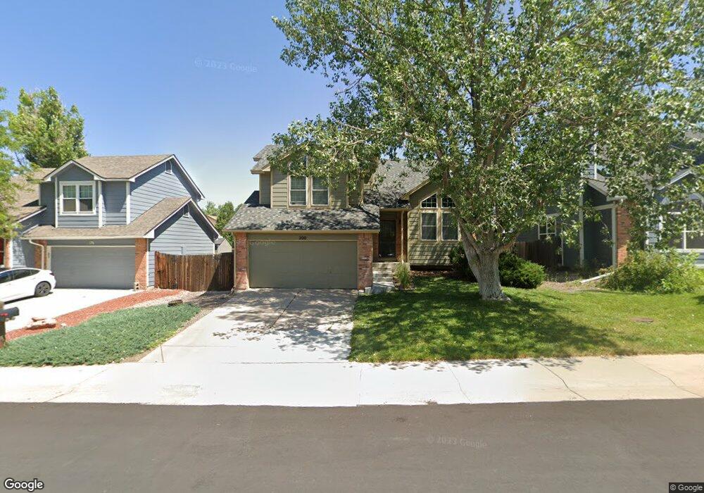
200 S Pembrook St Castle Rock, CO 80104
Founders Village NeighborhoodEstimated Value: $527,000 - $557,000
3
Beds
3
Baths
2,359
Sq Ft
$228/Sq Ft
Est. Value
About This Home
This home is located at 200 S Pembrook St, Castle Rock, CO 80104 and is currently estimated at $538,912, approximately $228 per square foot. 200 S Pembrook St is a home located in Douglas County with nearby schools including Rock Ridge Elementary School, Mesa Middle School, and Douglas County High School.
Ownership History
Date
Name
Owned For
Owner Type
Purchase Details
Closed on
Apr 19, 2016
Sold by
Wilemon Josh R and Wilemon Misa A
Bought by
Wilemon Joshua R and Wilemon Misa A
Current Estimated Value
Home Financials for this Owner
Home Financials are based on the most recent Mortgage that was taken out on this home.
Original Mortgage
$236,000
Outstanding Balance
$187,795
Interest Rate
3.73%
Mortgage Type
New Conventional
Estimated Equity
$351,117
Purchase Details
Closed on
Apr 20, 2012
Sold by
Scott James D and Scott Sheri L
Bought by
Wilemon John R and Wilemon Misa A
Home Financials for this Owner
Home Financials are based on the most recent Mortgage that was taken out on this home.
Original Mortgage
$207,600
Interest Rate
3.75%
Mortgage Type
FHA
Purchase Details
Closed on
Feb 19, 2004
Sold by
Scott James D and Scott Sheri L Vande
Bought by
Scott James D and Scott Sheri L
Home Financials for this Owner
Home Financials are based on the most recent Mortgage that was taken out on this home.
Original Mortgage
$174,400
Interest Rate
4.5%
Mortgage Type
Unknown
Purchase Details
Closed on
Feb 3, 2003
Sold by
Remington Carol and Remington William A
Bought by
Scott James D and Vande Voort Sheri L
Home Financials for this Owner
Home Financials are based on the most recent Mortgage that was taken out on this home.
Original Mortgage
$208,724
Interest Rate
5.84%
Mortgage Type
FHA
Purchase Details
Closed on
Jun 29, 1994
Sold by
Parlett Philip M
Bought by
Remington Carol and Remington William A
Home Financials for this Owner
Home Financials are based on the most recent Mortgage that was taken out on this home.
Original Mortgage
$92,000
Interest Rate
8.46%
Purchase Details
Closed on
May 26, 1989
Sold by
Bunch James M and Bunch Bonnie L
Bought by
Parlett Philip M
Purchase Details
Closed on
Dec 5, 1986
Sold by
Richmond Homes Ltd
Bought by
Bunch James M and Bunch Bonnie L
Create a Home Valuation Report for This Property
The Home Valuation Report is an in-depth analysis detailing your home's value as well as a comparison with similar homes in the area
Home Values in the Area
Average Home Value in this Area
Purchase History
| Date | Buyer | Sale Price | Title Company |
|---|---|---|---|
| Wilemon Joshua R | -- | None Available | |
| Wilemon John R | $213,000 | Land Title Guarantee Company | |
| Scott James D | -- | -- | |
| Scott James D | $212,000 | -- | |
| Remington Carol | $115,000 | Heritage Title | |
| Parlett Philip M | $106,500 | -- | |
| Bunch James M | $106,100 | -- |
Source: Public Records
Mortgage History
| Date | Status | Borrower | Loan Amount |
|---|---|---|---|
| Open | Wilemon Joshua R | $236,000 | |
| Closed | Wilemon John R | $207,600 | |
| Previous Owner | Scott James D | $174,400 | |
| Previous Owner | Scott James D | $208,724 | |
| Previous Owner | Remington Carol | $92,000 | |
| Closed | Remington Carol | $11,500 | |
| Closed | Scott James D | $37,576 |
Source: Public Records
Tax History Compared to Growth
Tax History
| Year | Tax Paid | Tax Assessment Tax Assessment Total Assessment is a certain percentage of the fair market value that is determined by local assessors to be the total taxable value of land and additions on the property. | Land | Improvement |
|---|---|---|---|---|
| 2024 | $5,820 | $39,110 | $8,430 | $30,680 |
| 2023 | $5,854 | $39,110 | $8,430 | $30,680 |
| 2022 | $4,189 | $26,460 | $6,220 | $20,240 |
| 2021 | $4,267 | $26,460 | $6,220 | $20,240 |
| 2020 | $4,077 | $26,020 | $5,250 | $20,770 |
| 2019 | $4,079 | $26,020 | $5,250 | $20,770 |
| 2018 | $3,543 | $22,430 | $4,060 | $18,370 |
| 2017 | $3,410 | $22,430 | $4,060 | $18,370 |
| 2016 | $2,885 | $19,810 | $3,930 | $15,880 |
| 2015 | $1,461 | $19,810 | $3,930 | $15,880 |
| 2014 | $2,479 | $16,140 | $3,420 | $12,720 |
Source: Public Records
Map
Nearby Homes
- 176 S Pembrook St
- 5181 Devon Ave
- 5282 Devon Ave
- 510 Fairhaven St
- 5133 E Essex Ave
- 5323 E Sandpiper Ave
- 321 Lockwood St
- 576 S Lindsey St
- 596 S Lindsey St
- 378 Benton St
- 5326 E Howe St
- 630 Fairhaven St
- 364 N Willow St
- 4590 Wakefield Ave
- 535 Howe St
- 157 S Quicksilver Ave
- 109 N Quicksilver Ave
- 4372 E Andover Ave
- 98 N Quicksilver Ave
- 5521 Spruce Ave
- 212 S Pembrook St
- 133 S Amherst St
- 152 S Pembrook St
- 117 S Amherst St
- 151 S Amherst St
- 232 S Pembrook St
- 171 S Amherst St
- 101 S Amherst St
- 199 S Pembrook St
- 132 S Pembrook St
- 219 S Pembrook St
- 85 S Amherst St
- 251 S Amherst St
- 221 S Amherst St
- 229 S Pembrook St
- 191 S Amherst St
- 112 S Pembrook St
- 69 S Amherst St
- 241 S Pembrook St
- 129 S Pembrook St