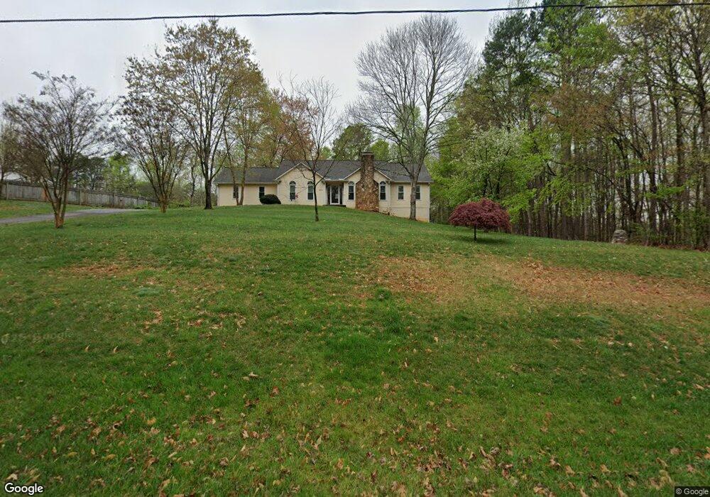
200 Scott Rd Lewisville, NC 27023
Estimated Value: $334,000 - $481,000
3
Beds
2
Baths
1,744
Sq Ft
$236/Sq Ft
Est. Value
About This Home
This home is located at 200 Scott Rd, Lewisville, NC 27023 and is currently estimated at $411,029, approximately $235 per square foot. 200 Scott Rd is a home located in Forsyth County with nearby schools including Lewisville Elementary School, Meadowlark Middle School, and West Forsyth High.
Ownership History
Date
Name
Owned For
Owner Type
Purchase Details
Closed on
Mar 24, 2025
Sold by
Mcbride Edward S
Bought by
Edward Smith Mcbride Jr Revocable Trust and Mcbride
Current Estimated Value
Purchase Details
Closed on
Dec 10, 1991
Bought by
Mcbride and Mcbride
Create a Home Valuation Report for This Property
The Home Valuation Report is an in-depth analysis detailing your home's value as well as a comparison with similar homes in the area
Home Values in the Area
Average Home Value in this Area
Purchase History
| Date | Buyer | Sale Price | Title Company |
|---|---|---|---|
| Edward Smith Mcbride Jr Revocable Trust | -- | None Listed On Document | |
| Edward Smith Mcbride Jr Revocable Trust | -- | None Listed On Document | |
| Mcbride | -- | -- |
Source: Public Records
Tax History Compared to Growth
Tax History
| Year | Tax Paid | Tax Assessment Tax Assessment Total Assessment is a certain percentage of the fair market value that is determined by local assessors to be the total taxable value of land and additions on the property. | Land | Improvement |
|---|---|---|---|---|
| 2025 | $1,859 | $419,800 | $64,700 | $355,100 |
| 2024 | $1,847 | $240,900 | $47,400 | $193,500 |
| 2023 | $1,847 | $240,900 | $47,400 | $193,500 |
| 2022 | $1,847 | $240,900 | $47,400 | $193,500 |
| 2021 | $1,835 | $240,900 | $47,400 | $193,500 |
| 2020 | $1,721 | $207,100 | $42,700 | $164,400 |
| 2019 | $1,741 | $207,100 | $42,700 | $164,400 |
| 2018 | $1,672 | $207,100 | $42,700 | $164,400 |
| 2016 | $1,543 | $190,263 | $48,706 | $141,557 |
| 2015 | $1,543 | $190,263 | $48,706 | $141,557 |
| 2014 | $1,513 | $190,263 | $48,706 | $141,557 |
Source: Public Records
Map
Nearby Homes
- 00 Scott Rd
- 0 Scott Rd
- 8265 Shallowford Rd
- 5131 Riverwest Rd
- 770 Dalton Rd
- 937 Montrachet Ct
- 834 Montrachet Ct
- 0 Hauser Rd
- 814 Montrachet Ct
- 710 Dorse Rd
- Roller Mill Plan at Montrachet
- Roller Mill II Plan at Montrachet
- Oak Crest Plan at Montrachet
- Heritage Bridge Plan at Montrachet
- 5339 Old Us Highway 421
- 1099 Cresthaven Rd
- 1287 Creek Knoll Dr
- 1317 Creek Knoll Dr
- 1329 Creek Knoll Dr
- 1335 Creek Knoll Dr
- 174 Scott Rd
- 260 Scott Rd
- 255 Scott Rd Unit Tract 2
- 255 Scott Rd Unit Tract 1
- 255 Scott Rd
- 255 Scott Rd
- 195 Scott Rd
- 250 Scott Rd
- 211 Beech Valley Rd
- 223 Beech Valley Rd
- 235 Beech Valley Rd
- 8955 Shallowford Rd
- 290 Scott Rd
- 9035 Shallowford Rd
- 291 Scott Rd
- 294 Scott Rd
- 210 Beech Valley Rd
- 228 Beech Valley Rd
- 110 Brittington Dr
- 9034 Shallowford Rd