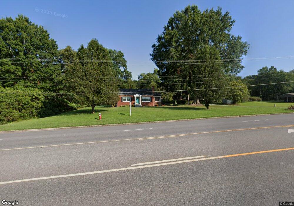
2002 Lincolnton Hwy Cherryville, NC 28021
Estimated Value: $174,000 - $207,000
2
Beds
1
Bath
1,084
Sq Ft
$177/Sq Ft
Est. Value
About This Home
This home is located at 2002 Lincolnton Hwy, Cherryville, NC 28021 and is currently estimated at $192,303, approximately $177 per square foot. 2002 Lincolnton Hwy is a home located in Gaston County with nearby schools including Cherryville Elementary School, William B. Beam Intermediate School, and John Chavis Middle School.
Ownership History
Date
Name
Owned For
Owner Type
Purchase Details
Closed on
Oct 14, 2016
Sold by
Davis Edward Arnold and Davis Elizabeth Ann
Bought by
Bowyer Sabrina Mcginnis
Current Estimated Value
Home Financials for this Owner
Home Financials are based on the most recent Mortgage that was taken out on this home.
Original Mortgage
$56,200
Outstanding Balance
$26,341
Interest Rate
3.46%
Mortgage Type
New Conventional
Estimated Equity
$165,962
Create a Home Valuation Report for This Property
The Home Valuation Report is an in-depth analysis detailing your home's value as well as a comparison with similar homes in the area
Home Values in the Area
Average Home Value in this Area
Purchase History
| Date | Buyer | Sale Price | Title Company |
|---|---|---|---|
| Bowyer Sabrina Mcginnis | $70,500 | Nc Title Center |
Source: Public Records
Mortgage History
| Date | Status | Borrower | Loan Amount |
|---|---|---|---|
| Open | Bowyer Sabrina Mcginnis | $56,200 |
Source: Public Records
Tax History Compared to Growth
Tax History
| Year | Tax Paid | Tax Assessment Tax Assessment Total Assessment is a certain percentage of the fair market value that is determined by local assessors to be the total taxable value of land and additions on the property. | Land | Improvement |
|---|---|---|---|---|
| 2025 | $1,327 | $122,990 | $14,000 | $108,990 |
| 2024 | $1,340 | $122,990 | $14,000 | $108,990 |
| 2023 | $1,354 | $124,180 | $14,000 | $110,180 |
| 2022 | $1,059 | $79,650 | $12,000 | $67,650 |
| 2021 | $1,075 | $79,650 | $12,000 | $67,650 |
| 2019 | $1,020 | $78,480 | $12,000 | $66,480 |
| 2018 | $963 | $72,380 | $12,000 | $60,380 |
| 2017 | $973 | $72,380 | $12,000 | $60,380 |
| 2016 | $986 | $74,157 | $0 | $0 |
| 2014 | $921 | $69,231 | $15,000 | $54,231 |
Source: Public Records
Map
Nearby Homes
- 00 Muirfield Dr
- 01 Muirfield Dr
- 4050 Muirfield Dr
- 1008 Rocky Ridge Dr
- 201 Dale Dr
- 197 Dale Dr
- 458 Roy Eaker Rd
- 211 Roy Eaker Rd
- 106 Guffey Rd
- 000 Lawrence Rd
- 543 Roy Eaker Rd
- 240 Hephzibah Church Rd
- 269 Bud Black Rd
- 5.68 acres Rosewood Ln
- 1015 E Academy St
- 404 Kings Dr
- 709 E Main St
- 111 Sussex Ave
- 302 N Houser St
- 400 N Houser St
- 2010 Lincolnton Hwy
- 1928 Lincolnton Hwy
- 1919 Lincolnton Hwy
- 2018 Lincolnton Hwy
- 2005 Lincolnton Hwy
- 1920 Lincolnton Hwy
- 2024 Lincolnton Hwy
- 116 Club View Dr
- 1914 Lincolnton Hwy
- 1914 Lincolnton Hwy Unit 3,4
- 117 Club View Dr
- 140 Dick Beam Rd
- 1910 Lincolnton Hwy
- 146 Dick Beam Rd
- 2032 Lincolnton Hwy
- 124 Missionary Dr
- 134 Dick Beam Rd
- 130 Dick Beam Rd
- 2038 Lincolnton Hwy
- 1906 Lincolnton Hwy