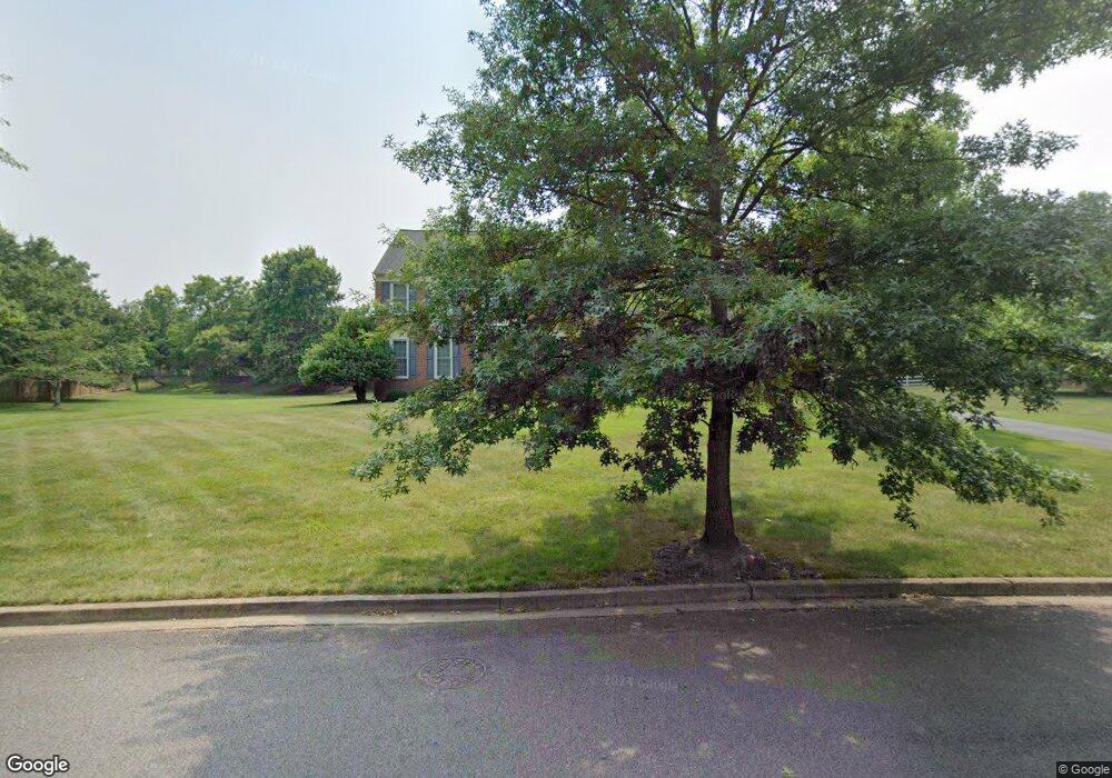
2004 Shadowrock Ln Bowie, MD 20721
Woodmore NeighborhoodEstimated Value: $756,818 - $896,000
--
Bed
3
Baths
3,694
Sq Ft
$225/Sq Ft
Est. Value
About This Home
This home is located at 2004 Shadowrock Ln, Bowie, MD 20721 and is currently estimated at $832,205, approximately $225 per square foot. 2004 Shadowrock Ln is a home located in Prince George's County with nearby schools including Woodmore Elementary School, Ernest Everett Just Middle, and Charles Herbert Flowers High School.
Ownership History
Date
Name
Owned For
Owner Type
Purchase Details
Closed on
Sep 27, 2001
Sold by
Smith Karen R and Frederica Banks
Bought by
Smith Karen R
Current Estimated Value
Purchase Details
Closed on
Dec 1, 1994
Sold by
Woodmore South Lp
Bought by
Smith Karen R
Home Financials for this Owner
Home Financials are based on the most recent Mortgage that was taken out on this home.
Original Mortgage
$224,600
Interest Rate
8.81%
Create a Home Valuation Report for This Property
The Home Valuation Report is an in-depth analysis detailing your home's value as well as a comparison with similar homes in the area
Home Values in the Area
Average Home Value in this Area
Purchase History
| Date | Buyer | Sale Price | Title Company |
|---|---|---|---|
| Smith Karen R | -- | -- | |
| Smith Karen R | $314,405 | -- |
Source: Public Records
Mortgage History
| Date | Status | Borrower | Loan Amount |
|---|---|---|---|
| Previous Owner | Smith Karen R | $224,600 | |
| Closed | Smith Karen R | $41,700 |
Source: Public Records
Tax History Compared to Growth
Tax History
| Year | Tax Paid | Tax Assessment Tax Assessment Total Assessment is a certain percentage of the fair market value that is determined by local assessors to be the total taxable value of land and additions on the property. | Land | Improvement |
|---|---|---|---|---|
| 2025 | $8,774 | $718,300 | $157,200 | $561,100 |
| 2024 | $8,774 | $656,733 | $0 | $0 |
| 2023 | $8,334 | $595,167 | $0 | $0 |
| 2022 | $7,829 | $533,600 | $157,200 | $376,400 |
| 2021 | $7,549 | $523,033 | $0 | $0 |
| 2020 | $7,452 | $512,467 | $0 | $0 |
| 2019 | $7,311 | $501,900 | $153,600 | $348,300 |
| 2018 | $7,049 | $474,500 | $0 | $0 |
| 2017 | $6,831 | $447,100 | $0 | $0 |
| 2016 | -- | $419,700 | $0 | $0 |
| 2015 | $7,814 | $419,700 | $0 | $0 |
| 2014 | $7,814 | $419,700 | $0 | $0 |
Source: Public Records
Map
Nearby Homes
- 11407 Waesche Dr
- 2101 Waterleaf Way
- 2200 Enterprise Rd
- 12001 Shadystone Terrace
- 1805 Albert Ct
- 11505 Chesley Ct
- 11500 Waesche Dr
- 11406 Canterbury Ct
- 12203 Kings Arrow St
- 1116 Kings Tree Dr
- 10907 Golf Course Terrace
- 1100 Kings Heather Dr
- 11110 Inverrary Ct
- 999 Kings Heather Dr
- 1503 Deer Run Ct
- 918 Lake Overlook Dr
- 11701 Locust Dale Ct
- 2101 Bermondsey Dr
- 83 Watkins Park Dr
- 1509 Baytree Terrace
- 2002 Shadowrock Ln
- 2003 Shadowrock Ln
- 2006 Shadowrock Ln
- 2000 Shadowrock Ln
- 2001 Shadowrock Ln
- 1801 Enterprise Rd
- 2005 Shadowrock Ln
- 2008 Shadowrock Ln
- 11803 Woodbrook Ct
- 1711 Enterprise Rd
- 1800 Enterprise Rd
- 1910 Shadowrock Ln
- 1865 Foxwood Cir
- 1863 Foxwood Cir
- 11805 Woodbrook Ct
- 1861 Foxwood Cir
- 1859 Foxwood Cir
- 2009 Shadowrock Ln
- 2010 Shadowrock Ln
- 1857 Foxwood Cir