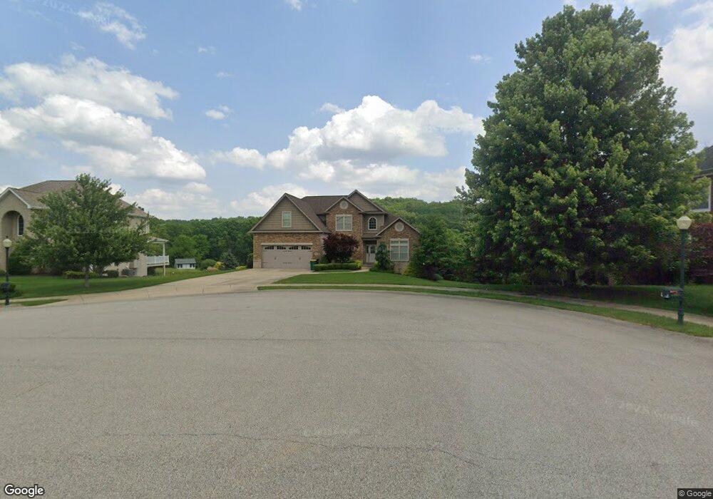
2005 Carol Lane Lot#22 Indiana Township - Nal, PA 15024
Indiana Township NeighborhoodEstimated Value: $710,000 - $1,047,000
4
Beds
3
Baths
2,948
Sq Ft
$290/Sq Ft
Est. Value
About This Home
This home is located at 2005 Carol Lane Lot#22, Indiana Township - Nal, PA 15024 and is currently estimated at $854,489, approximately $289 per square foot. 2005 Carol Lane Lot#22 is a home located in Allegheny County with nearby schools including Fox Chapel Area High School.
Ownership History
Date
Name
Owned For
Owner Type
Purchase Details
Closed on
Oct 9, 2013
Sold by
Michael Ricciuti Construction
Bought by
Sidhu Inderjit S and Singh Sarabjit
Current Estimated Value
Home Financials for this Owner
Home Financials are based on the most recent Mortgage that was taken out on this home.
Original Mortgage
$399,675
Outstanding Balance
$301,256
Interest Rate
4.58%
Mortgage Type
New Conventional
Estimated Equity
$553,233
Purchase Details
Closed on
Dec 6, 2012
Sold by
Forest View Associates Llc
Bought by
Michael Ricciuti Construction
Home Financials for this Owner
Home Financials are based on the most recent Mortgage that was taken out on this home.
Original Mortgage
$364,000
Interest Rate
3.46%
Mortgage Type
New Conventional
Create a Home Valuation Report for This Property
The Home Valuation Report is an in-depth analysis detailing your home's value as well as a comparison with similar homes in the area
Home Values in the Area
Average Home Value in this Area
Purchase History
| Date | Buyer | Sale Price | Title Company |
|---|---|---|---|
| Sidhu Inderjit S | $532,900 | -- | |
| Michael Ricciuti Construction | $84,300 | -- |
Source: Public Records
Mortgage History
| Date | Status | Borrower | Loan Amount |
|---|---|---|---|
| Open | Sidhu Inderjit S | $399,675 | |
| Previous Owner | Michael Ricciuti Construction | $364,000 |
Source: Public Records
Tax History Compared to Growth
Tax History
| Year | Tax Paid | Tax Assessment Tax Assessment Total Assessment is a certain percentage of the fair market value that is determined by local assessors to be the total taxable value of land and additions on the property. | Land | Improvement |
|---|---|---|---|---|
| 2025 | $13,336 | $460,900 | $50,100 | $410,800 |
| 2024 | $13,336 | $460,900 | $50,100 | $410,800 |
| 2023 | $13,195 | $460,900 | $50,100 | $410,800 |
| 2022 | $13,056 | $460,900 | $50,100 | $410,800 |
| 2021 | $12,933 | $460,900 | $50,100 | $410,800 |
| 2020 | $12,802 | $460,900 | $50,100 | $410,800 |
| 2019 | $12,802 | $460,900 | $50,100 | $410,800 |
| 2018 | $12,693 | $460,900 | $50,100 | $410,800 |
| 2017 | $12,307 | $460,900 | $50,100 | $410,800 |
| 2016 | $2,180 | $460,900 | $50,100 | $410,800 |
| 2015 | $2,180 | $460,900 | $50,100 | $410,800 |
| 2014 | $12,126 | $478,900 | $50,100 | $428,800 |
Source: Public Records
Map
Nearby Homes
- 348 Rich Hill Rd
- 1027 Shawnee Ridge Dr
- 108 Cove Run Rd
- 369 Lefever Hill Rd
- 5 Crest Dr
- 170 Lincoln Dr
- 104 Rivermont Ct
- 112 Rivermont Ct
- 1015 Rural Ridge Dr
- 224 Indianola Rd
- 513 Sandra Ln
- 553 Guys Run Rd
- 563 Meadowvale Dr
- 728 Heathergate Dr
- 1253-1255 Patton Dr
- 1255 Patton Dr
- 109 Weber Dr
- 15 Old Saxonburg Blvd
- 1318 Macarthur Dr
- 3745 Saxonburg Blvd
- 2005 Carol Ln
- 2009 Carol Ln
- 2001 Carol Lane Lot#23
- 2001 Carol Ln
- 2008 Carol Ln
- 2008 Carol Ln Unit lt20
- 2004 Carol Ln
- 2004 Carol Ln Unit 19
- 391 Rich Hill Rd
- 1000 Diane Ln
- 2000 Carol Ln
- 1004 Diane Ln
- 1004 Diane Lane Lot#2
- 1045 Diane Ln
- 1045 Diane Ln Unit 14
- 1041 Diane Ln
- 1008 Diane Lane Lot#3
- 1008 Diane Ln
- 1012 Diane Ln Unit 4
- 389 Rich Hill Rd