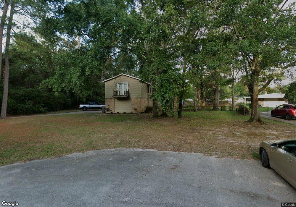
201 Karla St Lufkin, TX 75901
Estimated Value: $174,000 - $223,398
--
Bed
8
Baths
1,741
Sq Ft
$118/Sq Ft
Est. Value
About This Home
This home is located at 201 Karla St, Lufkin, TX 75901 and is currently estimated at $205,600, approximately $118 per square foot. 201 Karla St is a home located in Angelina County with nearby schools including Slack Elementary School, Burley Primary School, and Lufkin Middle School.
Ownership History
Date
Name
Owned For
Owner Type
Purchase Details
Closed on
Jul 26, 2022
Sold by
Melanie Goolsby
Bought by
Goolsby Kacie
Current Estimated Value
Purchase Details
Closed on
Jul 20, 2016
Sold by
Williams Heath and Williams Tana
Bought by
Goolsby Kacie and Goolsby Melanie
Home Financials for this Owner
Home Financials are based on the most recent Mortgage that was taken out on this home.
Original Mortgage
$87,500
Interest Rate
3.6%
Mortgage Type
New Conventional
Purchase Details
Closed on
Jul 18, 2008
Sold by
Mitchell Elda Nadine
Bought by
Williams Heath and Williams Tana
Home Financials for this Owner
Home Financials are based on the most recent Mortgage that was taken out on this home.
Original Mortgage
$74,450
Interest Rate
6.09%
Mortgage Type
FHA
Create a Home Valuation Report for This Property
The Home Valuation Report is an in-depth analysis detailing your home's value as well as a comparison with similar homes in the area
Home Values in the Area
Average Home Value in this Area
Purchase History
| Date | Buyer | Sale Price | Title Company |
|---|---|---|---|
| Goolsby Kacie | -- | None Listed On Document | |
| Goolsby Kacie | -- | Angelina Title Llc | |
| Williams Heath | $74,450 | None Available |
Source: Public Records
Mortgage History
| Date | Status | Borrower | Loan Amount |
|---|---|---|---|
| Previous Owner | Goolsby Kacie | $87,500 | |
| Previous Owner | Williams Heath | $74,450 |
Source: Public Records
Tax History Compared to Growth
Tax History
| Year | Tax Paid | Tax Assessment Tax Assessment Total Assessment is a certain percentage of the fair market value that is determined by local assessors to be the total taxable value of land and additions on the property. | Land | Improvement |
|---|---|---|---|---|
| 2025 | $3,107 | $148,670 | $28,240 | $120,430 |
| 2024 | $3,045 | $145,690 | $28,240 | $117,450 |
| 2023 | $2,856 | $143,700 | $28,240 | $115,460 |
| 2022 | $3,049 | $142,410 | $13,390 | $129,020 |
| 2021 | $2,998 | $127,040 | $13,390 | $113,650 |
| 2020 | $2,719 | $110,630 | $13,390 | $97,240 |
| 2019 | $2,876 | $110,630 | $13,390 | $97,240 |
| 2018 | $2,173 | $107,230 | $13,390 | $93,840 |
| 2017 | $2,173 | $97,500 | $13,390 | $84,110 |
| 2016 | $2,579 | $108,180 | $13,390 | $94,790 |
| 2015 | $2,175 | $108,180 | $13,390 | $94,790 |
| 2014 | $2,175 | $98,310 | $13,390 | $84,920 |
Source: Public Records
Map
Nearby Homes
- 107 Eastwood Place
- 5100 Farm To Market 58
- 2210 Peachtree St
- 5552 S Chestnut St
- 3306 S Chestnut St
- 3106 S Chestnut St
- 1302 Parkman St
- 1808 Fuller Springs Dr
- 110 Copperwood Loop
- 406 Forest Creek Dr
- 247 John James Rd
- 508 Forest Creek Dr
- 2707 S Chestnut St
- 115 Willow Brook Dr
- 106 Oakwood Dr
- R33234 Platt Rd
- 4404 S Chestnut St
- 1198 Sycamore Dr
- 13.29 acres Joyce Ln
- 701 Sandybrook Dr