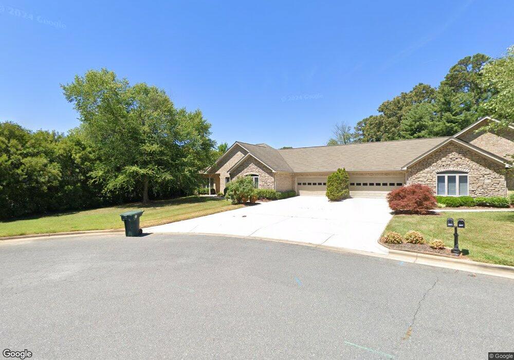
201 Lexington Place Asheboro, NC 27205
Estimated Value: $373,000 - $414,000
--
Bed
2
Baths
2,032
Sq Ft
$196/Sq Ft
Est. Value
About This Home
This home is located at 201 Lexington Place, Asheboro, NC 27205 and is currently estimated at $397,731, approximately $195 per square foot. 201 Lexington Place is a home located in Randolph County with nearby schools including Charles W. McCrary Elementary School, North Asheboro Middle School, and Asheboro High School.
Ownership History
Date
Name
Owned For
Owner Type
Purchase Details
Closed on
Nov 15, 2021
Sold by
Murray Jamie Anne and Weston Jamie Murray
Bought by
Bailey Annette A
Current Estimated Value
Home Financials for this Owner
Home Financials are based on the most recent Mortgage that was taken out on this home.
Original Mortgage
$275,895
Outstanding Balance
$252,278
Interest Rate
2.99%
Mortgage Type
FHA
Estimated Equity
$145,453
Purchase Details
Closed on
Mar 16, 2009
Sold by
Usher William Chauncey and Usher Susan Yow
Bought by
Weston Jamie Murray
Purchase Details
Closed on
Aug 19, 2003
Bought by
Weston Jamie Murray
Create a Home Valuation Report for This Property
The Home Valuation Report is an in-depth analysis detailing your home's value as well as a comparison with similar homes in the area
Home Values in the Area
Average Home Value in this Area
Purchase History
| Date | Buyer | Sale Price | Title Company |
|---|---|---|---|
| Bailey Annette A | $285,500 | None Available | |
| Weston Jamie Murray | $249,900 | None Available | |
| Weston Jamie Murray | $190,000 | -- |
Source: Public Records
Mortgage History
| Date | Status | Borrower | Loan Amount |
|---|---|---|---|
| Open | Bailey Annette A | $275,895 |
Source: Public Records
Tax History Compared to Growth
Tax History
| Year | Tax Paid | Tax Assessment Tax Assessment Total Assessment is a certain percentage of the fair market value that is determined by local assessors to be the total taxable value of land and additions on the property. | Land | Improvement |
|---|---|---|---|---|
| 2025 | $4,501 | $339,620 | $50,000 | $289,620 |
| 2024 | $4,501 | $339,620 | $50,000 | $289,620 |
| 2023 | $4,501 | $339,620 | $50,000 | $289,620 |
| 2022 | $3,904 | $270,810 | $45,000 | $225,810 |
| 2021 | $3,909 | $270,810 | $45,000 | $225,810 |
| 2020 | $3,909 | $270,810 | $45,000 | $225,810 |
| 2019 | $3,904 | $270,810 | $45,000 | $225,810 |
| 2018 | $3,109 | $211,630 | $30,000 | $181,630 |
| 2016 | $3,109 | $211,628 | $30,000 | $181,628 |
| 2015 | $3,114 | $211,628 | $30,000 | $181,628 |
| 2014 | -- | $211,628 | $30,000 | $181,628 |
Source: Public Records
Map
Nearby Homes
- 1263 Winslow Ave Unit A, B & C
- 135 West St
- 923 Arnold St
- 830 Sunset Ave
- 711 Sunset Ave Unit E
- 612 Sunset Ave Unit 6
- 435 Peachtree St
- 401 Uwharrie St
- 135 Dixon St
- 516 and 518 Peachtree St
- 627 Oakmont Dr
- 617 Uwharrie St Unit N
- 631 W Kivett St
- TBD Oakland Ave
- 806 Windermere Ct
- 866 Mountain Rd
- 627 Lee St
- 330 W Presnell St Unit 37
- 1110 Park Dr
- 0000 Little Gate Dr
- 207 Lexington Place
- 1127 Lexington Commons Dr
- 212 Lexington Place
- 1131 Lexington Commons Dr
- 200 Lexington Rd
- 220 Lexington Place
- 1137 Lexington Commons Dr
- 1203 Sunset Dr
- 155 Lexington Rd
- 226 Lexington Place
- 1145 Lexington Commons Dr
- 231 Lexington Place
- 232 Lexington Place
- 1209 Sunset Dr
- 1222 Winslow Ave
- 235 Lexington Place
- 1140 Lexington Commons Dr
- 1215 Winslow Ave
- 1163 Lexington Commons Dr
- 1217 Sunset Dr