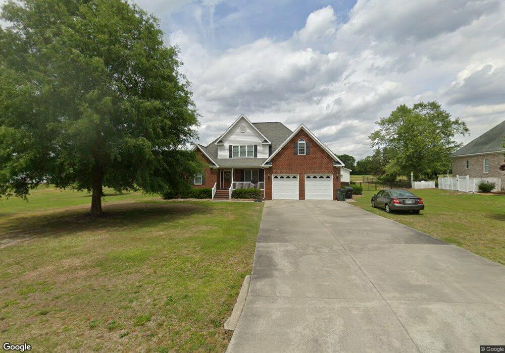
201 Spence St La Grange, NC 28551
Estimated Value: $277,000 - $373,447
3
Beds
4
Baths
2,727
Sq Ft
$124/Sq Ft
Est. Value
About This Home
This home is located at 201 Spence St, La Grange, NC 28551 and is currently estimated at $339,112, approximately $124 per square foot. 201 Spence St is a home located in Lenoir County with nearby schools including La Grange Elementary School, E.B. Frink Middle School, and North Lenoir High School.
Ownership History
Date
Name
Owned For
Owner Type
Purchase Details
Closed on
Jun 16, 2021
Sold by
Tyson Tanya Conner and Tyson Jody Craig
Bought by
Bannister Dustin Ryan and Bannister Danielle Baker
Current Estimated Value
Home Financials for this Owner
Home Financials are based on the most recent Mortgage that was taken out on this home.
Original Mortgage
$190,000
Outstanding Balance
$144,260
Interest Rate
2.9%
Mortgage Type
New Conventional
Estimated Equity
$194,853
Purchase Details
Closed on
Oct 30, 2019
Sold by
Craft John P
Bought by
Craft Tanya G
Create a Home Valuation Report for This Property
The Home Valuation Report is an in-depth analysis detailing your home's value as well as a comparison with similar homes in the area
Home Values in the Area
Average Home Value in this Area
Purchase History
| Date | Buyer | Sale Price | Title Company |
|---|---|---|---|
| Bannister Dustin Ryan | $265,000 | None Available | |
| Craft Tanya G | -- | -- |
Source: Public Records
Mortgage History
| Date | Status | Borrower | Loan Amount |
|---|---|---|---|
| Open | Bannister Dustin Ryan | $190,000 |
Source: Public Records
Tax History Compared to Growth
Tax History
| Year | Tax Paid | Tax Assessment Tax Assessment Total Assessment is a certain percentage of the fair market value that is determined by local assessors to be the total taxable value of land and additions on the property. | Land | Improvement |
|---|---|---|---|---|
| 2025 | $4,093 | $407,925 | $31,700 | $376,225 |
| 2024 | $3,202 | $232,505 | $16,000 | $216,505 |
| 2023 | $3,202 | $232,505 | $16,000 | $216,505 |
| 2022 | $3,202 | $232,505 | $16,000 | $216,505 |
| 2021 | $3,202 | $232,505 | $16,000 | $216,505 |
| 2020 | $3,202 | $232,505 | $16,000 | $216,505 |
| 2019 | $3,202 | $232,505 | $16,000 | $216,505 |
| 2018 | $3,167 | $232,505 | $16,000 | $216,505 |
| 2017 | $3,178 | $232,505 | $16,000 | $216,505 |
| 2014 | $3,156 | $245,393 | $16,000 | $229,393 |
| 2013 | -- | $245,393 | $16,000 | $229,393 |
| 2011 | -- | $245,393 | $16,000 | $229,393 |
Source: Public Records
Map
Nearby Homes
- 219 Wood St
- 210 Wood St
- 201 Wood St
- 202 Wood St
- 208 Wood St
- 217 Wood St
- 204 Wood St
- 205 Wood St
- 206 Wood St
- 614 S Caswell St
- Hayden Plan at Blair Ridge
- Freeport Plan at Blair Ridge
- Cali Plan at Blair Ridge
- Belhaven Plan at Blair Ridge
- 805 Madison Ann Dr
- 3619 S Caswell St
- 4725 Packhouse Rd
- 202 E Washington St
- 408 Lake Pines Dr
- 101 Forest Dr
- 203 Spence St
- 205 Spence St
- 206 Spence St
- 605 S Caswell St
- 207 Spence St
- 601 S Caswell St
- 201 Fire Tower Rd
- 203 Fire Tower Rd
- 607 S Caswell St
- 208 Spence St
- 205 Fire Tower Rd
- 209 Spence St
- 210 Spence St
- 612 S Caswell St
- 616 S Caswell St
- 305 Spence St
- 202 Fire Tower Rd
- 608 S Caswell St
- 107 Fire Tower Rd
- 209 Fire Tower Rd