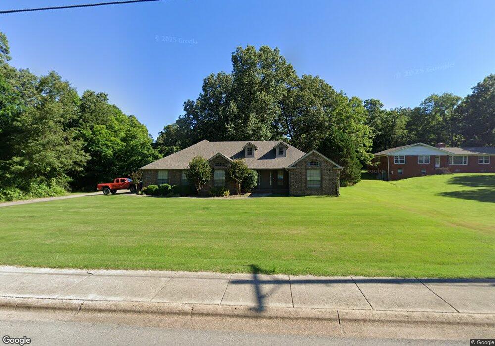
2011 Barnhill Rd Paragould, AR 72450
Estimated Value: $286,000 - $379,000
--
Bed
3
Baths
2,696
Sq Ft
$121/Sq Ft
Est. Value
About This Home
This home is located at 2011 Barnhill Rd, Paragould, AR 72450 and is currently estimated at $326,648, approximately $121 per square foot. 2011 Barnhill Rd is a home located in Greene County with nearby schools including Greene County Tech Primary School, Greene County Tech Elementary School, and Greene County Tech Intermediate School.
Ownership History
Date
Name
Owned For
Owner Type
Purchase Details
Closed on
May 26, 2006
Sold by
Leach Eddie L and Leach Gail
Bought by
Williams John Michael and Williams Audra E
Current Estimated Value
Home Financials for this Owner
Home Financials are based on the most recent Mortgage that was taken out on this home.
Original Mortgage
$219,828
Interest Rate
6.5%
Mortgage Type
New Conventional
Purchase Details
Closed on
Mar 24, 2006
Sold by
Sain Lacey Delite Phillips and Sain Anthony J
Bought by
Leach Eddie L and Leach Gail
Home Financials for this Owner
Home Financials are based on the most recent Mortgage that was taken out on this home.
Original Mortgage
$30,000
Interest Rate
7.75%
Mortgage Type
FHA
Purchase Details
Closed on
Sep 13, 1996
Bought by
Janet Sue Morgan
Purchase Details
Closed on
Apr 17, 1985
Bought by
Michael Robert Morgan
Create a Home Valuation Report for This Property
The Home Valuation Report is an in-depth analysis detailing your home's value as well as a comparison with similar homes in the area
Home Values in the Area
Average Home Value in this Area
Purchase History
| Date | Buyer | Sale Price | Title Company |
|---|---|---|---|
| Williams John Michael | $220,000 | None Available | |
| Leach Eddie L | $199,000 | None Available | |
| Janet Sue Morgan | -- | -- | |
| Janet Sue Morgan | -- | -- | |
| Michael Robert Morgan | -- | -- |
Source: Public Records
Mortgage History
| Date | Status | Borrower | Loan Amount |
|---|---|---|---|
| Closed | Williams John Michael | $219,828 | |
| Previous Owner | Leach Eddie L | $30,000 |
Source: Public Records
Tax History Compared to Growth
Tax History
| Year | Tax Paid | Tax Assessment Tax Assessment Total Assessment is a certain percentage of the fair market value that is determined by local assessors to be the total taxable value of land and additions on the property. | Land | Improvement |
|---|---|---|---|---|
| 2025 | $2,697 | $63,320 | $5,000 | $58,320 |
| 2024 | $2,589 | $63,320 | $5,000 | $58,320 |
| 2023 | $2,373 | $56,110 | $7,700 | $48,410 |
| 2022 | $1,998 | $56,110 | $7,700 | $48,410 |
| 2021 | $1,890 | $56,110 | $7,700 | $48,410 |
| 2020 | $2,157 | $47,010 | $6,000 | $41,010 |
| 2019 | $1,782 | $47,010 | $6,000 | $41,010 |
| 2018 | $1,807 | $47,010 | $6,000 | $41,010 |
| 2017 | $2,037 | $47,010 | $6,000 | $41,010 |
| 2016 | $1,595 | $47,010 | $6,000 | $41,010 |
| 2015 | $1,866 | $41,630 | $6,000 | $35,630 |
| 2014 | $1,866 | $41,630 | $6,000 | $35,630 |
Source: Public Records
Map
Nearby Homes
- 1905 Glendale St
- 2311 S 20th St
- 1801 Sara Ann Cir
- 1103 Summit Ridge Trail
- 1101 Summit Ridge Trail
- 1103 Summit Ridge Dr
- 1104 Summit Ridge Dr
- 1701 Barnhill Rd
- 1700 Barnhill Rd
- 3.65 ACRES U S 49
- 1811 Magnolia Ln
- 1901 Marlanita Dr
- 3.04 Lot 17 Cedar Ridge Estates Ph II
- 2001 W Kingshighway
- 1203 Michael St
- 1105 W Thompson St
- 1810 Linwood Dr
- 1007 S 11th St
- 412 Magnolia Dr
- 911 W Park St
- 2005 Barnhill Rd
- 999 Barnhill Rd
- 2017 Barnhill Rd
- 2019 Barnhill Rd
- 000 Barnhill Rd
- 2102 Barnhill Rd
- 2100 Barnhill Rd
- 2004 Barnhill Rd
- 2200 Barnhill Rd
- 2001 Barnhill Rd
- 2002 Barnhill Rd
- 2202 Barnhill Rd
- 804 Spencer Dr
- 2000 Barnhill Rd
- 800 Spencer Dr
- 706 Spencer Dr
- 704 Spencer Dr
- 1912 Barnhill Rd
- 904 Terra Ct
- 906 Terra Ct