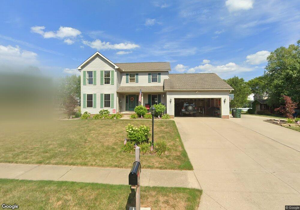
2014 Cherokee Ave Louisville, OH 44641
Estimated Value: $288,045 - $318,000
3
Beds
3
Baths
2,086
Sq Ft
$144/Sq Ft
Est. Value
About This Home
This home is located at 2014 Cherokee Ave, Louisville, OH 44641 and is currently estimated at $301,011, approximately $144 per square foot. 2014 Cherokee Ave is a home located in Stark County with nearby schools including Louisville High School and St. Thomas Aquinas High School & Middle School.
Ownership History
Date
Name
Owned For
Owner Type
Purchase Details
Closed on
Oct 2, 2025
Sold by
Berkshire Thomas R and Berkshire Christina J
Bought by
Berkshire Thomas R and Berkshire Christina J
Current Estimated Value
Purchase Details
Closed on
Jan 17, 1997
Sold by
Buffalo Ridge Allotment
Bought by
Bershire Thomas R and Bershire Christina
Create a Home Valuation Report for This Property
The Home Valuation Report is an in-depth analysis detailing your home's value as well as a comparison with similar homes in the area
Home Values in the Area
Average Home Value in this Area
Purchase History
| Date | Buyer | Sale Price | Title Company |
|---|---|---|---|
| Berkshire Thomas R | -- | None Listed On Document | |
| Bershire Thomas R | $21,500 | -- |
Source: Public Records
Tax History Compared to Growth
Tax History
| Year | Tax Paid | Tax Assessment Tax Assessment Total Assessment is a certain percentage of the fair market value that is determined by local assessors to be the total taxable value of land and additions on the property. | Land | Improvement |
|---|---|---|---|---|
| 2025 | -- | $96,220 | $17,750 | $78,470 |
| 2024 | -- | $96,220 | $17,750 | $78,470 |
| 2023 | $2,991 | $67,980 | $17,610 | $50,370 |
| 2022 | $2,998 | $67,980 | $17,610 | $50,370 |
| 2021 | $3,006 | $67,980 | $17,610 | $50,370 |
| 2020 | $2,501 | $61,220 | $15,890 | $45,330 |
| 2019 | $2,514 | $57,440 | $15,890 | $41,550 |
| 2018 | $2,350 | $57,440 | $15,890 | $41,550 |
| 2017 | $2,216 | $52,260 | $12,950 | $39,310 |
| 2016 | $2,261 | $52,260 | $12,950 | $39,310 |
| 2015 | $2,268 | $52,260 | $12,950 | $39,310 |
| 2014 | $106 | $45,120 | $11,200 | $33,920 |
| 2013 | $1,057 | $45,120 | $11,200 | $33,920 |
Source: Public Records
Map
Nearby Homes
- 908 Sand Lot Cir
- 1702 View Pointe Ave
- 1639 Horizon Dr
- 8225 Georgetown St
- 641 S Nickelplate St
- 520 S Silver St
- 510 S Bauman Ct
- 728 E Broad St
- 204 E Broad St
- 2425 Miday Ave NE
- 6969 Georgetown St NE
- 107 E Broad St
- 308 Superior St
- 3390 Meese Rd NE
- 2110 Edmar St
- 1715 High St
- 1812 E Broad St
- 325 Lincoln Ave
- 0 Michigan Blvd
- 201 Indiana Ave
- 514 Buffalo Ridge St
- 414 Buffalo Ridge St
- 505 Rodeo St
- 515 Rodeo St
- 524 Buffalo Ridge St
- 1924 Cherokee Ave
- 415 Rodeo Cir
- 515 Buffalo Ridge St
- 404 Buffalo Ridge St
- 525 Rodeo St
- 415 Buffalo Ridge St
- 525 Buffalo Ridge St
- 604 Buffalo Ridge St
- 405 Rodeo Cir
- 405 Buffalo Ridge St
- 605 Rodeo St
- 314 Buffalo Ridge St
- 605 Buffalo Ridge St
- 504 Shawnee St
- 315 Rodeo Cir