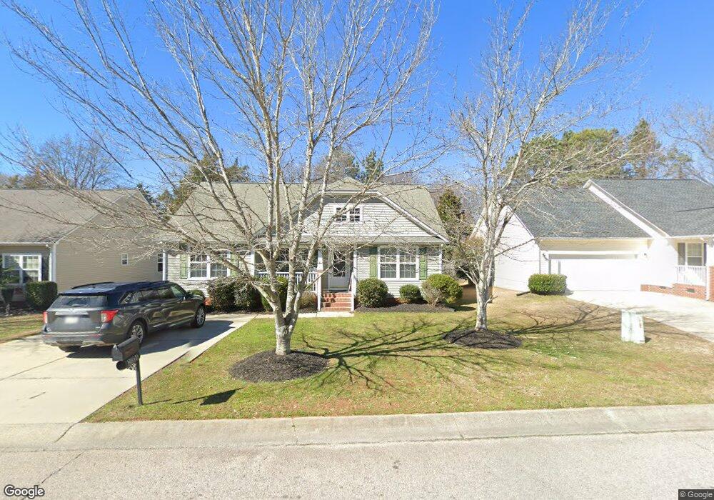
2014 Mallard Creek Dr Rock Hill, SC 29732
Estimated Value: $279,036 - $305,000
--
Bed
--
Bath
1,416
Sq Ft
$208/Sq Ft
Est. Value
About This Home
This home is located at 2014 Mallard Creek Dr, Rock Hill, SC 29732 and is currently estimated at $294,009, approximately $207 per square foot. 2014 Mallard Creek Dr is a home with nearby schools including Mount Gallant Elementary School, Dutchman Creek Middle School, and Northwestern High School.
Ownership History
Date
Name
Owned For
Owner Type
Purchase Details
Closed on
May 2, 2006
Sold by
Infinity Designs Inc
Bought by
Howard Philip P and Howard Maxine W
Current Estimated Value
Home Financials for this Owner
Home Financials are based on the most recent Mortgage that was taken out on this home.
Original Mortgage
$123,300
Outstanding Balance
$71,818
Interest Rate
6.5%
Mortgage Type
VA
Estimated Equity
$222,191
Purchase Details
Closed on
Aug 25, 2003
Sold by
Mallard Creek Of York County Inc
Bought by
Infinity Designs Inc
Create a Home Valuation Report for This Property
The Home Valuation Report is an in-depth analysis detailing your home's value as well as a comparison with similar homes in the area
Home Values in the Area
Average Home Value in this Area
Purchase History
| Date | Buyer | Sale Price | Title Company |
|---|---|---|---|
| Howard Philip P | $123,300 | None Available | |
| Infinity Designs Inc | $400,000 | -- |
Source: Public Records
Mortgage History
| Date | Status | Borrower | Loan Amount |
|---|---|---|---|
| Open | Howard Philip P | $123,300 |
Source: Public Records
Tax History Compared to Growth
Tax History
| Year | Tax Paid | Tax Assessment Tax Assessment Total Assessment is a certain percentage of the fair market value that is determined by local assessors to be the total taxable value of land and additions on the property. | Land | Improvement |
|---|---|---|---|---|
| 2024 | $532 | $5,796 | $1,076 | $4,720 |
| 2023 | $545 | $5,796 | $1,076 | $4,720 |
| 2022 | $547 | $5,796 | $1,076 | $4,720 |
| 2021 | -- | $5,796 | $1,076 | $4,720 |
| 2020 | $546 | $5,796 | $0 | $0 |
| 2019 | $458 | $5,040 | $0 | $0 |
| 2018 | $455 | $5,040 | $0 | $0 |
| 2017 | $429 | $5,040 | $0 | $0 |
| 2016 | $421 | $5,040 | $0 | $0 |
| 2014 | $640 | $5,040 | $1,200 | $3,840 |
| 2013 | $640 | $5,020 | $1,280 | $3,740 |
Source: Public Records
Map
Nearby Homes
- 5022 Drake Pond Ln
- 4073 Canvas Ave
- 423 Shallowford Dr
- 1015 Hands Mill Hwy
- 239 Heatherland Dr
- 1767 Hands Mill Hwy
- 1230 Bowater Rd
- 5380 Woodside Dr
- 5381 Woodside Dr
- 479 Shallowford Dr
- 440 Shallowford Dr
- 364 Paraham Rd S
- 3029 Oxtail Ct
- 3059 Oxtail Ct
- 2060 Covered Bridge Ct
- 1592 Covenant Place
- 305 White Water Dr
- 2035 Covered Bridge Ct
- 2028 Covered Bridge Ct
- 228 Tributary Dr
- 2018 Mallard Creek Dr
- 2010 Mallard Creek Dr
- 2010 Mallard Creek Dr Unit 1
- 2022 Mallard Creek Dr
- 2026 Mallard Creek Dr
- 1363 Hands Mill Hwy
- 2030 Mallard Creek Dr Unit 6
- 2030 Mallard Creek Dr
- 2034 Mallard Creek Dr
- 1352 Hands Mill Hwy
- 2042 Mallard Creek Dr
- 1307 Hands Mill Hwy
- 2043 Mallard Creek Dr
- 2046 Mallard Creek Dr
- 1384 Hands Mill Hwy
- 2047 Mallard Creek Dr
- 2050 Mallard Creek Dr
- 1362 Hands Mill Hwy
- 1412 Hands Mill Hwy
- 1311 Allison Cir