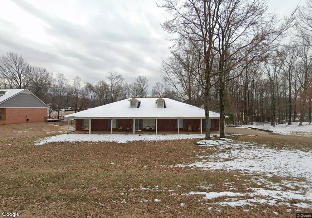
2015 Wood Hill Dr Horn Lake, MS 38637
Estimated Value: $339,000 - $366,000
3
Beds
2
Baths
2,231
Sq Ft
$159/Sq Ft
Est. Value
About This Home
This home is located at 2015 Wood Hill Dr, Horn Lake, MS 38637 and is currently estimated at $355,676, approximately $159 per square foot. 2015 Wood Hill Dr is a home located in DeSoto County with nearby schools including Horn Lake Elementary School, Horn Lake Intermediate School, and Horn Lake Middle School.
Ownership History
Date
Name
Owned For
Owner Type
Purchase Details
Closed on
Oct 15, 2021
Sold by
Weigandt Jerry T
Bought by
Cowan Natasha J
Current Estimated Value
Home Financials for this Owner
Home Financials are based on the most recent Mortgage that was taken out on this home.
Original Mortgage
$269,920
Outstanding Balance
$246,142
Interest Rate
2.8%
Mortgage Type
FHA
Estimated Equity
$109,534
Create a Home Valuation Report for This Property
The Home Valuation Report is an in-depth analysis detailing your home's value as well as a comparison with similar homes in the area
Home Values in the Area
Average Home Value in this Area
Purchase History
| Date | Buyer | Sale Price | Title Company |
|---|---|---|---|
| Cowan Natasha J | -- | Regency Title And Escrow Llc |
Source: Public Records
Mortgage History
| Date | Status | Borrower | Loan Amount |
|---|---|---|---|
| Open | Cowan Natasha J | $269,920 | |
| Closed | Cowan Natasha J | $269,920 |
Source: Public Records
Tax History Compared to Growth
Tax History
| Year | Tax Paid | Tax Assessment Tax Assessment Total Assessment is a certain percentage of the fair market value that is determined by local assessors to be the total taxable value of land and additions on the property. | Land | Improvement |
|---|---|---|---|---|
| 2024 | $3,061 | $20,632 | $3,000 | $17,632 |
| 2023 | $3,061 | $20,632 | $0 | $0 |
| 2022 | $3,061 | $20,632 | $3,000 | $17,632 |
| 2021 | $2,761 | $20,632 | $3,000 | $17,632 |
| 2020 | $1,439 | $17,174 | $3,000 | $14,174 |
| 2019 | $1,439 | $17,174 | $3,000 | $14,174 |
| 2017 | $1,513 | $32,244 | $17,622 | $14,622 |
| 2016 | $1,472 | $17,622 | $3,000 | $14,622 |
| 2015 | $2,550 | $32,244 | $17,622 | $14,622 |
| 2014 | $2,258 | $17,622 | $0 | $0 |
| 2013 | $2,173 | $17,622 | $0 | $0 |
Source: Public Records
Map
Nearby Homes
- 2065 Tall Tree Dr
- 5240 Park Place Dr
- 2095 Tall Tree Dr
- 1926 Tissington Dr
- 1939 Ingleside Cove
- 2155 Church Rd
- 1876 Greeno Dr
- 2515 Bryce Cove
- 4925 Winesap Dr
- 1784 Thomas St
- 1664 Thomas St
- 1652 Thomas St
- 5381 Peppermill Dr
- 5822 Waverly Dr
- 5508 Tulane Rd
- 6275 U S Highway 51
- 2605 Valleybrook Rd
- 2920 Devon Cir
- 6265 Foxbriar Dr
- 4343 Sharon Dr
- 2025 Wood Hill Dr
- 2005 Wood Hill Dr
- 2010 Wood Hill Dr
- 2035 Wood Hill Dr
- 5411 Park Place Dr
- 2020 Wood Hill Dr
- 2085 Wood St
- 2070 Wood St
- 2120 Lakeland Cove
- 2130 Lakeland Cove
- 5400 Park Place Dr
- 2045 Wood Hill Dr
- 2030 Wood Hill Dr
- 2015 Tall Tree Dr
- 2110 Lakeland Cove
- 5420 Park Place Dr
- 5410 Park Place Dr
- 2025 Tall Tree Dr
- 5390 Park Place Dr
- 1980 Tall Tree Dr