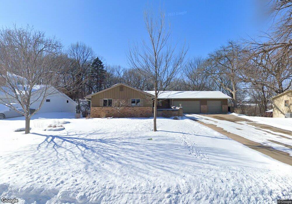
2016 Big Oak Dr Burnsville, MN 55337
Estimated Value: $438,000 - $514,000
3
Beds
3
Baths
1,794
Sq Ft
$266/Sq Ft
Est. Value
About This Home
This home is located at 2016 Big Oak Dr, Burnsville, MN 55337 and is currently estimated at $477,338, approximately $266 per square foot. 2016 Big Oak Dr is a home located in Dakota County with nearby schools including Vista View Elementary School, Joseph Nicollet Middle School, and Burnsville High School.
Ownership History
Date
Name
Owned For
Owner Type
Purchase Details
Closed on
Oct 16, 2019
Sold by
Stark Carol M and Jones Carol M
Bought by
Jones Jimmie D
Current Estimated Value
Purchase Details
Closed on
Aug 28, 2003
Sold by
Freund Frank F and Freund Joyce C
Bought by
Jones Jimmie D and Jones Carol M
Purchase Details
Closed on
Apr 27, 2001
Sold by
Sufka Leo J and Deckard Nancy D
Bought by
Freund Frank F and Freund Joyce C
Purchase Details
Closed on
Nov 23, 1998
Sold by
Pankow Paul A H and Pankow Patricia A
Bought by
Sufka Leo J and Deckland Nancy D
Create a Home Valuation Report for This Property
The Home Valuation Report is an in-depth analysis detailing your home's value as well as a comparison with similar homes in the area
Home Values in the Area
Average Home Value in this Area
Purchase History
| Date | Buyer | Sale Price | Title Company |
|---|---|---|---|
| Jones Jimmie D | -- | None Available | |
| Jones Jimmie D | $291,000 | -- | |
| Freund Frank F | $239,900 | -- | |
| Sufka Leo J | $191,500 | -- |
Source: Public Records
Tax History Compared to Growth
Tax History
| Year | Tax Paid | Tax Assessment Tax Assessment Total Assessment is a certain percentage of the fair market value that is determined by local assessors to be the total taxable value of land and additions on the property. | Land | Improvement |
|---|---|---|---|---|
| 2024 | $5,498 | $517,300 | $117,400 | $399,900 |
| 2023 | $5,620 | $518,700 | $117,500 | $401,200 |
| 2022 | $4,684 | $521,500 | $117,200 | $404,300 |
| 2021 | $4,680 | $434,800 | $101,900 | $332,900 |
| 2020 | $4,580 | $411,600 | $97,100 | $314,500 |
| 2019 | $4,536 | $389,700 | $85,100 | $304,600 |
| 2018 | $4,376 | $368,100 | $81,000 | $287,100 |
| 2017 | $4,086 | $346,200 | $77,100 | $269,100 |
| 2016 | $4,139 | $319,400 | $73,500 | $245,900 |
| 2015 | $3,950 | $301,859 | $69,182 | $232,677 |
| 2014 | -- | $300,987 | $67,899 | $233,088 |
| 2013 | -- | $275,481 | $61,549 | $213,932 |
Source: Public Records
Map
Nearby Homes
- 13100 Thomas Ave S
- 13303 Morgan Ave S
- 13147 Thomas Ave S
- 13208 Upton Ave S
- 2729 Terrace Dr
- 2708 Williams Dr
- 13212 Fremont Ave S
- 2704 W 135th St
- 13236 Fremont Ave S
- 1009 Knob Hill Rd
- XXXX Woodhill Rd
- 3220 Harmony Cir
- 1200 W 136th St
- 1701 W 138th St
- 13817 Thomas Ave S
- 521 Timberland Dr
- 1724 W 140th St
- 13036 Judicial Rd
- 2104 W 140th St
- 1905 W 140th St
- 2012 Big Oak Dr
- 2020 Big Oak Dr
- 2024 Big Oak Dr
- 2008 Big Oak Dr
- 2009 Big Oak Dr
- 2104 Manor Dr
- 2013 Big Oak Dr
- 2005 Big Oak Dr
- 2108 Manor Dr
- 2017 Big Oak Dr
- 2004 Big Oak Dr
- 2001 Big Oak Dr
- 2020 Manor Dr
- 2113 Eagle Bluff Cir
- 1904 Manor Dr
- 2109 Eagle Bluff Cir
- 2200 Manor Dr
- 1905 Big Oak Dr
- 2105 Manor Dr
- 2101 Manor Dr