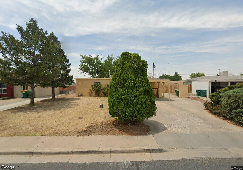
2017 Lynwood Dr Farmington, NM 87401
Estimated Value: $161,000 - $309,000
--
Bed
--
Bath
2,580
Sq Ft
$98/Sq Ft
Est. Value
About This Home
This home is located at 2017 Lynwood Dr, Farmington, NM 87401 and is currently estimated at $252,333, approximately $97 per square foot. 2017 Lynwood Dr is a home located in San Juan County with nearby schools including McKinley Elementary School, Tibbetts Middle School, and Farmington High School.
Ownership History
Date
Name
Owned For
Owner Type
Purchase Details
Closed on
Oct 29, 2020
Sold by
Merilatt Timothy L and Merilatt Janet H
Bought by
Lesueur Properties Llc
Current Estimated Value
Purchase Details
Closed on
Sep 15, 2020
Sold by
Merilatt Jonathan D and Merilatt Gretchen
Bought by
Merilatt Timothy L and Merilatt Janet H
Purchase Details
Closed on
Dec 16, 2016
Sold by
Merilatt Timothy L
Bought by
Merilatt Jonathan D and Merilatt Timothy L
Purchase Details
Closed on
Dec 7, 2016
Sold by
Merilatt Paula G
Bought by
Merilatt Timothy L
Purchase Details
Closed on
Oct 22, 2015
Sold by
Merilatt Lyle and Merilatt Wilma
Bought by
Merilatt Timothy Lyle and Merilatt Craig Carl
Create a Home Valuation Report for This Property
The Home Valuation Report is an in-depth analysis detailing your home's value as well as a comparison with similar homes in the area
Home Values in the Area
Average Home Value in this Area
Purchase History
| Date | Buyer | Sale Price | Title Company |
|---|---|---|---|
| Lesueur Properties Llc | -- | None Available | |
| Merilatt Timothy L | -- | None Available | |
| Merilatt Jonathan D | -- | None Available | |
| Merilatt Timothy L | -- | None Available | |
| Merilatt Timothy Lyle | -- | None Available | |
| Merilatt Timothy Lyle | -- | None Available |
Source: Public Records
Tax History Compared to Growth
Tax History
| Year | Tax Paid | Tax Assessment Tax Assessment Total Assessment is a certain percentage of the fair market value that is determined by local assessors to be the total taxable value of land and additions on the property. | Land | Improvement |
|---|---|---|---|---|
| 2024 | $1,450 | $61,005 | $0 | $0 |
| 2023 | $1,450 | $59,229 | $0 | $0 |
| 2022 | $1,382 | $57,504 | $0 | $0 |
| 2021 | $1,339 | $56,142 | $0 | $0 |
| 2020 | $1,182 | $51,682 | $0 | $0 |
| 2019 | $1,140 | $50,177 | $0 | $0 |
| 2018 | $1,086 | $47,297 | $0 | $0 |
| 2017 | $1,039 | $45,919 | $0 | $0 |
| 2016 | $1,003 | $44,582 | $0 | $0 |
| 2015 | $986 | $44,582 | $0 | $0 |
| 2014 | $918 | $41,690 | $0 | $0 |
Source: Public Records
Map
Nearby Homes
- 212 W Sunset Place
- 1805 Brenwood Dr
- 195 McDonald Rd
- 200 W 24th St
- 636 Ridge Lea Ct
- XX Brookside Dr
- LOT 4 XX W 24th St
- 212 W 25th St
- 2413 N Municipal Dr
- 2900 Northwood Dr
- 2906 Northwood Dr
- 3003 Northwood Cir
- 3104 N Western Ave
- 2412 Pheasant Place
- 3108 N Mesa Dr
- 3105 N Sunset Ave
- 1011 N Auburn Ave
- 1013 N Orchard Dr
- 3110 N Sunset Ave
- 1108 N Dustin Ave
- 2013 Lynwood Dr
- 2101 Lynwood Dr
- 2012 Summit Dr
- 2020 Summit Dr
- 2009 Lynwood Dr
- 2103 Lynwood Dr
- 2100 Summit Dr
- 2100 Lynwood Dr
- 2008 Summit Dr
- 2104 Summit Dr
- 2012 Lynwood Dr
- 2005 Lynwood Dr
- 2008 Lynwood Dr
- 2105 Lynwood Dr
- 2104 Lynwood Dr
- 2108 Summit Dr
- 2004 Summit Dr
- 2004 Lynwood Dr
- 2017 Summit Dr
- 2021 Summit Dr