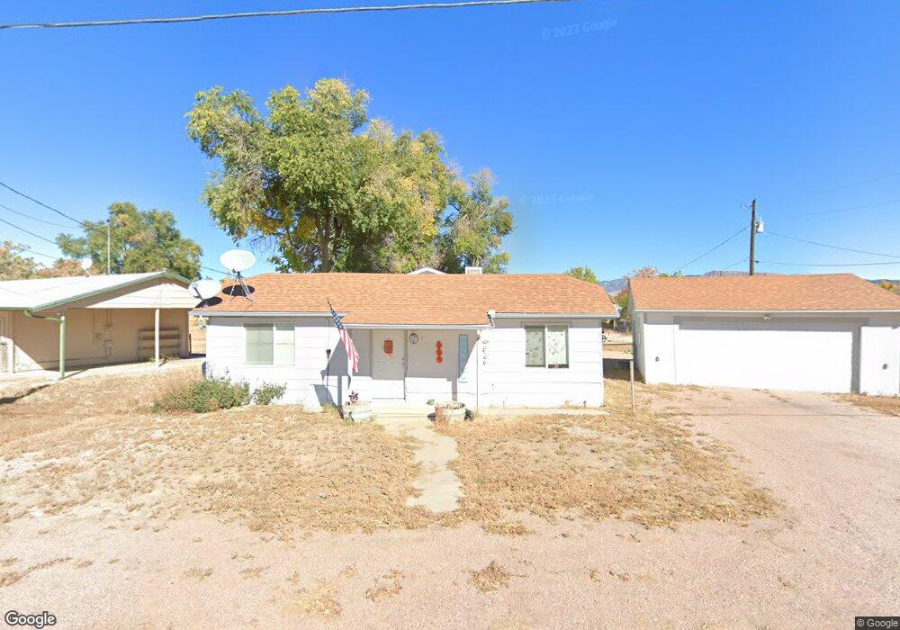
2017 Pear St Cañon City, CO 81212
Estimated Value: $275,219 - $344,000
4
Beds
2
Baths
1,728
Sq Ft
$179/Sq Ft
Est. Value
About This Home
This home is located at 2017 Pear St, Cañon City, CO 81212 and is currently estimated at $310,055, approximately $179 per square foot. 2017 Pear St is a home located in Fremont County with nearby schools including Harrison School, Canon City High School, and Mount View Core Knowledge Charter School.
Ownership History
Date
Name
Owned For
Owner Type
Purchase Details
Closed on
Dec 2, 2013
Sold by
Wells Fargo Bank Na
Bought by
Threet James S and Haines Threet Pamela S
Current Estimated Value
Purchase Details
Closed on
Sep 16, 2013
Sold by
Gehring Linda and Gehring Robin
Bought by
Wells Fargo Bank Na
Purchase Details
Closed on
Nov 25, 2008
Sold by
Gehring Linda Kathleen and Gehring Robin Kelly
Bought by
Gehring Linda Kathleen and Berstler Scott David
Purchase Details
Closed on
Sep 1, 2005
Sold by
Erichsen Mildred
Bought by
Gehring Linda and Gehring Robin
Purchase Details
Closed on
Dec 14, 2001
Sold by
Steinbach
Bought by
Erichsen
Create a Home Valuation Report for This Property
The Home Valuation Report is an in-depth analysis detailing your home's value as well as a comparison with similar homes in the area
Home Values in the Area
Average Home Value in this Area
Purchase History
| Date | Buyer | Sale Price | Title Company |
|---|---|---|---|
| Threet James S | $51,500 | None Available | |
| Wells Fargo Bank Na | -- | None Available | |
| Gehring Linda Kathleen | -- | None Available | |
| Gehring Linda | -- | Security Title | |
| Erichsen | $85,000 | -- |
Source: Public Records
Tax History Compared to Growth
Tax History
| Year | Tax Paid | Tax Assessment Tax Assessment Total Assessment is a certain percentage of the fair market value that is determined by local assessors to be the total taxable value of land and additions on the property. | Land | Improvement |
|---|---|---|---|---|
| 2024 | $974 | $14,686 | $0 | $0 |
| 2023 | $974 | $11,001 | $0 | $0 |
| 2022 | $1,118 | $12,883 | $0 | $0 |
| 2021 | $1,121 | $13,254 | $0 | $0 |
| 2020 | $774 | $9,215 | $0 | $0 |
| 2019 | $764 | $9,215 | $0 | $0 |
| 2018 | $667 | $7,835 | $0 | $0 |
| 2017 | $621 | $7,835 | $0 | $0 |
| 2016 | $521 | $7,120 | $0 | $0 |
| 2015 | $520 | $7,120 | $0 | $0 |
| 2012 | $701 | $10,069 | $2,388 | $7,681 |
Source: Public Records
Map
Nearby Homes
- 725 Yarbrough St
- 720 N 19th St
- 785 Harrow Ct
- 1860 Central Ave
- 709 Oxford Ct
- 603 N Orchard Ave
- 628 Phelps Ave
- 815 Della Vista Ln
- 2264 Surrey Ln
- 510 N 19th St Unit 19A
- 510 N 19th St Unit 27
- 510 N 19th St Unit 40
- 510 N 19th St Unit 23
- 510 N 19th St Unit 1
- 854 Briarwood St
- 860 Zona St Unit 2A
- 860 Zona St Unit 32
- 790 Cone Ave
- 470 Crestmoor Rd
- 467 Crestmoor Rd