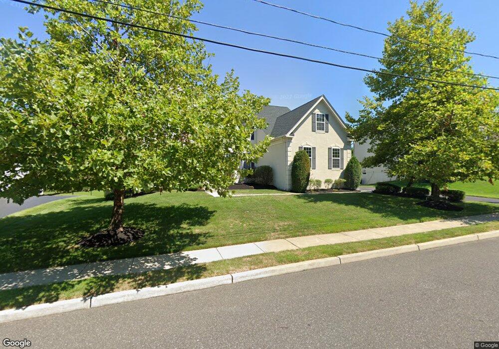
202 Cemetery Rd Mount Laurel, NJ 08054
Estimated Value: $880,000 - $986,000
--
Bed
--
Bath
3,422
Sq Ft
$270/Sq Ft
Est. Value
About This Home
This home is located at 202 Cemetery Rd, Mount Laurel, NJ 08054 and is currently estimated at $923,259, approximately $269 per square foot. 202 Cemetery Rd is a home located in Burlington County with nearby schools including Springville School, T.E. Harrington Middle School, and Mount Laurel Hartford School.
Ownership History
Date
Name
Owned For
Owner Type
Purchase Details
Closed on
Mar 2, 2007
Sold by
West Douglas and Donnon Gloria
Bought by
Schaming David J and Schaming Karen A
Current Estimated Value
Home Financials for this Owner
Home Financials are based on the most recent Mortgage that was taken out on this home.
Original Mortgage
$417,000
Outstanding Balance
$252,266
Interest Rate
6.25%
Mortgage Type
Purchase Money Mortgage
Estimated Equity
$670,993
Purchase Details
Closed on
Feb 28, 2006
Sold by
Orleans At Maple Glen Llc
Bought by
West Douglas and Donnon Gloria
Home Financials for this Owner
Home Financials are based on the most recent Mortgage that was taken out on this home.
Original Mortgage
$544,000
Interest Rate
1%
Mortgage Type
Fannie Mae Freddie Mac
Create a Home Valuation Report for This Property
The Home Valuation Report is an in-depth analysis detailing your home's value as well as a comparison with similar homes in the area
Home Values in the Area
Average Home Value in this Area
Purchase History
| Date | Buyer | Sale Price | Title Company |
|---|---|---|---|
| Schaming David J | $675,000 | Surety Title Corp | |
| West Douglas | $684,955 | Surety Title Corp |
Source: Public Records
Mortgage History
| Date | Status | Borrower | Loan Amount |
|---|---|---|---|
| Open | Schaming David J | $417,000 | |
| Previous Owner | West Douglas | $544,000 |
Source: Public Records
Tax History Compared to Growth
Tax History
| Year | Tax Paid | Tax Assessment Tax Assessment Total Assessment is a certain percentage of the fair market value that is determined by local assessors to be the total taxable value of land and additions on the property. | Land | Improvement |
|---|---|---|---|---|
| 2025 | $16,445 | $520,900 | $147,000 | $373,900 |
| 2024 | $15,342 | $520,900 | $147,000 | $373,900 |
| 2023 | $15,342 | $505,000 | $147,000 | $358,000 |
| 2022 | $15,291 | $505,000 | $147,000 | $358,000 |
| 2021 | $14,736 | $496,000 | $147,000 | $349,000 |
| 2020 | $14,448 | $496,000 | $147,000 | $349,000 |
| 2019 | $14,300 | $496,000 | $147,000 | $349,000 |
| 2018 | $14,191 | $496,000 | $147,000 | $349,000 |
| 2017 | $13,824 | $496,000 | $147,000 | $349,000 |
| 2016 | $13,615 | $496,000 | $147,000 | $349,000 |
| 2015 | $13,456 | $496,000 | $147,000 | $349,000 |
| 2014 | $13,323 | $496,000 | $147,000 | $349,000 |
Source: Public Records
Map
Nearby Homes
- 89 Peppergrass Dr S
- 15 Pecan Ct
- 132 Peppergrass Dr S
- 3 Abington Rd
- 17 Peppergrass Dr N
- 7 Buttonbush Ct
- 422 Elderberry Ct
- 420 Elderberry Ct
- 12 Taconia Ct
- 8 Raven Ct
- 212 Dogwood Dr
- 13 Marcy Ct
- 1 Adner Dr
- 3 United States Cir
- 23 Emory Ln
- 10 Gretna Ct
- 5 Hilltop Dr
- 1201A Ginger Ct
- 11 E Berwin Way
- 329 Mount Laurel Rd
- 204 Cemetery Rd
- 200 Cemetery Rd
- 206 Cemetery Rd
- 1 Cranbury Hill Ct
- 3 Cranbury Hill Ct
- 5 Cranbury Hill Ct
- 9 Old Hickory Ct
- 7 Old Hickory Ct
- 2 Cranbury Hill Ct
- 215 Cemetery Rd
- 4 Cranbury Hill Ct
- 6 Cranbury Hill Ct
- 8 Cranbury Hill Ct
- 10 Cranbury Hill Ct
- 201 Cemetery Rd
- 5 Old Hickory Ct
- 1 Maple Glenn Rd
- 3 Maple Glenn Rd
- 39 Broadacre Dr
- 43 Broadacre Dr