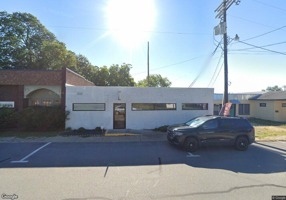
202 N Oak St Sheridan, AR 72150
Estimated Value: $108,023
--
Bed
--
Bath
2,760
Sq Ft
$39/Sq Ft
Est. Value
About This Home
This home is located at 202 N Oak St, Sheridan, AR 72150 and is currently estimated at $108,023, approximately $39 per square foot. 202 N Oak St is a home located in Grant County with nearby schools including Sheridan High School.
Ownership History
Date
Name
Owned For
Owner Type
Purchase Details
Closed on
Aug 23, 2023
Sold by
Arkansas Blossoms Birth & Wellness Llc
Bought by
Pleasant Valley Properties Llc
Current Estimated Value
Purchase Details
Closed on
Aug 31, 2020
Sold by
Grant County Chamber Of Commerce
Bought by
Parscrog Commercial Llc
Home Financials for this Owner
Home Financials are based on the most recent Mortgage that was taken out on this home.
Original Mortgage
$70,550
Interest Rate
3%
Mortgage Type
Commercial
Create a Home Valuation Report for This Property
The Home Valuation Report is an in-depth analysis detailing your home's value as well as a comparison with similar homes in the area
Home Values in the Area
Average Home Value in this Area
Purchase History
| Date | Buyer | Sale Price | Title Company |
|---|---|---|---|
| Pleasant Valley Properties Llc | $48,000 | First National Title | |
| Pleasant Valley Properties Llc | $48,000 | First National Title | |
| Parscrog Commercial Llc | $75,000 | First National Title Company |
Source: Public Records
Mortgage History
| Date | Status | Borrower | Loan Amount |
|---|---|---|---|
| Previous Owner | Parscrog Commercial Llc | $70,550 |
Source: Public Records
Tax History Compared to Growth
Tax History
| Year | Tax Paid | Tax Assessment Tax Assessment Total Assessment is a certain percentage of the fair market value that is determined by local assessors to be the total taxable value of land and additions on the property. | Land | Improvement |
|---|---|---|---|---|
| 2025 | $612 | $14,580 | $4,500 | $10,080 |
| 2024 | $510 | $11,330 | $1,650 | $9,680 |
| 2023 | $510 | $11,330 | $1,650 | $9,680 |
| 2022 | $510 | $11,330 | $1,650 | $9,680 |
| 2021 | $510 | $11,330 | $1,650 | $9,680 |
| 2020 | $589 | $13,090 | $1,500 | $11,590 |
| 2019 | $589 | $13,090 | $1,500 | $11,590 |
| 2018 | $589 | $13,090 | $1,500 | $11,590 |
| 2017 | $589 | $13,090 | $1,500 | $11,590 |
| 2015 | -- | $14,690 | $1,500 | $13,190 |
| 2014 | -- | $14,690 | $1,500 | $13,190 |
| 2012 | -- | $14,690 | $1,500 | $13,190 |
Source: Public Records
Map
Nearby Homes
- 205 N Main St
- 206 W High St
- 300 W High St
- 0 W Bell St
- 0 E Center St
- 0 Center Street Hwy Unit 25041214
- 611 W Church St
- 407 E Holly St
- 211 N College St
- 709 W Church St
- 711 W Church St
- 801 N Arch St
- 1 Rose Ct
- 708 E 2nd St
- 0 Grant 9 Unit 25044833
- 701 N Red St
- 38 Valley Ct
- 1000 N Arch St
- 39 Valley Ct
- 610 S Rock St
- 200 N Oak St
- 201 N Oak St
- 203 N Main St
- 117 N Oak St
- 113 N Oak St
- 0 Westbrooke Dr Unit 20038704
- 0 Westbrooke Dr Unit 17029736
- 209 N Main St
- 0 N Main St
- 205 & 209 N Main St
- 302 N Oak St
- 106 & 109 N Oak St
- 109 N Oak St
- 104 W Church St
- 212 N Main St
- 206 N Main St
- 120 W Center St
- 208 W Bell St
- 102 W Church St
- 110 N Rose St