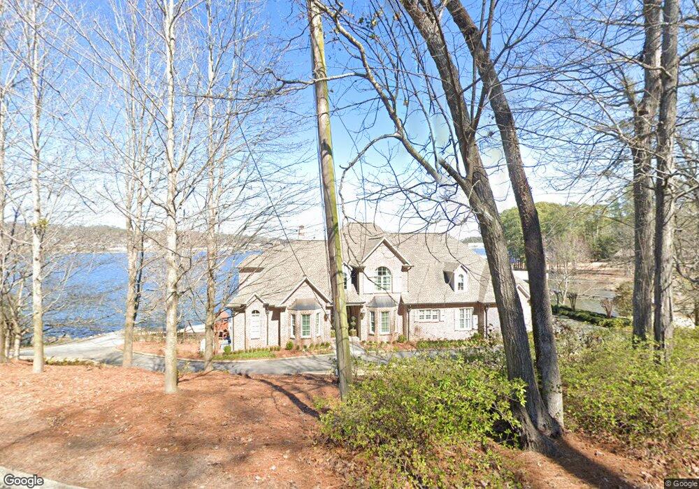
2020 Wyeth Dr Guntersville, AL 35976
Estimated Value: $1,147,000 - $1,687,935
--
Bed
2
Baths
4,949
Sq Ft
$277/Sq Ft
Est. Value
About This Home
This home is located at 2020 Wyeth Dr, Guntersville, AL 35976 and is currently estimated at $1,370,978, approximately $277 per square foot. 2020 Wyeth Dr is a home located in Marshall County with nearby schools including Guntersville Elementary School, Cherokee Elementary School, and Guntersville Middle School.
Ownership History
Date
Name
Owned For
Owner Type
Purchase Details
Closed on
Jun 7, 2024
Sold by
Oliver Amanda Abernathy and Oliver James
Bought by
Barnes James Edward and Barnes Desiree Dawn
Current Estimated Value
Purchase Details
Closed on
Aug 8, 2016
Sold by
Flanagan Michael L and Flanagan Laura B
Bought by
Flanagan Jonathan Kirk and Flanagan Johnna C
Home Financials for this Owner
Home Financials are based on the most recent Mortgage that was taken out on this home.
Original Mortgage
$416,000
Interest Rate
3.56%
Mortgage Type
New Conventional
Create a Home Valuation Report for This Property
The Home Valuation Report is an in-depth analysis detailing your home's value as well as a comparison with similar homes in the area
Home Values in the Area
Average Home Value in this Area
Purchase History
| Date | Buyer | Sale Price | Title Company |
|---|---|---|---|
| Barnes James Edward | $320,000 | None Listed On Document | |
| Flanagan Jonathan Kirk | $520,000 | None Available |
Source: Public Records
Mortgage History
| Date | Status | Borrower | Loan Amount |
|---|---|---|---|
| Previous Owner | Flanagan Jonathan Kirk | $416,000 |
Source: Public Records
Tax History Compared to Growth
Tax History
| Year | Tax Paid | Tax Assessment Tax Assessment Total Assessment is a certain percentage of the fair market value that is determined by local assessors to be the total taxable value of land and additions on the property. | Land | Improvement |
|---|---|---|---|---|
| 2024 | $6,807 | $149,120 | $0 | $0 |
| 2023 | $6,359 | $148,940 | $0 | $0 |
| 2022 | $6,351 | $148,940 | $0 | $0 |
| 2021 | $5,472 | $128,480 | $0 | $0 |
| 2020 | $4,637 | $109,080 | $0 | $0 |
| 2017 | $4,743 | $112,120 | $0 | $0 |
| 2015 | -- | $101,640 | $0 | $0 |
| 2014 | -- | $99,080 | $0 | $0 |
Source: Public Records
Map
Nearby Homes
- Lot 4 Wyeth Dr
- Lot 9 Wyeth Dr
- 40 & 41 Wyeth Dr
- Lot 13 Wyeth Dr
- LOTS 82 AND 83 Wyeth Dr
- Lot 7 Wyeth Dr
- Lot 6 Wyeth Dr
- Lot 12 Wyeth Dr
- Lot 5 Wyeth Dr
- Lot 8 Wyeth Dr
- Lot 1 Wyeth Dr
- 121.46 Acres Wyeth Dr
- Lot 3 Wyeth Dr
- Lot 10 & 11 Wyeth Dr
- 1605 Wyeth Dr
- 3.7 acres Wyeth Dr
- 56 Fall Creek Dr
- 1629 Gunter Ave
- 1609 Obrig Ave
- Lot 18 and 19 Obrig Ave