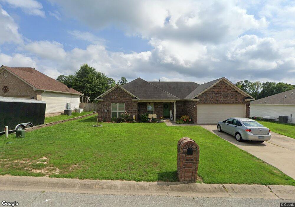
2024 Milburn Dr Benton, AR 72015
Estimated Value: $209,000 - $229,000
3
Beds
2
Baths
1,458
Sq Ft
$149/Sq Ft
Est. Value
About This Home
This home is located at 2024 Milburn Dr, Benton, AR 72015 and is currently estimated at $217,800, approximately $149 per square foot. 2024 Milburn Dr is a home located in Saline County with nearby schools including Angie Grant Elementary School, Benton Middle School, and Benton Junior High School.
Ownership History
Date
Name
Owned For
Owner Type
Purchase Details
Closed on
Nov 23, 2010
Sold by
Prestige Homes Construction Inc
Bought by
Burns Robert C and Reaves Andrea
Current Estimated Value
Home Financials for this Owner
Home Financials are based on the most recent Mortgage that was taken out on this home.
Original Mortgage
$82,719
Outstanding Balance
$54,465
Interest Rate
4.23%
Mortgage Type
FHA
Estimated Equity
$163,335
Purchase Details
Closed on
Apr 9, 2010
Sold by
Bryant Meadows Development Inc
Bought by
Prestige Homes Construction Inc
Home Financials for this Owner
Home Financials are based on the most recent Mortgage that was taken out on this home.
Original Mortgage
$105,600
Interest Rate
4.88%
Mortgage Type
Purchase Money Mortgage
Create a Home Valuation Report for This Property
The Home Valuation Report is an in-depth analysis detailing your home's value as well as a comparison with similar homes in the area
Home Values in the Area
Average Home Value in this Area
Purchase History
| Date | Buyer | Sale Price | Title Company |
|---|---|---|---|
| Burns Robert C | $140,000 | -- | |
| Prestige Homes Construction Inc | $20,000 | -- |
Source: Public Records
Mortgage History
| Date | Status | Borrower | Loan Amount |
|---|---|---|---|
| Open | Burns Robert C | $82,719 | |
| Previous Owner | Prestige Homes Construction Inc | $105,600 |
Source: Public Records
Tax History Compared to Growth
Tax History
| Year | Tax Paid | Tax Assessment Tax Assessment Total Assessment is a certain percentage of the fair market value that is determined by local assessors to be the total taxable value of land and additions on the property. | Land | Improvement |
|---|---|---|---|---|
| 2025 | $1,528 | $34,780 | $6,240 | $28,540 |
| 2024 | $1,564 | $34,780 | $6,240 | $28,540 |
| 2023 | $1,103 | $34,780 | $6,240 | $28,540 |
| 2022 | $1,153 | $34,780 | $6,240 | $28,540 |
| 2021 | $1,153 | $27,580 | $4,800 | $22,780 |
| 2020 | $1,153 | $27,580 | $4,800 | $22,780 |
| 2019 | $1,153 | $27,580 | $4,800 | $22,780 |
| 2018 | $1,175 | $27,580 | $4,800 | $22,780 |
| 2017 | $1,175 | $27,580 | $4,800 | $22,780 |
| 2016 | $1,614 | $28,460 | $4,800 | $23,660 |
| 2015 | $1,235 | $28,460 | $4,800 | $23,660 |
| 2014 | $1,247 | $28,460 | $4,800 | $23,660 |
Source: Public Records
Map
Nearby Homes
- 1709 Milburn Dr
- 1521 Chatfield
- 2423 S Chatfield Rd
- 1507 Chatfield
- 000 Sorrell Rd
- 2607 Silica Heights
- 00 S Neeley St
- 3503 S Chatfield Rd
- 3222 Silica Heights
- 1304 Gray St
- 806 Canterbury
- 1423 Cedar
- 3108 Edison Ave
- 507 Algood St
- 712 S Border St
- 1707 Dixie
- 508 Pleasant Ridge Dr
- 391 Genesis Dr
- 605 Revis St
- 1121 Stewart
- 2030 Milburn Dr
- 1960 Milburn Dr
- 1956 Auburn Hills Dr
- 1956 Auburn Hills Dr
- 0 Milburn Dr Unit 15004660
- 0 Milburn Dr Unit 17001148
- 1952 Auburn Hills Dr
- 2009 Milburn Dr
- 2036 Milburn Dr
- 2028 Milburn Dr
- 2018 Milburn Dr
- 2037 Milburn Dr
- 1973 Milburn Dr
- 2042 Milburn Dr
- 2043 Milburn Dr
- 1961 Auburn Hills Dr
- 2048 Milburn Dr
- 1965 Auburn Hills Dr
- 1827 Milburn Dr
- 1993 Milburn Dr