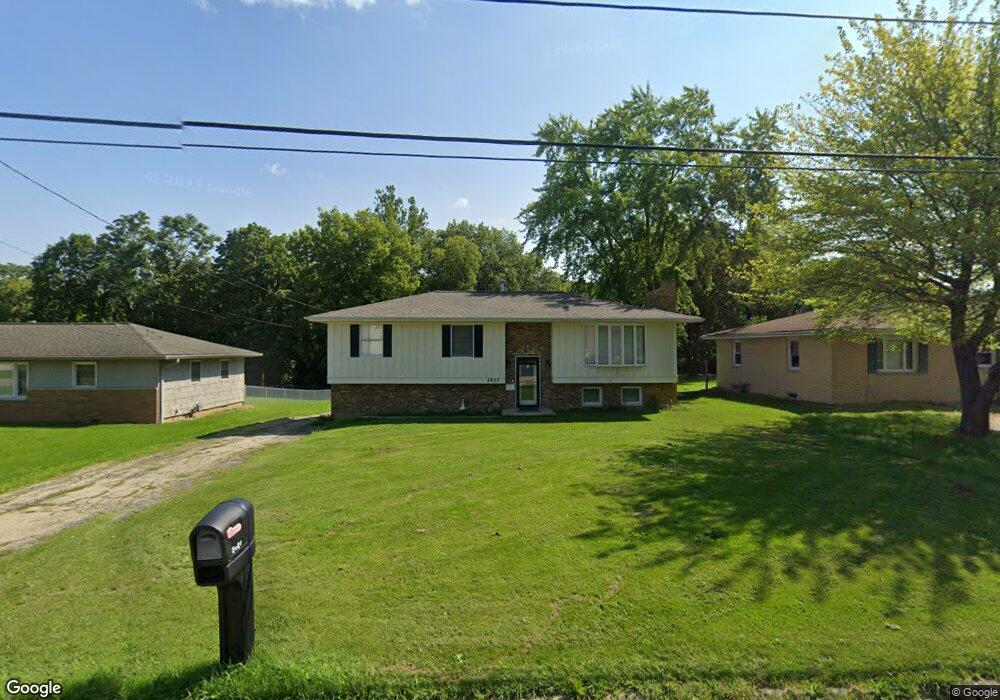
2027 Springfield Rd East Peoria, IL 61611
Estimated Value: $169,000 - $193,000
3
Beds
2
Baths
1,636
Sq Ft
$109/Sq Ft
Est. Value
About This Home
This home is located at 2027 Springfield Rd, East Peoria, IL 61611 and is currently estimated at $178,363, approximately $109 per square foot. 2027 Springfield Rd is a home located in Tazewell County with nearby schools including Don D. Shute Elementary School, Lincoln Elementary School, and Central Junior High School.
Ownership History
Date
Name
Owned For
Owner Type
Purchase Details
Closed on
Sep 25, 2007
Sold by
Gregory Kay
Bought by
Beckwith Lynda
Current Estimated Value
Purchase Details
Closed on
Jul 26, 2007
Sold by
Meixsell Janis C
Bought by
Gregory Kay
Purchase Details
Closed on
Jun 9, 2006
Sold by
Linck James H and Linck Betty L
Bought by
Meixsell Janis C and The Linck Family Trust
Create a Home Valuation Report for This Property
The Home Valuation Report is an in-depth analysis detailing your home's value as well as a comparison with similar homes in the area
Home Values in the Area
Average Home Value in this Area
Purchase History
| Date | Buyer | Sale Price | Title Company |
|---|---|---|---|
| Beckwith Lynda | -- | None Available | |
| Gregory Kay | $111,000 | None Available | |
| Meixsell Janis C | -- | None Available |
Source: Public Records
Tax History Compared to Growth
Tax History
| Year | Tax Paid | Tax Assessment Tax Assessment Total Assessment is a certain percentage of the fair market value that is determined by local assessors to be the total taxable value of land and additions on the property. | Land | Improvement |
|---|---|---|---|---|
| 2024 | $3,621 | $47,370 | $8,300 | $39,070 |
| 2023 | $3,621 | $43,490 | $7,620 | $35,870 |
| 2022 | $3,401 | $40,230 | $7,050 | $33,180 |
| 2021 | $3,241 | $38,680 | $6,780 | $31,900 |
| 2020 | $3,168 | $38,680 | $6,780 | $31,900 |
| 2019 | $3,146 | $38,680 | $6,780 | $31,900 |
| 2018 | $3,059 | $38,680 | $6,780 | $31,900 |
| 2017 | $2,913 | $37,440 | $6,780 | $30,660 |
| 2016 | $2,821 | $36,860 | $5,160 | $31,700 |
| 2015 | $2,667 | $0 | $0 | $0 |
| 2013 | $2,684 | $35,710 | $5,000 | $30,710 |
Source: Public Records
Map
Nearby Homes
- 2217 Springfield Rd
- 129 Glenridge Dr
- 515 Briarbrook Dr
- 409 Briarbrook Dr
- 106 Field Grove Rd
- 101 Woodbrook Ct
- 1604 Springfield Rd
- 301 Briarbrook Dr
- Lot 1 Briarbrook Dr
- Lot 2 Briarbrook Dr
- 1406 Springfield Rd
- 015 Harris Rd
- Lot 4 Harris Rd
- 0 Pinecrest Dr
- 110 Susan Ct
- 122 Susan Ct
- 126 Susan Ct
- 118 Susan Ct
- 130 Susan Ct
- 108 Kohl St
- 2029 Springfield Rd
- 2025 Springfield Rd
- 2023 Springfield Rd
- 2021 Springfield Rd
- 2028 Springfield Rd
- 102 James Ct
- 2017 Springfield Rd
- 106 James Ct
- 2015 Springfield Rd
- 103 Mabee Ave
- 101 James Ct
- 105 James Ct
- 114 James Ct
- 109 James Ct
- 105 Mabee Ave
- 115 Herman St
- 113 James Ct
- 117 Herman St
- 2120 Springfield Rd
- 2121 Springfield Rd