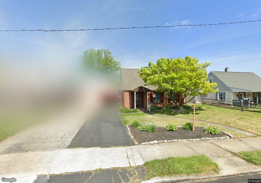
2029 Clearview Ave Norristown, PA 19403
West Norriton Township NeighborhoodEstimated Value: $341,000 - $386,755
3
Beds
2
Baths
1,525
Sq Ft
$241/Sq Ft
Est. Value
About This Home
This home is located at 2029 Clearview Ave, Norristown, PA 19403 and is currently estimated at $367,439, approximately $240 per square foot. 2029 Clearview Ave is a home located in Montgomery County with nearby schools including Charles Blockson Middle School, Paul V Fly Elementary School, and East Norriton Middle School.
Ownership History
Date
Name
Owned For
Owner Type
Purchase Details
Closed on
Apr 9, 2009
Sold by
Miller Denise M and Anderson Thomas P
Bought by
Reinike Christine Michelle
Current Estimated Value
Home Financials for this Owner
Home Financials are based on the most recent Mortgage that was taken out on this home.
Original Mortgage
$186,558
Outstanding Balance
$117,871
Interest Rate
4.93%
Estimated Equity
$249,568
Purchase Details
Closed on
Oct 11, 2006
Sold by
Miller Denise H and Anderson Thomas P
Bought by
Miller Denise H and Anderson Thomas P
Home Financials for this Owner
Home Financials are based on the most recent Mortgage that was taken out on this home.
Original Mortgage
$142,000
Interest Rate
6.49%
Create a Home Valuation Report for This Property
The Home Valuation Report is an in-depth analysis detailing your home's value as well as a comparison with similar homes in the area
Home Values in the Area
Average Home Value in this Area
Purchase History
| Date | Buyer | Sale Price | Title Company |
|---|---|---|---|
| Reinike Christine Michelle | $190,000 | None Available | |
| Miller Denise H | -- | None Available |
Source: Public Records
Mortgage History
| Date | Status | Borrower | Loan Amount |
|---|---|---|---|
| Open | Reinike Christine Michelle | $186,558 | |
| Previous Owner | Miller Denise H | $142,000 |
Source: Public Records
Tax History Compared to Growth
Tax History
| Year | Tax Paid | Tax Assessment Tax Assessment Total Assessment is a certain percentage of the fair market value that is determined by local assessors to be the total taxable value of land and additions on the property. | Land | Improvement |
|---|---|---|---|---|
| 2025 | $5,492 | $112,410 | $41,190 | $71,220 |
| 2024 | $5,492 | $112,410 | $41,190 | $71,220 |
| 2023 | $5,430 | $112,410 | $41,190 | $71,220 |
| 2022 | $5,395 | $112,410 | $41,190 | $71,220 |
| 2021 | $5,362 | $112,410 | $41,190 | $71,220 |
| 2020 | $5,202 | $112,410 | $41,190 | $71,220 |
| 2019 | $5,086 | $112,410 | $41,190 | $71,220 |
| 2018 | $3,903 | $112,410 | $41,190 | $71,220 |
| 2017 | $4,801 | $112,410 | $41,190 | $71,220 |
| 2016 | $4,758 | $112,410 | $41,190 | $71,220 |
| 2015 | $4,407 | $112,410 | $41,190 | $71,220 |
| 2014 | $4,407 | $112,410 | $41,190 | $71,220 |
Source: Public Records
Map
Nearby Homes
- 2025 Sterigere St
- 37 Burnside Ave
- 1104 Arden Dr Unit METHACTON SCHOOL
- 709 Middleton Place
- 1749 W Marshall St
- 166 Hoover Ave
- 214 Oxford Cir
- 145 Colonial Ave
- 1613 Countryside Ln
- 1924 Juniata Rd
- 1635 W Marshall W Marshall St
- 612 Glen Ln Unit 56A
- 2515 Fieldcrest Ave
- 1506 W Marshall St
- 1448 W James St
- 805 Stonybrook Dr
- 1219 Stonybrook Dr Unit 1219
- 533 Brandon Rd
- 1633 Williams Way
- 501 Stonybrook Dr
- 2033 Clearview Ave
- 2025 Clearview Ave
- 2037 Clearview Ave
- 2021 Clearview Ave
- 2028 Clearview Ave
- 2017 Clearview Ave
- 2016 Davis Dr
- 2024 Clearview Ave
- 2032 Clearview Ave
- 2020 Clearview Ave
- 2024 Davis Dr
- 2036 Clearview Ave
- 2013 Clearview Ave
- 2016 Clearview Ave
- 2044 Clearview Ave
- 2012 Davis Dr
- 2045 Clearview Ave
- 2009 Clearview Ave
- 2012 Clearview Ave
- 206 Liberty Ave