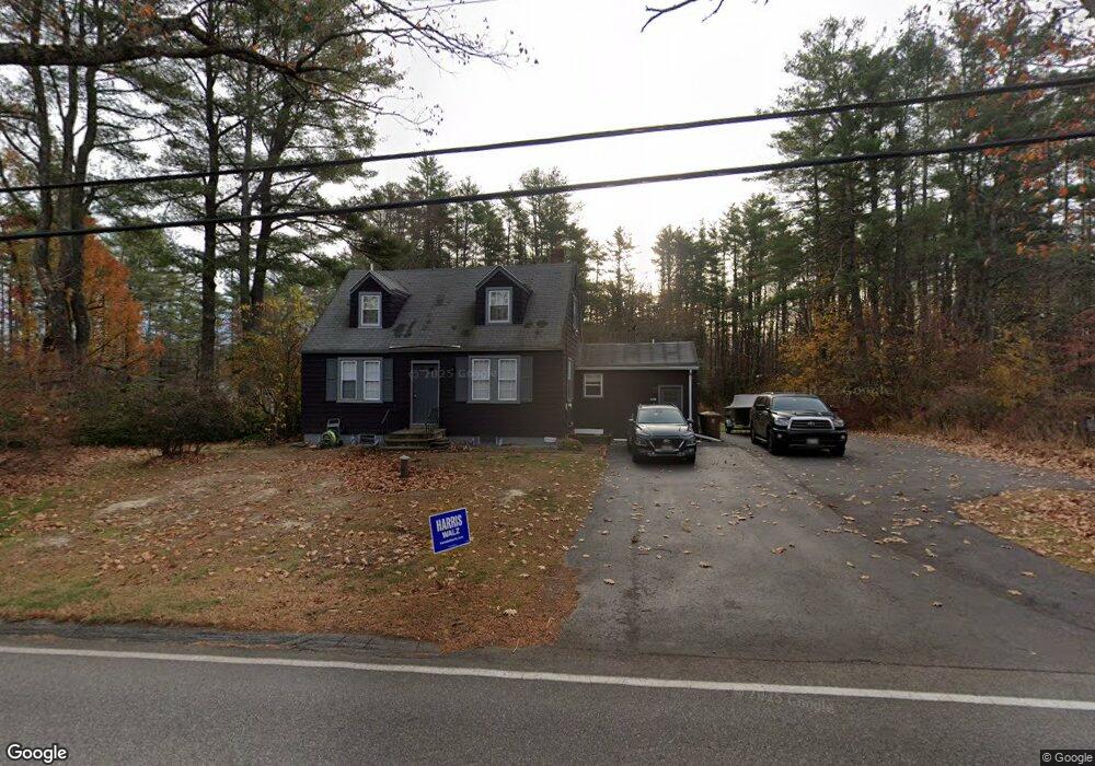
203 Heath Rd Saco, ME 04072
North Saco NeighborhoodEstimated Value: $394,000 - $474,000
2
Beds
1
Bath
1,155
Sq Ft
$365/Sq Ft
Est. Value
About This Home
This home is located at 203 Heath Rd, Saco, ME 04072 and is currently estimated at $422,014, approximately $365 per square foot. 203 Heath Rd is a home located in York County with nearby schools including C K Burns School and Saco Middle School.
Ownership History
Date
Name
Owned For
Owner Type
Purchase Details
Closed on
Nov 7, 2014
Sold by
Serrano Melanie H
Bought by
Serrano Melanie H and Serrano Irvin I
Current Estimated Value
Purchase Details
Closed on
Aug 29, 2012
Sold by
Weld Clarice W Est
Bought by
Hansen Melanie B
Home Financials for this Owner
Home Financials are based on the most recent Mortgage that was taken out on this home.
Original Mortgage
$139,400
Interest Rate
3.56%
Mortgage Type
New Conventional
Create a Home Valuation Report for This Property
The Home Valuation Report is an in-depth analysis detailing your home's value as well as a comparison with similar homes in the area
Home Values in the Area
Average Home Value in this Area
Purchase History
| Date | Buyer | Sale Price | Title Company |
|---|---|---|---|
| Serrano Melanie H | -- | -- | |
| Hansen Melanie B | -- | -- |
Source: Public Records
Mortgage History
| Date | Status | Borrower | Loan Amount |
|---|---|---|---|
| Closed | Hansen Melanie B | $139,400 |
Source: Public Records
Tax History Compared to Growth
Tax History
| Year | Tax Paid | Tax Assessment Tax Assessment Total Assessment is a certain percentage of the fair market value that is determined by local assessors to be the total taxable value of land and additions on the property. | Land | Improvement |
|---|---|---|---|---|
| 2024 | $4,669 | $332,300 | $179,300 | $153,000 |
| 2023 | $4,901 | $332,300 | $179,300 | $153,000 |
| 2022 | $4,476 | $244,200 | $136,600 | $107,600 |
| 2021 | $4,312 | $228,400 | $125,300 | $103,100 |
| 2020 | $4,017 | $204,200 | $110,200 | $94,000 |
| 2019 | $3,957 | $204,200 | $110,200 | $94,000 |
| 2018 | $3,764 | $194,200 | $100,200 | $94,000 |
| 2017 | $3,496 | $180,400 | $93,200 | $87,200 |
| 2016 | $3,453 | $177,800 | $75,600 | $102,200 |
| 2015 | $3,394 | $176,600 | $75,600 | $101,000 |
| 2014 | $3,312 | $177,900 | $76,900 | $101,000 |
| 2013 | $3,305 | $177,900 | $76,900 | $101,000 |
Source: Public Records
Map
Nearby Homes
- 110/009 Mast Hill Rd
- 9 Jada Dr
- 3 Nonesuch Rd
- 436 Flag Pond Rd
- Lot 1 & 2 Memory Ln
- 130 Mckenney Rd
- 5 Marguerite Rd
- 295 Buxton Rd
- 75 Ash Swamp Rd
- 91 C Broadturn Rd
- 74 Hearn Rd
- Lot 2 TBD Bobby Ave
- 177 Old Orchard Rd
- 158 Lord Rd
- 9 Bonita Way
- 15 Silver Brook Cir
- 0 Beech Plains Rd
- lot 3 June Dr
- Lot 72 Martell Way
- lot 2 June Dr
- Lot E Heath Rd
- 199 Heath Rd
- 204 Heath Rd
- 0 Heath Rd
- 195 Heath Rd
- 191 Heath Rd
- 0 Mast Hill
- 3 Acres Mast Hill Rd
- 211 Heath Rd
- 2 Acres Mast Hill Rd
- 2 Mast Hill Rd
- 2.7acres Mast Hill Rd
- 7 Mast Hill Rd
- 1.9 Acres Mast Hill Rd
- 5 Justine's Way
- 0 Graceland Acres
- 187 Heath Rd
- 1 Justine's Way
- 6 Graceland Acres
- 1 Justines Way