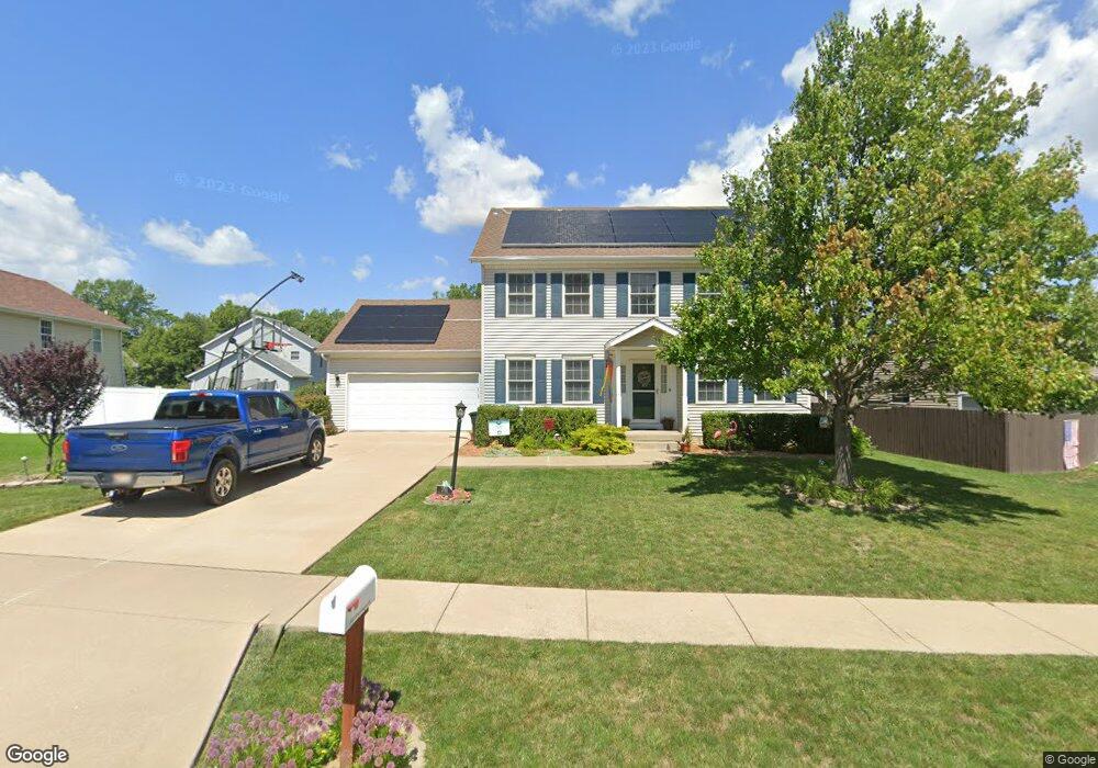
203 Stonewood Dr East Peoria, IL 61611
Estimated Value: $265,000 - $325,000
--
Bed
--
Bath
2,276
Sq Ft
$131/Sq Ft
Est. Value
About This Home
This home is located at 203 Stonewood Dr, East Peoria, IL 61611 and is currently estimated at $299,232, approximately $131 per square foot. 203 Stonewood Dr is a home located in Tazewell County with nearby schools including Lasalle Elementary School, Parkview Jr High School, and East Peoria High School.
Ownership History
Date
Name
Owned For
Owner Type
Purchase Details
Closed on
Mar 15, 2006
Sold by
Cole Valley Llc
Bought by
Miller Troy R and Miller Michelle
Current Estimated Value
Home Financials for this Owner
Home Financials are based on the most recent Mortgage that was taken out on this home.
Original Mortgage
$175,900
Outstanding Balance
$100,349
Interest Rate
6.33%
Mortgage Type
Purchase Money Mortgage
Estimated Equity
$198,883
Create a Home Valuation Report for This Property
The Home Valuation Report is an in-depth analysis detailing your home's value as well as a comparison with similar homes in the area
Home Values in the Area
Average Home Value in this Area
Purchase History
| Date | Buyer | Sale Price | Title Company |
|---|---|---|---|
| Miller Troy R | $190,000 | None Available |
Source: Public Records
Mortgage History
| Date | Status | Borrower | Loan Amount |
|---|---|---|---|
| Open | Miller Troy R | $175,900 |
Source: Public Records
Tax History Compared to Growth
Tax History
| Year | Tax Paid | Tax Assessment Tax Assessment Total Assessment is a certain percentage of the fair market value that is determined by local assessors to be the total taxable value of land and additions on the property. | Land | Improvement |
|---|---|---|---|---|
| 2024 | $6,569 | $83,990 | $9,850 | $74,140 |
| 2023 | $6,569 | $77,110 | $9,040 | $68,070 |
| 2022 | $6,258 | $71,320 | $8,360 | $62,960 |
| 2021 | $5,944 | $68,580 | $8,040 | $60,540 |
| 2020 | $5,746 | $68,580 | $8,040 | $60,540 |
| 2019 | $5,696 | $68,580 | $8,040 | $60,540 |
| 2018 | $5,551 | $68,580 | $8,040 | $60,540 |
| 2017 | $5,493 | $68,580 | $8,040 | $60,540 |
| 2016 | $5,652 | $71,400 | $14,130 | $57,270 |
| 2015 | $5,403 | $0 | $0 | $0 |
| 2013 | $5,442 | $69,170 | $13,690 | $55,480 |
Source: Public Records
Map
Nearby Homes
- 101 Woodbrook Ct
- 2217 Springfield Rd
- 1604 Springfield Rd
- 106 Field Grove Rd
- 108 Kohl St
- 129 Glenridge Dr
- 1406 Springfield Rd
- 515 Briarbrook Dr
- 409 Briarbrook Dr
- 404 Rainbow Dr
- 301 Briarbrook Dr
- Lot 1 Briarbrook Dr
- Lot 2 Briarbrook Dr
- 015 Harris Rd
- Lot 4 Harris Rd
- 557 Groveland St
- 104 Lewis Ct
- 1004 Springfield Rd
- 120 Gerber Ct
- 3041 Zion Oaks Rd
- 205 Stonewood Dr
- 102 Stone Creek Ct
- 100 Stone Creek Ct
- 200 Stonewood Dr
- 202 Stonewood Dr
- 103 Woodbrook Ct
- 204 Stonewood Dr
- 104 Stone Creek Ct
- 206 Stonewood Dr
- 105 Woodbrook Ct
- 208 Stonewood Dr
- 101 Stone Creek Ct
- 210 Stonewood Dr
- 107 Woodbrook Ct
- 106 Stonewood Dr
- 103 Stone Creek Ct
- 105 Stone Creek Ct
- 109 Stone Creek Ct
- 104 Stonewood Dr