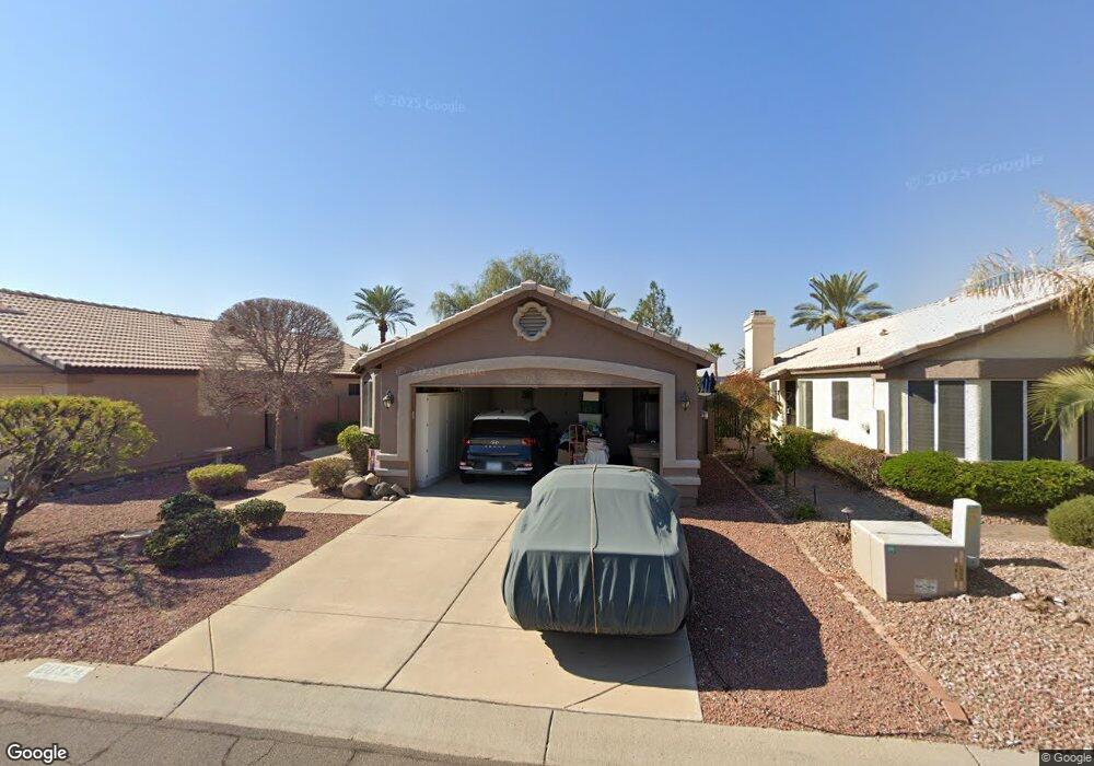
20324 N 106th Ln Peoria, AZ 85382
Estimated Value: $292,556 - $386,000
2
Beds
2
Baths
1,299
Sq Ft
$266/Sq Ft
Est. Value
About This Home
This home is located at 20324 N 106th Ln, Peoria, AZ 85382 and is currently estimated at $344,889, approximately $265 per square foot. 20324 N 106th Ln is a home located in Maricopa County with nearby schools including Parkridge Elementary School, Sunrise Mountain High School, and Candeo Peoria.
Ownership History
Date
Name
Owned For
Owner Type
Purchase Details
Closed on
Aug 11, 2009
Sold by
Galura Susan A
Bought by
Chesbrough William R
Current Estimated Value
Purchase Details
Closed on
Sep 18, 2001
Sold by
Brince Patricia A
Bought by
Brince Patricia A
Purchase Details
Closed on
Nov 13, 1998
Sold by
Wittenbreder Victoria C
Bought by
Brince Patricia A
Purchase Details
Closed on
Oct 17, 1995
Sold by
Angebrand Joe and Angebrand Karen
Bought by
Wittenbreder Victoria C
Create a Home Valuation Report for This Property
The Home Valuation Report is an in-depth analysis detailing your home's value as well as a comparison with similar homes in the area
Home Values in the Area
Average Home Value in this Area
Purchase History
| Date | Buyer | Sale Price | Title Company |
|---|---|---|---|
| Chesbrough William R | $139,500 | Equity Title Agency Inc | |
| Brince Patricia A | -- | -- | |
| Brince Patricia A | $90,000 | First American Title | |
| Wittenbreder Victoria C | $100,000 | First American Title |
Source: Public Records
Tax History Compared to Growth
Tax History
| Year | Tax Paid | Tax Assessment Tax Assessment Total Assessment is a certain percentage of the fair market value that is determined by local assessors to be the total taxable value of land and additions on the property. | Land | Improvement |
|---|---|---|---|---|
| 2025 | $1,122 | $14,316 | -- | -- |
| 2024 | $1,105 | $13,634 | -- | -- |
| 2023 | $1,105 | $23,110 | $4,620 | $18,490 |
| 2022 | $1,082 | $18,100 | $3,620 | $14,480 |
| 2021 | $1,158 | $17,100 | $3,420 | $13,680 |
| 2020 | $1,169 | $14,930 | $2,980 | $11,950 |
| 2019 | $1,131 | $14,130 | $2,820 | $11,310 |
| 2018 | $1,091 | $13,180 | $2,630 | $10,550 |
| 2017 | $1,092 | $11,280 | $2,250 | $9,030 |
| 2016 | $1,081 | $11,100 | $2,220 | $8,880 |
| 2015 | $1,009 | $10,420 | $2,080 | $8,340 |
Source: Public Records
Map
Nearby Homes
- 10659 W Yukon Dr
- 20360 N 106th Ln
- 10763 W Runion Dr
- 10630 W Mohawk Ln
- 20670 N 105th Dr
- 10722 W Irma Ln
- 10728 W Irma Ln
- 20056 N 107th Ln
- 20615 N 105th Ave
- 20769 N 106th Ln
- 10952 W Tonopah Dr
- 20274 N 104th Ave
- 20957 N 107th Dr
- 10528 W Potter Dr
- 19822 N Turquoise Hills Dr
- 10672 W Ross Ave
- 10379 W Tonopah Dr
- 10347 W Mohawk Ln
- 19822 N 108th Ave
- 20641 N 110th Ave
- 20330 N 106th Ln
- 20318 N 106th Ln
- 20312 N 106th Ln
- 20336 N 106th Ln
- 20362 N 106th Ln
- 20306 N 106th Ln
- 20342 N 106th Ln
- 20325 N 106th Ln
- 20319 N 106th Ln
- 20331 N 106th Ln
- 20313 N 106th Ln
- 20348 N 106th Ln
- 20337 N 106th Ln
- 20300 N 106th Ln
- 20343 N 106th Ln
- 20354 N 106th Ln
- 20349 N 106th Ln
- 20419 N 107th Dr
- 10655 W Yukon Dr
- 20425 N 107th Dr