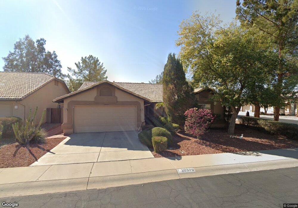
20370 N 109th Ln Sun City, AZ 85373
Estimated Value: $324,488 - $400,000
--
Bed
3
Baths
1,503
Sq Ft
$245/Sq Ft
Est. Value
About This Home
This home is located at 20370 N 109th Ln, Sun City, AZ 85373 and is currently estimated at $368,122, approximately $244 per square foot. 20370 N 109th Ln is a home located in Maricopa County with nearby schools including Parkridge Elementary School, Sunrise Mountain High School, and Candeo Peoria.
Ownership History
Date
Name
Owned For
Owner Type
Purchase Details
Closed on
Dec 21, 2004
Sold by
Saxton Ronald W and Saxton Janiece L
Bought by
Poorman Edward E and Poorman Bettylou
Current Estimated Value
Home Financials for this Owner
Home Financials are based on the most recent Mortgage that was taken out on this home.
Original Mortgage
$147,048
Outstanding Balance
$73,789
Interest Rate
5.76%
Mortgage Type
VA
Estimated Equity
$294,333
Purchase Details
Closed on
Sep 26, 2000
Sold by
Borst Bruno F and Borst Charlotte H
Bought by
Saxton Ronald W and Saxton Janiece L
Home Financials for this Owner
Home Financials are based on the most recent Mortgage that was taken out on this home.
Original Mortgage
$100,000
Interest Rate
7.88%
Mortgage Type
New Conventional
Create a Home Valuation Report for This Property
The Home Valuation Report is an in-depth analysis detailing your home's value as well as a comparison with similar homes in the area
Home Values in the Area
Average Home Value in this Area
Purchase History
| Date | Buyer | Sale Price | Title Company |
|---|---|---|---|
| Poorman Edward E | $152,500 | Grand Canyon Title Agency In | |
| Saxton Ronald W | $131,500 | First American Title |
Source: Public Records
Mortgage History
| Date | Status | Borrower | Loan Amount |
|---|---|---|---|
| Open | Poorman Edward E | $147,048 | |
| Previous Owner | Saxton Ronald W | $100,000 |
Source: Public Records
Tax History Compared to Growth
Tax History
| Year | Tax Paid | Tax Assessment Tax Assessment Total Assessment is a certain percentage of the fair market value that is determined by local assessors to be the total taxable value of land and additions on the property. | Land | Improvement |
|---|---|---|---|---|
| 2025 | $1,329 | $17,052 | -- | -- |
| 2024 | $1,309 | $16,240 | -- | -- |
| 2023 | $1,309 | $26,120 | $5,220 | $20,900 |
| 2022 | $1,281 | $20,470 | $4,090 | $16,380 |
| 2021 | $1,372 | $19,400 | $3,880 | $15,520 |
| 2020 | $1,385 | $17,050 | $3,410 | $13,640 |
| 2019 | $1,340 | $16,070 | $3,210 | $12,860 |
| 2018 | $1,296 | $15,150 | $3,030 | $12,120 |
| 2017 | $1,296 | $13,160 | $2,630 | $10,530 |
| 2016 | $1,283 | $12,910 | $2,580 | $10,330 |
| 2015 | $1,197 | $12,180 | $2,430 | $9,750 |
Source: Public Records
Map
Nearby Homes
- 10952 W Tonopah Dr
- 10763 W Runion Dr
- 20641 N 110th Ave
- 11002 W Yukon Dr
- 20360 N 106th Ln
- 10728 W Irma Ln
- 10722 W Irma Ln
- 10659 W Yukon Dr
- 20323 N 110th Ln
- 11076 W Runion Dr
- 20056 N 107th Ln
- 10630 W Mohawk Ln
- 20957 N 107th Dr
- 20769 N 106th Ln
- 20037 N 110th Ln
- 20670 N 105th Dr
- 10672 W Ross Ave
- 19927 N 108th Ln
- 19822 N 108th Ave
- 11023 W Chino Dr
- 20364 N 109th Ln
- 20358 N 109th Ln
- 10959 W Tonopah Dr
- 10934 W Tonopah Dr
- 20371 N 109th Ln
- 10965 W Tonopah Dr
- 20365 N 109th Ln
- 10940 W Tonopah Dr
- 20359 N 109th Ln
- 10946 W Tonopah Dr
- 10971 W Tonopah Dr
- 20346 N 109th Ln
- 20410 N 109th Dr
- 20353 N 109th Ln
- 10958 W Tonopah Dr
- 20364 N 109th Ave
- 20370 N 109th Ave
- 20358 N 109th Ave
- 20347 N 109th Ln
- 10964 W Tonopah Dr