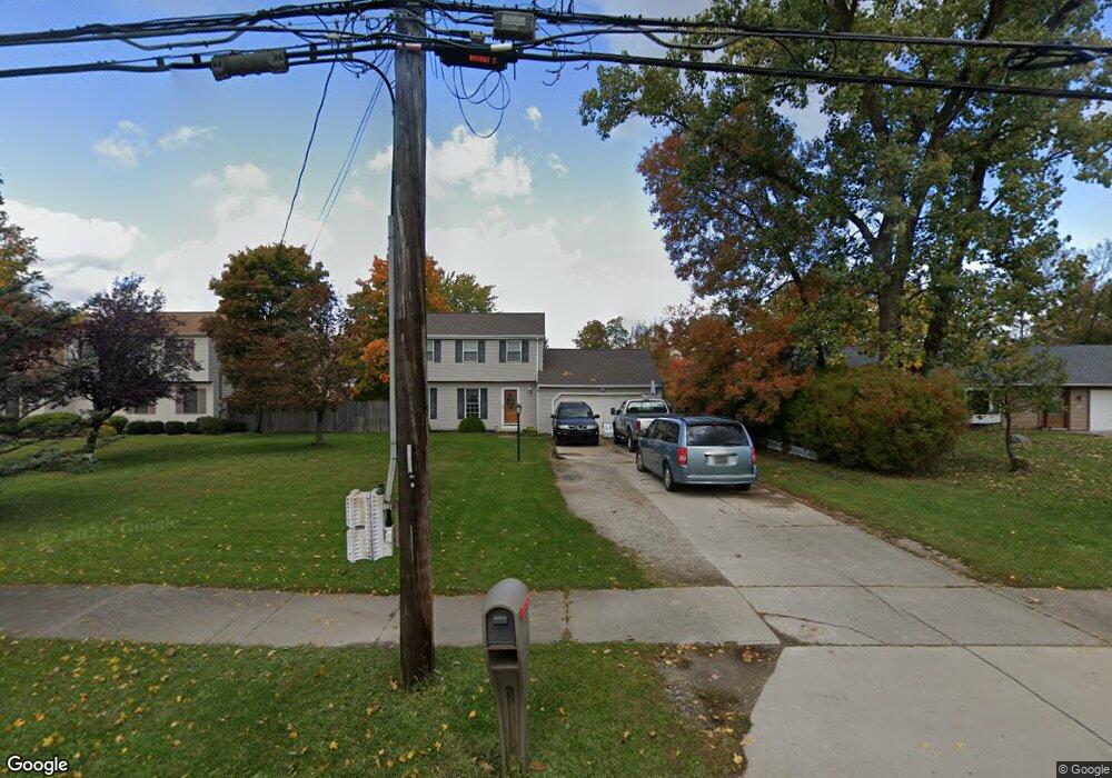
20372 Westwood Dr Strongsville, OH 44149
Estimated Value: $266,661 - $282,000
3
Beds
2
Baths
1,452
Sq Ft
$188/Sq Ft
Est. Value
About This Home
This home is located at 20372 Westwood Dr, Strongsville, OH 44149 and is currently estimated at $273,165, approximately $188 per square foot. 20372 Westwood Dr is a home located in Cuyahoga County with nearby schools including Strongsville High School, Strongsville Academy, and Sts Joseph & John Interparochial School.
Ownership History
Date
Name
Owned For
Owner Type
Purchase Details
Closed on
Jun 24, 1998
Sold by
Strayer Michael and Strayer Laurel Ann
Bought by
Wonder Michael L and Wonder Patricia
Current Estimated Value
Home Financials for this Owner
Home Financials are based on the most recent Mortgage that was taken out on this home.
Original Mortgage
$105,500
Outstanding Balance
$21,510
Interest Rate
7.27%
Estimated Equity
$251,655
Purchase Details
Closed on
Jun 5, 1987
Sold by
Ludwig James F
Bought by
Strayer Michael
Purchase Details
Closed on
Jun 23, 1983
Sold by
Martinson Timothy E
Bought by
Ludwig James F
Purchase Details
Closed on
Aug 31, 1978
Sold by
Watson Bernard L and Jean Ann
Bought by
Martinson Timothy E
Purchase Details
Closed on
Jan 1, 1975
Bought by
Watson Bernard L and Jean Ann
Create a Home Valuation Report for This Property
The Home Valuation Report is an in-depth analysis detailing your home's value as well as a comparison with similar homes in the area
Home Values in the Area
Average Home Value in this Area
Purchase History
| Date | Buyer | Sale Price | Title Company |
|---|---|---|---|
| Wonder Michael L | $132,500 | Chicago Title Insurance Comp | |
| Strayer Michael | $77,000 | -- | |
| Ludwig James F | $70,300 | -- | |
| Martinson Timothy E | $64,300 | -- | |
| Watson Bernard L | -- | -- |
Source: Public Records
Mortgage History
| Date | Status | Borrower | Loan Amount |
|---|---|---|---|
| Open | Wonder Michael L | $105,500 |
Source: Public Records
Tax History Compared to Growth
Tax History
| Year | Tax Paid | Tax Assessment Tax Assessment Total Assessment is a certain percentage of the fair market value that is determined by local assessors to be the total taxable value of land and additions on the property. | Land | Improvement |
|---|---|---|---|---|
| 2024 | $3,686 | $78,505 | $8,715 | $69,790 |
| 2023 | $3,778 | $60,340 | $13,160 | $47,180 |
| 2022 | $3,751 | $60,340 | $13,160 | $47,180 |
| 2021 | $3,721 | $60,340 | $13,160 | $47,180 |
| 2020 | $3,448 | $49,460 | $10,780 | $38,680 |
| 2019 | $3,347 | $141,300 | $30,800 | $110,500 |
| 2018 | $3,037 | $49,460 | $10,780 | $38,680 |
| 2017 | $2,942 | $44,350 | $8,540 | $35,810 |
| 2016 | $2,918 | $44,350 | $8,540 | $35,810 |
| 2015 | $2,873 | $44,350 | $8,540 | $35,810 |
| 2014 | $2,873 | $43,060 | $8,300 | $34,760 |
Source: Public Records
Map
Nearby Homes
- 12651 Alameda Dr
- 13236 Tomson Dr
- 12647 Edgepark Cir
- 12694 Ionia Ct
- 12385 Corinth Ct
- 12539 Olympus Way
- 13066 Olympus Way
- 13156 Olympus Way
- 13099 Olympus Way
- 22125 Olde Creek Trail
- 22235 North Trail
- 14112 Settlers Way
- 19620 Porters Ln Unit 15F
- 20078 Trapper Trail
- 19997 Idlewood Trail
- 14400 Prospect Rd
- 20684 Albion Rd
- 20050 Idlewood Trail
- 11179 Fawn Meadow Ln
- 10839 Prospect Rd
- 20368 Westwood Dr
- 20338 Westwood Dr
- 20308 Westwood Dr
- 20466 Westwood Dr
- 20399 Westwood Dr
- 20369 Westwood Dr
- 20429 Westwood Dr
- 20335 Westwood Dr
- 20300 Westwood Dr
- 12700 Alameda Dr
- 20309 Westwood Dr
- 20467 Westwood Dr
- 20301 Westwood Dr
- 20272 Westwood Dr
- 20526 Westwood Dr
- 20501 Westwood Dr
- 20247 Westwood Dr
- 20238 Westwood Dr
- 20527 Westwood Dr
- 20402 Carlyle Dr