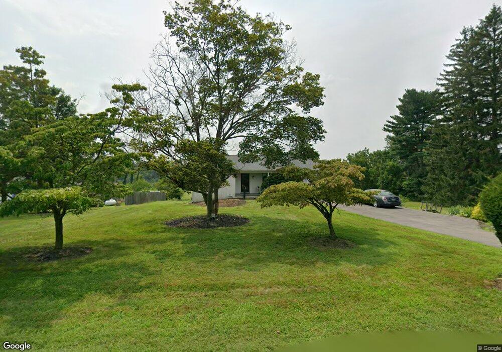
2038 Mill Rd Norristown, PA 19403
West Norriton Township NeighborhoodEstimated Value: $303,000 - $363,207
3
Beds
1
Bath
1,020
Sq Ft
$328/Sq Ft
Est. Value
About This Home
This home is located at 2038 Mill Rd, Norristown, PA 19403 and is currently estimated at $334,802, approximately $328 per square foot. 2038 Mill Rd is a home located in Montgomery County with nearby schools including Charles Blockson Middle School, Paul V Fly Elementary School, and East Norriton Middle School.
Ownership History
Date
Name
Owned For
Owner Type
Purchase Details
Closed on
Jun 19, 2006
Sold by
Pascal Teresa C
Bought by
Pascal Teresa C and Pascal Samantha T
Current Estimated Value
Home Financials for this Owner
Home Financials are based on the most recent Mortgage that was taken out on this home.
Original Mortgage
$135,000
Interest Rate
6.58%
Create a Home Valuation Report for This Property
The Home Valuation Report is an in-depth analysis detailing your home's value as well as a comparison with similar homes in the area
Home Values in the Area
Average Home Value in this Area
Purchase History
| Date | Buyer | Sale Price | Title Company |
|---|---|---|---|
| Pascal Teresa C | -- | None Available |
Source: Public Records
Mortgage History
| Date | Status | Borrower | Loan Amount |
|---|---|---|---|
| Closed | Pascal Teresa C | $135,000 |
Source: Public Records
Tax History Compared to Growth
Tax History
| Year | Tax Paid | Tax Assessment Tax Assessment Total Assessment is a certain percentage of the fair market value that is determined by local assessors to be the total taxable value of land and additions on the property. | Land | Improvement |
|---|---|---|---|---|
| 2025 | $5,317 | $108,850 | $47,840 | $61,010 |
| 2024 | $5,317 | $108,850 | $47,840 | $61,010 |
| 2023 | $5,257 | $108,850 | $47,840 | $61,010 |
| 2022 | $5,224 | $108,850 | $47,840 | $61,010 |
| 2021 | $5,192 | $108,850 | $47,840 | $61,010 |
| 2020 | $5,037 | $108,850 | $47,840 | $61,010 |
| 2019 | $4,925 | $108,850 | $47,840 | $61,010 |
| 2018 | $4,019 | $108,850 | $47,840 | $61,010 |
| 2017 | $4,649 | $108,850 | $47,840 | $61,010 |
| 2016 | $4,607 | $108,850 | $47,840 | $61,010 |
| 2015 | $4,268 | $108,850 | $47,840 | $61,010 |
| 2014 | $4,268 | $108,850 | $47,840 | $61,010 |
Source: Public Records
Map
Nearby Homes
- 2044 Mill Rd
- 0 Roosevelt Blvd
- 123 Glenwood Ave
- 37 Burnside Ave
- 2017 Yorktown S
- 526 Bassett Ln
- 1924 Juniata Rd
- 2012 Yorktown S
- 1914 Yorktown S
- 1905 Yorktown N
- 365 Norris Hall Ln
- 533 Brandon Rd
- 402 Brandon Rd
- 307 Brandon Rd
- 1503 Reagan Ct
- 143 Riversedge Dr Unit CONDO 143
- 2504 Grant Ct
- 167 Woodstream Dr Unit CONDO 167
- 176 Riversedge Dr
- 121 Woodstream Dr Unit CONDO 121
- 2036 Mill Rd
- 2048 Mill Rd
- 2030 Mill Rd
- 2037 Mill Rd
- 2052 Mill Rd
- 2027 Mill Rd
- 109 Sand Trap Ct
- 107 Sand Trap Ct Unit LOT 37
- 107 Sand Trap Ct
- 223 Egypt Rd Unit 10
- 108 Sand Trap Ct Unit 43
- 108 Sand Trap Ct
- 105 Sand Trap Ct Unit LOT 36
- 105 Sand Trap Ct
- 219 Egypt Rd
- 106 Sand Trap Ct
- 106 Sand Trap Ct Unit 42
- 103 Sand Trap Ct
- 101 Sand Trap Ct
- 215 Egypt Rd