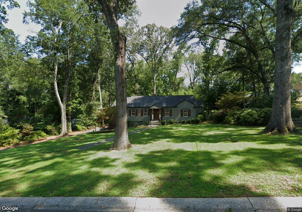
204 Maxwell Ave SW Marietta, GA 30064
Whitlock NeighborhoodEstimated Value: $334,232 - $451,000
3
Beds
1
Bath
1,092
Sq Ft
$365/Sq Ft
Est. Value
About This Home
This home is located at 204 Maxwell Ave SW, Marietta, GA 30064 and is currently estimated at $398,558, approximately $364 per square foot. 204 Maxwell Ave SW is a home located in Cobb County with nearby schools including A.L. Burruss Elementary School, Marietta Sixth Grade Academy, and Marietta Middle School.
Ownership History
Date
Name
Owned For
Owner Type
Purchase Details
Closed on
Mar 26, 2021
Sold by
Smith Charles L and Smith Charlie L
Bought by
Lassiter Benjamin Hagood
Current Estimated Value
Home Financials for this Owner
Home Financials are based on the most recent Mortgage that was taken out on this home.
Original Mortgage
$209,000
Outstanding Balance
$187,024
Interest Rate
2.73%
Mortgage Type
New Conventional
Estimated Equity
$211,534
Purchase Details
Closed on
Jan 20, 2010
Sold by
Smith Betty J
Bought by
Smith Charles L
Create a Home Valuation Report for This Property
The Home Valuation Report is an in-depth analysis detailing your home's value as well as a comparison with similar homes in the area
Home Values in the Area
Average Home Value in this Area
Purchase History
| Date | Buyer | Sale Price | Title Company |
|---|---|---|---|
| Lassiter Benjamin Hagood | $220,000 | None Available | |
| Smith Charles L | -- | -- |
Source: Public Records
Mortgage History
| Date | Status | Borrower | Loan Amount |
|---|---|---|---|
| Open | Lassiter Benjamin Hagood | $209,000 |
Source: Public Records
Tax History Compared to Growth
Tax History
| Year | Tax Paid | Tax Assessment Tax Assessment Total Assessment is a certain percentage of the fair market value that is determined by local assessors to be the total taxable value of land and additions on the property. | Land | Improvement |
|---|---|---|---|---|
| 2025 | $1,047 | $133,708 | $60,000 | $73,708 |
| 2024 | $1,047 | $133,708 | $60,000 | $73,708 |
| 2023 | $818 | $124,728 | $52,000 | $72,728 |
| 2022 | $1,131 | $133,744 | $52,000 | $81,744 |
| 2021 | $356 | $113,172 | $52,000 | $61,172 |
| 2020 | $354 | $102,912 | $52,000 | $50,912 |
| 2019 | $354 | $99,412 | $48,000 | $51,412 |
| 2018 | $351 | $80,192 | $44,000 | $36,192 |
| 2017 | $283 | $80,192 | $44,000 | $36,192 |
| 2016 | $285 | $73,268 | $44,000 | $29,268 |
| 2015 | $310 | $69,268 | $40,000 | $29,268 |
| 2014 | $318 | $68,540 | $0 | $0 |
Source: Public Records
Map
Nearby Homes
- 73 Whitlock Square SW
- 25 Whitlock Square SW
- 59 Trammell St SW
- 32 Durham St SW
- 266 Crescent Cir SW
- 99 Griggs St SW
- 557 Henry Dr
- 207 Walthall St NW
- 0 Polk St NW Unit 1523635
- 528 Mansell St SE
- 305 Brookwood Dr SW
- 563 Hillandale Cir SW
- 80 Lindley Ave NW Unit 1
- 250 Green St SE
- 327 Stewart Ave NW
- 307 Green St SE
- 285 Kennesaw Ave NW
- 313 Senna St
- 226 Maxwell Ave SW
- 96 Northcutt St SW
- 104 Northcutt St SW
- 205 Maxwell Ave SW
- 82 Northcutt St SW
- 0 Maxwell Ave SW Unit 7124613
- 0 Maxwell Ave SW Unit 7041059
- 0 Maxwell Ave SW Unit 8869422
- 0 Maxwell Ave SW Unit 8405269
- 0 Maxwell Ave SW Unit 7046234
- 0 Maxwell Ave SW
- 116 Northcutt St SW
- 213 Maxwell Ave SW
- 116 Rambo Place SW
- 238 Maxwell Ave SW
- 58 Northcutt St SW
- 0 Northcutt St SW Unit 8281293
- 0 Northcutt St SW Unit 8121643
- 94 Whitlock Square SW
- 139 Rambo Place SW