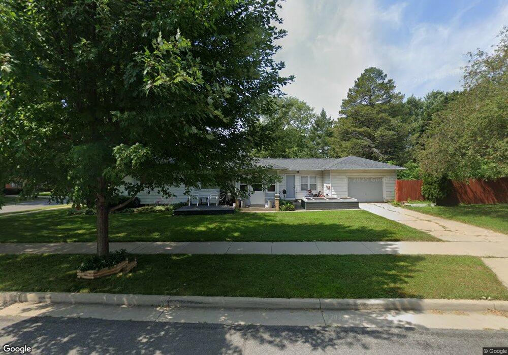
204 Roland St Sun Prairie, WI 53590
Central Sun Prairie NeighborhoodEstimated Value: $309,172 - $351,000
3
Beds
1
Bath
1,040
Sq Ft
$320/Sq Ft
Est. Value
About This Home
This home is located at 204 Roland St, Sun Prairie, WI 53590 and is currently estimated at $333,043, approximately $320 per square foot. 204 Roland St is a home located in Dane County with nearby schools including Northside Elementary School, Central Heights Middle School, and Sun Prairie East High School.
Ownership History
Date
Name
Owned For
Owner Type
Purchase Details
Closed on
Feb 24, 2024
Sold by
Dick Arthur E and Dick Violet L
Bought by
Guidry Perry F
Current Estimated Value
Purchase Details
Closed on
Mar 28, 2016
Sold by
Dick Arthur E
Bought by
Dick Arthur E and Dick Violet L
Create a Home Valuation Report for This Property
The Home Valuation Report is an in-depth analysis detailing your home's value as well as a comparison with similar homes in the area
Home Values in the Area
Average Home Value in this Area
Purchase History
| Date | Buyer | Sale Price | Title Company |
|---|---|---|---|
| Guidry Perry F | -- | None Listed On Document | |
| Guidry Perry F | -- | None Listed On Document | |
| Dick Arthur E | -- | Attorney |
Source: Public Records
Tax History Compared to Growth
Tax History
| Year | Tax Paid | Tax Assessment Tax Assessment Total Assessment is a certain percentage of the fair market value that is determined by local assessors to be the total taxable value of land and additions on the property. | Land | Improvement |
|---|---|---|---|---|
| 2024 | $4,858 | $261,200 | $64,300 | $196,900 |
| 2023 | $4,387 | $261,200 | $64,300 | $196,900 |
| 2021 | $4,073 | $199,600 | $59,400 | $140,200 |
| 2020 | $4,203 | $199,600 | $59,400 | $140,200 |
| 2019 | $3,724 | $158,500 | $47,600 | $110,900 |
| 2018 | $3,465 | $158,500 | $47,600 | $110,900 |
| 2017 | $3,350 | $158,500 | $47,600 | $110,900 |
| 2016 | $3,457 | $148,300 | $41,700 | $106,600 |
| 2015 | $3,364 | $148,300 | $41,700 | $106,600 |
| 2014 | $3,366 | $147,500 | $41,700 | $105,800 |
| 2013 | $3,496 | $147,500 | $41,700 | $105,800 |
Source: Public Records
Map
Nearby Homes
- 530 W Main St
- 147 Flint St
- 706 Woodland Dr
- 227 Windsor St
- 916 Ring St
- 1033 Lothe St
- 2543 Water Lily Cir
- 2560 Water Lily Cir
- 2535 Water Lily Cir
- 2522 Water Lily Cir
- 200 Queens St
- 921 Pine St
- 201 E Lane St Unit 202
- 1013 Vandenburg St
- 1010 Andrews Dr
- 3345 U S 151
- 600 Linnerud Dr
- 1048 Stonewood Crossing
- 1486 Ivory Dr
- 709 Linnerud Dr