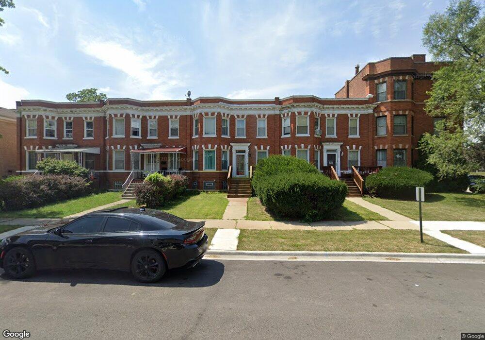
204 S 4th Ave Maywood, IL 60153
Downtown Maywood NeighborhoodEstimated Value: $183,000 - $350,000
4
Beds
1
Bath
1,570
Sq Ft
$176/Sq Ft
Est. Value
About This Home
This home is located at 204 S 4th Ave, Maywood, IL 60153 and is currently estimated at $276,186, approximately $175 per square foot. 204 S 4th Ave is a home located in Cook County with nearby schools including Emerson Elementary School, Irving Middle School, and Proviso East High School.
Ownership History
Date
Name
Owned For
Owner Type
Purchase Details
Closed on
Mar 10, 2007
Sold by
Thurman Lillie
Bought by
King Bridget
Current Estimated Value
Purchase Details
Closed on
Mar 8, 1999
Sold by
Continental Community Bank & Trust Co
Bought by
Thurman Lillie and Thurman Katrina
Home Financials for this Owner
Home Financials are based on the most recent Mortgage that was taken out on this home.
Original Mortgage
$74,350
Interest Rate
6.78%
Mortgage Type
FHA
Create a Home Valuation Report for This Property
The Home Valuation Report is an in-depth analysis detailing your home's value as well as a comparison with similar homes in the area
Home Values in the Area
Average Home Value in this Area
Purchase History
| Date | Buyer | Sale Price | Title Company |
|---|---|---|---|
| King Bridget | -- | None Available | |
| Thurman Lillie | $75,000 | -- |
Source: Public Records
Mortgage History
| Date | Status | Borrower | Loan Amount |
|---|---|---|---|
| Previous Owner | Thurman Lillie | $74,350 |
Source: Public Records
Tax History Compared to Growth
Tax History
| Year | Tax Paid | Tax Assessment Tax Assessment Total Assessment is a certain percentage of the fair market value that is determined by local assessors to be the total taxable value of land and additions on the property. | Land | Improvement |
|---|---|---|---|---|
| 2024 | $8,195 | $20,489 | $1,805 | $18,684 |
| 2023 | $1,936 | $23,000 | $1,805 | $21,195 |
| 2022 | $1,936 | $7,545 | $1,559 | $5,986 |
| 2021 | $2,005 | $7,543 | $1,558 | $5,985 |
| 2020 | $2,105 | $7,543 | $1,558 | $5,985 |
| 2019 | $2,701 | $8,390 | $1,394 | $6,996 |
| 2018 | $2,623 | $8,390 | $1,394 | $6,996 |
| 2017 | $2,578 | $8,390 | $1,394 | $6,996 |
| 2016 | $3,285 | $8,501 | $1,230 | $7,271 |
| 2015 | $3,403 | $8,501 | $1,230 | $7,271 |
| 2014 | $3,141 | $8,501 | $1,230 | $7,271 |
| 2013 | $3,112 | $9,064 | $1,230 | $7,834 |
Source: Public Records
Map
Nearby Homes
- 310 S 2nd Ave
- 400 S 7th Ave
- 601 S 6th Ave
- 608 S 2nd Ave
- 146 S 9th Ave
- 220 S 9th Ave
- 716 S 7th Ave
- 407 N 2nd Ave
- 406 S 10th Ave
- 613 Huron St
- 230 S 11th Ave
- 902 S 3rd Ave Unit A
- 902 S 3rd Ave Unit B
- 8213 Lake St
- 500 Auvergne Place
- 619 N 4th Ave
- 234 S 12th Ave
- 126 S 12th Ave
- 8129 Lake St
- 105 N 12th Ave
- 202 S 4th Ave
- 406 Oak St Unit 2E
- 406 Oak St Unit 3W
- 406 Oak St Unit 3E
- 406 Oak St Unit 2W
- 406 Oak St Unit 1W
- 206 S 4th Ave
- 208 S 4th Ave
- 201 S 5th Ave
- 205 S 5th Ave Unit 4
- 205 S 5th Ave
- 201 S 4th Ave
- 216 S 4th Ave
- 205 S 4th Ave
- 207 S 5th Ave
- 215 S 4th Ave
- 217 S 5th Ave
- 217 S 4th Ave
- 300 S 4th Ave
- 200 S 3rd Ave