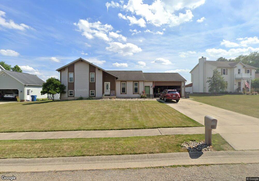
204 Shawnee Cir Louisville, OH 44641
Estimated Value: $237,000 - $254,000
3
Beds
3
Baths
1,258
Sq Ft
$195/Sq Ft
Est. Value
About This Home
This home is located at 204 Shawnee Cir, Louisville, OH 44641 and is currently estimated at $245,603, approximately $195 per square foot. 204 Shawnee Cir is a home located in Stark County with nearby schools including Louisville High School and St. Thomas Aquinas High School & Middle School.
Ownership History
Date
Name
Owned For
Owner Type
Purchase Details
Closed on
Sep 29, 2015
Sold by
Moulin Jodie L
Bought by
Moulin Justin
Current Estimated Value
Purchase Details
Closed on
Mar 21, 2005
Sold by
Moulin Jodie L
Bought by
Moulin Jodie L and The Jodie L Moulin Revocable Living Tr
Purchase Details
Closed on
Apr 22, 2004
Sold by
Moulin Timothy L
Bought by
Moulin Jodie L
Purchase Details
Closed on
Aug 23, 1999
Sold by
Cannatti Donald and Cannatti Jodi
Bought by
Moulin Timothy L and Moulin Jodie L
Home Financials for this Owner
Home Financials are based on the most recent Mortgage that was taken out on this home.
Original Mortgage
$105,000
Outstanding Balance
$30,079
Interest Rate
7.61%
Mortgage Type
Purchase Money Mortgage
Estimated Equity
$215,524
Purchase Details
Closed on
Aug 4, 1994
Sold by
Buffalo Ridge Allotment
Bought by
Cannatti Donald and Cannatti Jodi
Create a Home Valuation Report for This Property
The Home Valuation Report is an in-depth analysis detailing your home's value as well as a comparison with similar homes in the area
Home Values in the Area
Average Home Value in this Area
Purchase History
| Date | Buyer | Sale Price | Title Company |
|---|---|---|---|
| Moulin Justin | -- | Attorney | |
| Moulin Jodie L | -- | -- | |
| Moulin Jodie L | -- | -- | |
| Moulin Timothy L | $141,000 | -- | |
| Cannatti Donald | $19,500 | -- |
Source: Public Records
Mortgage History
| Date | Status | Borrower | Loan Amount |
|---|---|---|---|
| Open | Moulin Timothy L | $105,000 |
Source: Public Records
Tax History Compared to Growth
Tax History
| Year | Tax Paid | Tax Assessment Tax Assessment Total Assessment is a certain percentage of the fair market value that is determined by local assessors to be the total taxable value of land and additions on the property. | Land | Improvement |
|---|---|---|---|---|
| 2025 | -- | $75,040 | $17,360 | $57,680 |
| 2024 | -- | $75,040 | $17,360 | $57,680 |
| 2023 | $2,761 | $64,260 | $17,220 | $47,040 |
| 2022 | $2,767 | $64,260 | $17,220 | $47,040 |
| 2021 | $2,775 | $64,260 | $17,220 | $47,040 |
| 2020 | $2,316 | $58,250 | $15,510 | $42,740 |
| 2019 | $2,326 | $58,250 | $15,510 | $42,740 |
| 2018 | $2,317 | $58,250 | $15,510 | $42,740 |
| 2017 | $2,160 | $52,400 | $12,670 | $39,730 |
| 2016 | $2,204 | $52,400 | $12,670 | $39,730 |
| 2015 | $2,337 | $55,410 | $12,670 | $42,740 |
| 2014 | $169 | $47,810 | $10,920 | $36,890 |
| 2013 | $1,088 | $47,810 | $10,920 | $36,890 |
Source: Public Records
Map
Nearby Homes
- 1702 View Pointe Ave
- 1639 Horizon Dr
- 908 Sand Lot Cir
- 8225 Georgetown St
- 6969 Georgetown St NE
- 510 S Bauman Ct
- 204 E Broad St
- 728 E Broad St
- 107 E Broad St
- 520 S Silver St
- 641 S Nickelplate St
- 2425 Miday Ave NE
- 308 Superior St
- 1715 High St
- 2110 Edmar St
- 3390 Meese Rd NE
- 1812 E Broad St
- 325 Lincoln Ave
- 201 Indiana Ave
- 4060 Hambleton Ave NE
- 114 Shawnee Cir
- 214 Shawnee Cir
- 205 Buffalo Ridge St
- 115 Buffalo Ridge St
- 215 Buffalo Ridge St
- 304 Shawnee Cir
- 104 Shawnee Cir
- 205 Shawnee Cir
- 215 Shawnee Cir
- 115 Shawnee Cir
- 105 Buffalo Ridge St
- 305 Buffalo Ridge St
- 40 Shawnee Cir
- 314 Shawnee Cir
- 38 Shawnee Cir
- 305 Shawnee Cir
- 105 Shawnee Cir
- 34 Shawnee Cir
- 315 Buffalo Ridge St
- 33 Shawnee Cir