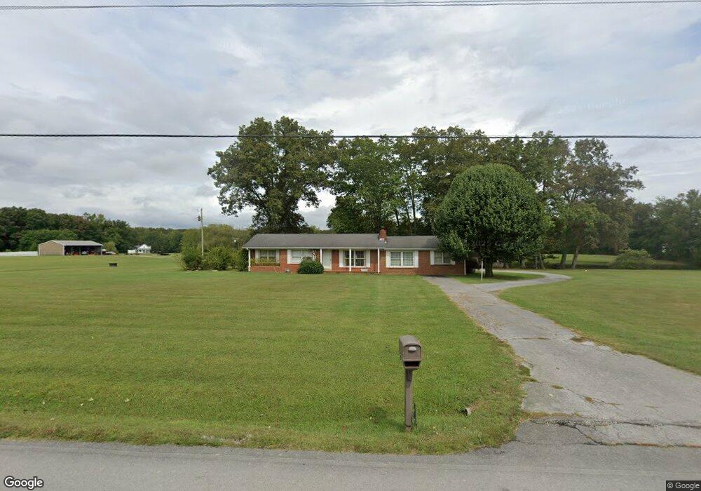
2041 Wayside Rd Manchester, TN 37355
Estimated Value: $351,000 - $473,000
--
Bed
2
Baths
2,081
Sq Ft
$203/Sq Ft
Est. Value
About This Home
This home is located at 2041 Wayside Rd, Manchester, TN 37355 and is currently estimated at $421,508, approximately $202 per square foot. 2041 Wayside Rd is a home located in Coffee County with nearby schools including New Union Elementary School, Coffee County Middle School, and Coffee County Central High School.
Ownership History
Date
Name
Owned For
Owner Type
Purchase Details
Closed on
May 7, 2025
Sold by
Cunningham Brenda Sue
Bought by
Brenda Sue Cunningham Living Trust and Cunningham
Current Estimated Value
Purchase Details
Closed on
Feb 5, 2025
Sold by
Bartlett Irene and Bartlett James
Bought by
Cunningham Brenda Sue and Bartlett Benton
Purchase Details
Closed on
Apr 27, 2013
Sold by
Bartlett Irene D
Bought by
Rainey Mary Ann and Rainey Clarence
Create a Home Valuation Report for This Property
The Home Valuation Report is an in-depth analysis detailing your home's value as well as a comparison with similar homes in the area
Home Values in the Area
Average Home Value in this Area
Purchase History
| Date | Buyer | Sale Price | Title Company |
|---|---|---|---|
| Brenda Sue Cunningham Living Trust | -- | None Listed On Document | |
| Brenda Sue Cunningham Living Trust | -- | None Listed On Document | |
| Cunningham Brenda Sue | -- | None Listed On Document | |
| Cunningham Brenda Sue | -- | None Listed On Document | |
| Rainey Mary Ann | $12,500 | -- |
Source: Public Records
Tax History Compared to Growth
Tax History
| Year | Tax Paid | Tax Assessment Tax Assessment Total Assessment is a certain percentage of the fair market value that is determined by local assessors to be the total taxable value of land and additions on the property. | Land | Improvement |
|---|---|---|---|---|
| 2024 | $1,109 | $47,575 | $11,850 | $35,725 |
| 2023 | $1,109 | $47,575 | $0 | $0 |
| 2022 | $1,109 | $47,575 | $11,850 | $35,725 |
| 2021 | $959 | $38,600 | $8,850 | $29,750 |
| 2020 | $959 | $38,600 | $8,850 | $29,750 |
| 2019 | $959 | $38,600 | $8,850 | $29,750 |
| 2018 | $1,132 | $38,600 | $8,850 | $29,750 |
| 2017 | $1,207 | $37,000 | $7,950 | $29,050 |
| 2016 | $1,207 | $37,000 | $7,950 | $29,050 |
| 2015 | $1,207 | $37,000 | $7,950 | $29,050 |
| 2014 | $1,207 | $37,005 | $0 | $0 |
Source: Public Records
Map
Nearby Homes
- 837 Circle Dr
- 781 Circle Dr
- 2635 Pete Sain Rd
- 670 Old McMinnville Hwy
- 4282 McMinnville Hwy Unit 4270
- 0 Pete Sain Rd
- 363 Willow Brook Dr
- 300 Willow Brook Dr
- 3313 McMinnville Hwy
- 621 Brandon Rd
- 667 Pete Sain Rd
- 499 Ridgewood Dr
- 493 Maple Springs Rd
- 166 Keele Rd
- 1270 Taylor Rd
- 2498 Sp Anderson Rd
- 106 Rigney Rd
- 676 Riddle Rd
- 220 Winton Way Rd
- 304 W Lynn Dr
- 2050 Wayside Rd
- 2020 Wayside Rd
- 2082 Wayside Rd
- 2127 Wayside Rd
- 1980 Wayside Rd
- 2126 Wayside Rd
- 1929 Wayside Rd
- 2161 Wayside Rd
- 2160 Wayside Rd
- 119 Wright Rd
- 143 Wright Rd
- 2196 Wayside Rd
- 129 Country Air Ln
- 159 Country Air Ln
- 103 Country Air Ln
- 189 Country Air Ln
- 79 Country Air Ln
- 49 Country Air Ln
- 277 Country Air Ln
- 2230 Wayside Rd