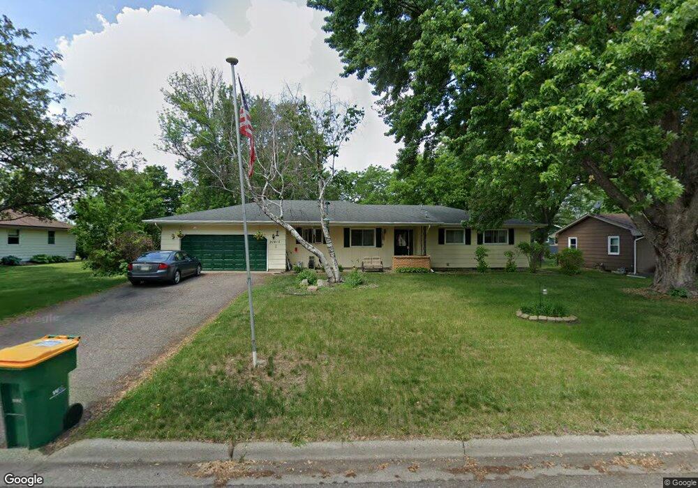
20415 Howland Ave W Lakeville, MN 55044
Estimated Value: $334,000 - $403,494
4
Beds
2
Baths
1,568
Sq Ft
$242/Sq Ft
Est. Value
About This Home
This home is located at 20415 Howland Ave W, Lakeville, MN 55044 and is currently estimated at $379,874, approximately $242 per square foot. 20415 Howland Ave W is a home located in Dakota County with nearby schools including Lake Marion Elementary School, Mcguire Middle School, and Lakeville South High School.
Ownership History
Date
Name
Owned For
Owner Type
Purchase Details
Closed on
Jan 20, 2022
Sold by
The Estate Of Ronald K Carrick
Bought by
Carrick Troy
Current Estimated Value
Home Financials for this Owner
Home Financials are based on the most recent Mortgage that was taken out on this home.
Original Mortgage
$196,000
Outstanding Balance
$180,638
Interest Rate
3.11%
Mortgage Type
New Conventional
Estimated Equity
$199,236
Purchase Details
Closed on
Aug 20, 1997
Sold by
Erickson Steven B and Erickson Elizabeth I
Bought by
Carrick Ronald K
Create a Home Valuation Report for This Property
The Home Valuation Report is an in-depth analysis detailing your home's value as well as a comparison with similar homes in the area
Home Values in the Area
Average Home Value in this Area
Purchase History
| Date | Buyer | Sale Price | Title Company |
|---|---|---|---|
| Carrick Troy | $216,000 | -- | |
| Carrick Ronald K | $133,900 | -- |
Source: Public Records
Mortgage History
| Date | Status | Borrower | Loan Amount |
|---|---|---|---|
| Open | Carrick Troy | $196,000 |
Source: Public Records
Tax History Compared to Growth
Tax History
| Year | Tax Paid | Tax Assessment Tax Assessment Total Assessment is a certain percentage of the fair market value that is determined by local assessors to be the total taxable value of land and additions on the property. | Land | Improvement |
|---|---|---|---|---|
| 2024 | $4,112 | $353,800 | $77,900 | $275,900 |
| 2023 | $4,112 | $358,200 | $77,600 | $280,600 |
| 2022 | $3,636 | $360,700 | $77,400 | $283,300 |
| 2021 | $4,292 | $295,100 | $67,300 | $227,800 |
| 2020 | $3,736 | $271,700 | $64,100 | $207,600 |
| 2019 | $4,383 | $277,900 | $61,000 | $216,900 |
| 2018 | $3,491 | $271,700 | $58,100 | $213,600 |
| 2017 | $3,951 | $262,600 | $55,300 | $207,300 |
| 2016 | $3,859 | $246,300 | $52,600 | $193,700 |
| 2015 | $3,282 | $216,294 | $47,518 | $168,776 |
| 2014 | -- | $212,806 | $46,105 | $166,701 |
| 2013 | -- | $181,414 | $41,148 | $140,266 |
Source: Public Records
Map
Nearby Homes
- 20420 Hughes Ave W
- 20304 Hunter Ct
- 20685 Howland Ave W
- 20060 Heritage Dr
- 20023 Homestead Ct Unit 25
- 20055 Heritage Dr
- 20055 Holt Ave W
- 20144 Holister Ln
- 20041 Heritage Dr
- 20450 Dodd Blvd
- 20061 Highview Ave
- 20724 Hurley Ave
- 19820 Henning Ave
- 20026 Icenic Trail
- 19879 Iberis Ave
- 19966 Hiawatha Ct
- 20035 Ideal Way
- 9485 204th St W
- 19962 Hexham Way
- 8266 200th St W
- 20405 Howland Ave W
- 20435 Howland Ave W
- 20400 Hughes Ave W
- 20440 Hughes Ave W
- 20420 Howland Ave W
- 20345 Howland Ave W
- 20406 Howland Ave W
- 20465 Howland Ave W
- 20456 Howland Ave W
- 20460 Hughes Ave W
- 20370 Hughes Ave W
- 20460 Howland Ave W
- 20405 Hughes Ave W
- 20485 Howland Ave W
- 20425 Hughes Ave W
- 20419 Holyoke Ave
- 20405 Holyoke Ave
- 20365 Hughes Ave W
- 20435 Holyoke Ave
- 20470 Howland Ave W