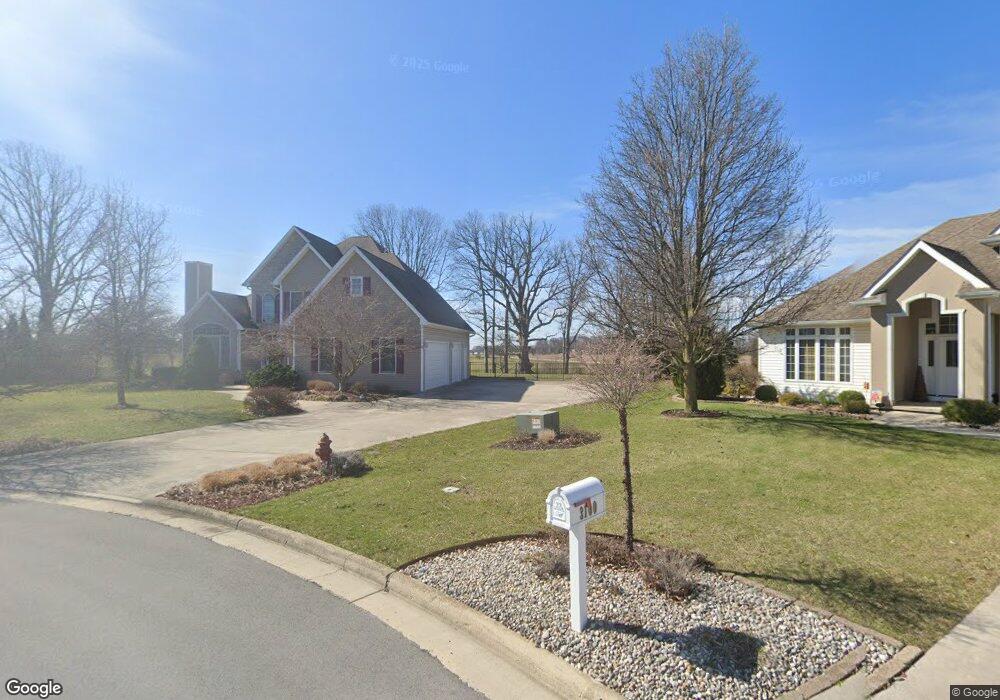
2043 Lakeland Dr Findlay, OH 45840
Estimated Value: $482,000 - $512,000
4
Beds
3
Baths
2,382
Sq Ft
$207/Sq Ft
Est. Value
About This Home
This home is located at 2043 Lakeland Dr, Findlay, OH 45840 and is currently estimated at $492,020, approximately $206 per square foot. 2043 Lakeland Dr is a home located in Hancock County with nearby schools including Liberty-Benton Elementary School, Liberty-Benton Middle School, and Liberty-Benton High School.
Ownership History
Date
Name
Owned For
Owner Type
Purchase Details
Closed on
Feb 9, 2000
Sold by
Sifard Ronald L
Bought by
Chasse Cynthia D and Chasse Steven N
Current Estimated Value
Home Financials for this Owner
Home Financials are based on the most recent Mortgage that was taken out on this home.
Original Mortgage
$175,000
Outstanding Balance
$52,442
Interest Rate
6.88%
Mortgage Type
New Conventional
Estimated Equity
$439,578
Create a Home Valuation Report for This Property
The Home Valuation Report is an in-depth analysis detailing your home's value as well as a comparison with similar homes in the area
Home Values in the Area
Average Home Value in this Area
Purchase History
| Date | Buyer | Sale Price | Title Company |
|---|---|---|---|
| Chasse Cynthia D | $268,015 | -- |
Source: Public Records
Mortgage History
| Date | Status | Borrower | Loan Amount |
|---|---|---|---|
| Open | Chasse Cynthia D | $175,000 |
Source: Public Records
Tax History Compared to Growth
Tax History
| Year | Tax Paid | Tax Assessment Tax Assessment Total Assessment is a certain percentage of the fair market value that is determined by local assessors to be the total taxable value of land and additions on the property. | Land | Improvement |
|---|---|---|---|---|
| 2024 | $5,427 | $146,000 | $22,870 | $123,130 |
| 2023 | $5,299 | $146,000 | $22,870 | $123,130 |
| 2022 | $5,247 | $146,000 | $22,870 | $123,130 |
| 2021 | $4,966 | $121,970 | $21,320 | $100,650 |
| 2020 | $5,008 | $121,970 | $21,320 | $100,650 |
| 2019 | $4,805 | $121,970 | $21,320 | $100,650 |
| 2018 | $3,785 | $106,060 | $18,540 | $87,520 |
| 2017 | $3,905 | $106,060 | $18,540 | $87,520 |
| 2016 | $3,783 | $106,060 | $18,540 | $87,520 |
| 2015 | $3,637 | $99,320 | $19,020 | $80,300 |
| 2014 | $3,670 | $99,320 | $19,020 | $80,300 |
| 2012 | $3,833 | $99,320 | $19,020 | $80,300 |
Source: Public Records
Map
Nearby Homes
- 0 County Road 95 Unit 6097574
- 6535 Silver Lake Dr
- 1405 Cypress Lake
- 3106 Saddlebrook
- 0 Rock Candy Rd Unit Lot 159
- 0 Rock Candy Rd Unit Lot 170
- 0 Rock Candy Rd Unit Lot 172 206819
- 0 Rock Candy Rd Unit Lot 162
- 0 Rock Candy Rd Unit Lot 171
- 0 Rock Candy Rd Unit Lot 168
- 0 Rock Candy Rd Or Bushwillow Dr Unit Lot 173
- 0 Bushwillow Dr Or Rock Candy Rd Unit Lot 157
- 0 Bearcat Way Or Rock Candy Rd Unit Lot 167
- 3018 Gleneagle Dr
- 0 County Road 140
- 1310 Muirfield Dr
- 933 Laurel Ln
- 9960 W Us Route 224
- 925 W Melrose Ave
- 0 Allen Township 142
- 3100 Jacob Dr
- 2029 Lakeland Dr
- 2001 Lakeland Dr
- 2000 Lakeland Dr
- 3115 Jacob Dr
- 3108 Jurnee Dr
- 3200 Jacob Dr
- 1935 Lakeland Dr
- Lot 1 Glenmar Pkwy
- 0 Glenmar Pkwy
- 1936 Lakeland Dr
- 6321 County Road 140
- 3116 Jurnee Dr
- 6355 County Road 140
- 1923 Lakeland Dr
- 1924 Lakeland Dr
- 3107 Jurnee Dr
- 9909 Glenmar Pkwy
- 3200 Jurnee Dr
- 3125 Jurnee Dr