Estimated Value: $217,356 - $264,000
--
Bed
--
Bath
1,456
Sq Ft
$163/Sq Ft
Est. Value
About This Home
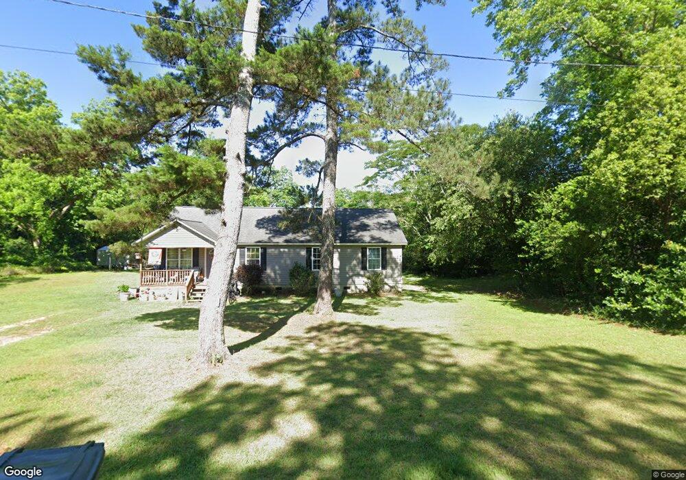
This home is located at 2045 N College St, Pavo, GA 31778 and is currently estimated at $236,839, approximately $162 per square foot. 2045 N College St is a home with nearby schools including Hand in Hand Primary School, Garrison-Pilcher Elementary School, and Cross Creek Elementary School.
Ownership History
Date
Name
Owned For
Owner Type
Purchase Details
Closed on
Sep 28, 2010
Sold by
Mackenzie Construction Llc
Bought by
Lewis Charles
Current Estimated Value
Home Financials for this Owner
Home Financials are based on the most recent Mortgage that was taken out on this home.
Original Mortgage
$114,810
Outstanding Balance
$81,909
Interest Rate
4.36%
Mortgage Type
USDA
Estimated Equity
$154,930
Create a Home Valuation Report for This Property
The Home Valuation Report is an in-depth analysis detailing your home's value as well as a comparison with similar homes in the area
Home Values in the Area
Average Home Value in this Area
Purchase History
| Date | Buyer | Sale Price | Title Company |
|---|---|---|---|
| Lewis Charles | $114,322 | -- |
Source: Public Records
Mortgage History
| Date | Status | Borrower | Loan Amount |
|---|---|---|---|
| Open | Lewis Charles | $114,810 |
Source: Public Records
Tax History Compared to Growth
Tax History
| Year | Tax Paid | Tax Assessment Tax Assessment Total Assessment is a certain percentage of the fair market value that is determined by local assessors to be the total taxable value of land and additions on the property. | Land | Improvement |
|---|---|---|---|---|
| 2024 | $2,626 | $76,967 | $2,314 | $74,653 |
| 2023 | $2,198 | $70,204 | $2,314 | $67,890 |
| 2022 | $1,361 | $58,402 | $1,852 | $56,550 |
| 2021 | $1,215 | $47,724 | $1,852 | $45,872 |
| 2020 | $1,157 | $44,567 | $1,852 | $42,715 |
| 2019 | $1,164 | $44,567 | $1,852 | $42,715 |
| 2018 | $1,132 | $43,051 | $1,852 | $41,199 |
| 2017 | $1,125 | $42,191 | $1,648 | $40,543 |
| 2016 | $1,084 | $40,606 | $1,648 | $38,958 |
| 2015 | $983 | $36,660 | $1,537 | $35,123 |
| 2014 | $965 | $35,822 | $1,537 | $34,286 |
| 2013 | -- | $35,822 | $1,536 | $34,285 |
Source: Public Records
Map
Nearby Homes
- 2051 W Pear St
- 2055 S Roberts St
- 1230 Parrish Rd
- 16343 Georgia 33
- 16343 Ga Hwy 33 -8 34 Acres
- 16343
- 16343 Ga Hwy 33 - 8 34 Acres Hwy
- 1136 Nesbitt Rd
- 813 Vonier Road (6 Acres)
- 13876 Ga Highway 122
- 1038-BA Church St
- 7402 Coffee Rd
- 7921 Five Forks Rd
- 9283 Tallokas Rd Unit 54/13
- 9283 Tallokas Rd
- 3812 Ponder Rd
- 110 Nicole Britt Dr
- 101 Bailey Cir
- 203 Bailey Cir
- 4855 Harts Mill Rd
- 2088 W Pear St
- 1065 N College St
- 1070 N College St
- 2089 N College St
- 3033PA W Peachtree St
- 2060 W Pear St
- 2038 W Pear St
- 3015 N College St
- 2088 Harris St
- 4780 Harts Mill Rd
- 3018 W Harris St
- 3068 W Joiner St
- 2082 W Harris St
- 3086 W Joiner St
- 1041 N Roberts St
- 2046 W Harris St
- 3098 W Joiner St
- 2004 N Roberts St
- 1099 W Pear St