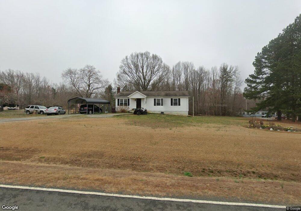
205 Marvin Gill Rd Roxboro, NC 27574
Estimated Value: $188,000 - $228,640
2
Beds
2
Baths
1,203
Sq Ft
$173/Sq Ft
Est. Value
About This Home
This home is located at 205 Marvin Gill Rd, Roxboro, NC 27574 and is currently estimated at $207,910, approximately $172 per square foot. 205 Marvin Gill Rd is a home located in Person County with nearby schools including Person High School.
Ownership History
Date
Name
Owned For
Owner Type
Purchase Details
Closed on
Feb 17, 2015
Sold by
Kirk Dolores and Neil Kirk C
Bought by
Mckeown Properties Llc
Current Estimated Value
Purchase Details
Closed on
Sep 29, 2011
Sold by
Gill Bruce E and Gill Wanda M
Bought by
Frazier Bobby R and Frazier Brenda L
Home Financials for this Owner
Home Financials are based on the most recent Mortgage that was taken out on this home.
Original Mortgage
$78,000
Interest Rate
4.26%
Create a Home Valuation Report for This Property
The Home Valuation Report is an in-depth analysis detailing your home's value as well as a comparison with similar homes in the area
Home Values in the Area
Average Home Value in this Area
Purchase History
| Date | Buyer | Sale Price | Title Company |
|---|---|---|---|
| Mckeown Properties Llc | $22,000 | None Available | |
| Frazier Bobby R | $78,000 | None Available |
Source: Public Records
Mortgage History
| Date | Status | Borrower | Loan Amount |
|---|---|---|---|
| Previous Owner | Frazier Bobby R | $78,000 |
Source: Public Records
Tax History Compared to Growth
Tax History
| Year | Tax Paid | Tax Assessment Tax Assessment Total Assessment is a certain percentage of the fair market value that is determined by local assessors to be the total taxable value of land and additions on the property. | Land | Improvement |
|---|---|---|---|---|
| 2025 | $1,462 | $215,856 | $0 | $0 |
| 2024 | $1,102 | $140,621 | $0 | $0 |
| 2023 | $1,102 | $140,621 | $0 | $0 |
| 2022 | $1,099 | $140,621 | $0 | $0 |
| 2021 | $1,067 | $140,621 | $0 | $0 |
| 2020 | $880 | $115,618 | $0 | $0 |
| 2019 | $892 | $115,618 | $0 | $0 |
| 2018 | $837 | $115,618 | $0 | $0 |
| 2017 | $825 | $115,609 | $0 | $0 |
| 2016 | $825 | $115,609 | $0 | $0 |
| 2015 | $825 | $115,609 | $0 | $0 |
| 2014 | $825 | $115,609 | $0 | $0 |
Source: Public Records
Map
Nearby Homes
- 670 Tingen Mine Rd
- 00 Pulliam-Tingen Mine Rd
- 1469 Mollie Mooney Rd
- 122 Old Surl Rd
- 0 Old Surl Rd
- 2201 Mollie Mooney Rd
- 153 Ninovan Place
- 1002 Dennys Store Rd
- 0 Doc Bass Rd
- 95 Doc Bass Rd
- 576 Duncan Rd
- 243 Victor Chandler Rd
- 2081 Peed Rd
- 689 Lockamy Rd
- 771 Cedar Grove Church Rd
- 204 Deep Woods Trail
- 127 Cobble Brook Dr
- 0 Cedar Grove Church Rd Unit 10077427
- 0 Cedar Grove Church Rd Unit 10075146
- O Shortline Rd
- 165 Marvin Gill Rd
- 257 Marvin Gill Rd
- 110 Renegade Ln
- 111 Izuba Day Dr
- 97 Izuba Day Dr
- 287 Marvin Gill Rd
- 105 Renegade Ln
- 105 Renegade Ln
- 65 Izuba Day Dr
- 31 Izuba Day Dr
- 118 Izuba Day Dr
- 10 Harriet Gentry Ln
- 291 Marvin Gill Rd
- 0 Izuba Day Dr Unit 1784754
- 0 Izuba Day Dr Unit 1863634
- 0 Izuba Day Dr Unit 990737
- 0 Izuba Day Dr Unit 1675054
- 0 Izuba Day Dr Unit 1704484
- 0 Izuba Day Dr Unit 34 TR1704484
- 0 Izuba Day Dr Unit 36 TR1784754