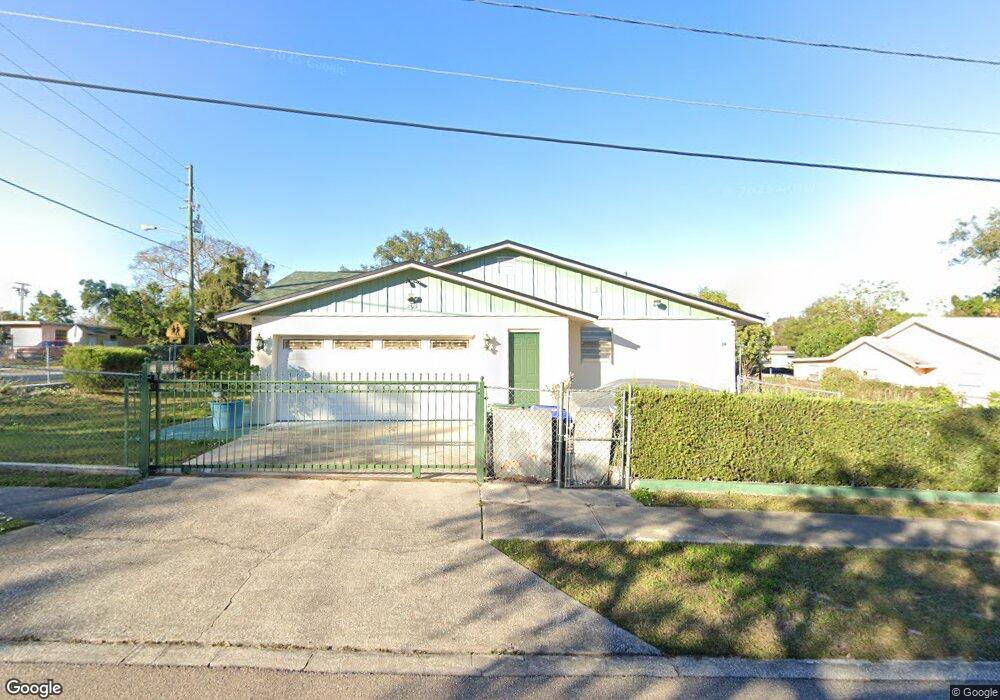
205 N Powers Dr Orlando, FL 32835
MetroWest NeighborhoodEstimated Value: $257,532 - $284,000
3
Beds
2
Baths
1,228
Sq Ft
$222/Sq Ft
Est. Value
About This Home
This home is located at 205 N Powers Dr, Orlando, FL 32835 and is currently estimated at $272,133, approximately $221 per square foot. 205 N Powers Dr is a home located in Orange County with nearby schools including Oak Hill Elementary, Gotha Middle School, and Olympia High.
Ownership History
Date
Name
Owned For
Owner Type
Purchase Details
Closed on
Dec 21, 2007
Sold by
Rodriguez Irizarry Rafael and Ortiz Maria Mercado
Bought by
Rodriguez Mercado Jorge R
Current Estimated Value
Purchase Details
Closed on
Nov 3, 2000
Sold by
Khatoon Bibi
Bought by
Rodriguez-Iriza Rafael and Ortiz Maria M
Home Financials for this Owner
Home Financials are based on the most recent Mortgage that was taken out on this home.
Original Mortgage
$72,546
Interest Rate
7.94%
Mortgage Type
FHA
Purchase Details
Closed on
Jan 14, 1994
Sold by
Kaiuyum Sheik Mohammed and Kaiuyum Nesha
Bought by
Khatoon Bibi
Create a Home Valuation Report for This Property
The Home Valuation Report is an in-depth analysis detailing your home's value as well as a comparison with similar homes in the area
Home Values in the Area
Average Home Value in this Area
Purchase History
| Date | Buyer | Sale Price | Title Company |
|---|---|---|---|
| Rodriguez Mercado Jorge R | -- | None Available | |
| Rodriguez-Iriza Rafael | $72,600 | -- | |
| Khatoon Bibi | $57,000 | -- |
Source: Public Records
Mortgage History
| Date | Status | Borrower | Loan Amount |
|---|---|---|---|
| Previous Owner | Rodriguez-Iriza Rafael | $72,546 |
Source: Public Records
Tax History Compared to Growth
Tax History
| Year | Tax Paid | Tax Assessment Tax Assessment Total Assessment is a certain percentage of the fair market value that is determined by local assessors to be the total taxable value of land and additions on the property. | Land | Improvement |
|---|---|---|---|---|
| 2025 | $369 | $60,114 | -- | -- |
| 2024 | $348 | $58,420 | -- | -- |
| 2023 | $348 | $55,120 | $0 | $0 |
| 2022 | $308 | $53,515 | $0 | $0 |
| 2021 | $298 | $51,956 | $0 | $0 |
| 2020 | $281 | $51,239 | $0 | $0 |
| 2019 | $278 | $50,087 | $0 | $0 |
| 2018 | $278 | $49,153 | $0 | $0 |
| 2017 | $261 | $96,879 | $15,000 | $81,879 |
| 2016 | $234 | $81,106 | $12,000 | $69,106 |
| 2015 | $240 | $76,263 | $12,000 | $64,263 |
| 2014 | $281 | $56,303 | $10,500 | $45,803 |
Source: Public Records
Map
Nearby Homes
- 6227 Melbourne Ave
- 325 N Hart Blvd
- 329 N Hart Blvd
- 326 N Lancelot Ave
- 233 N Hudson St
- 0 S Buena Vista Ave Unit MFRO6351745
- 244 N Hastings St
- 310 Parrish Ave
- 431 N Hiawassee Rd
- 338 S Hart Blvd
- 330 S Lancelot Ave
- 5910 Old Winter Garden Rd
- 729 Charles St
- 415 S Lancelot Ave
- 6136 Berry St
- 901 Charles St
- 450 S Buena Vista Ave
- 5525 W Central Blvd
- 402 S Hudson St
- 525 S Buena Vista Ave
- 207 N Powers Dr
- 209 N Powers Dr
- 6245 Chantry St
- 6226 W Robinson St
- 6301 Chantry St
- 6219 Chantry St
- 6220 W Robinson St
- 153 N Observatory Dr
- 6305 Chantry St
- 6233 W Robinson St
- 6213 Chantry St
- 6214 W Robinson St
- 6227 W Robinson St
- 145 N Observatory Dr
- 6221 W Robinson St
- 6208 W Robinson St
- 6207 Chantry St
- 139 N Observatory Dr
- 6215 W Robinson St
- 306 N Powers Dr