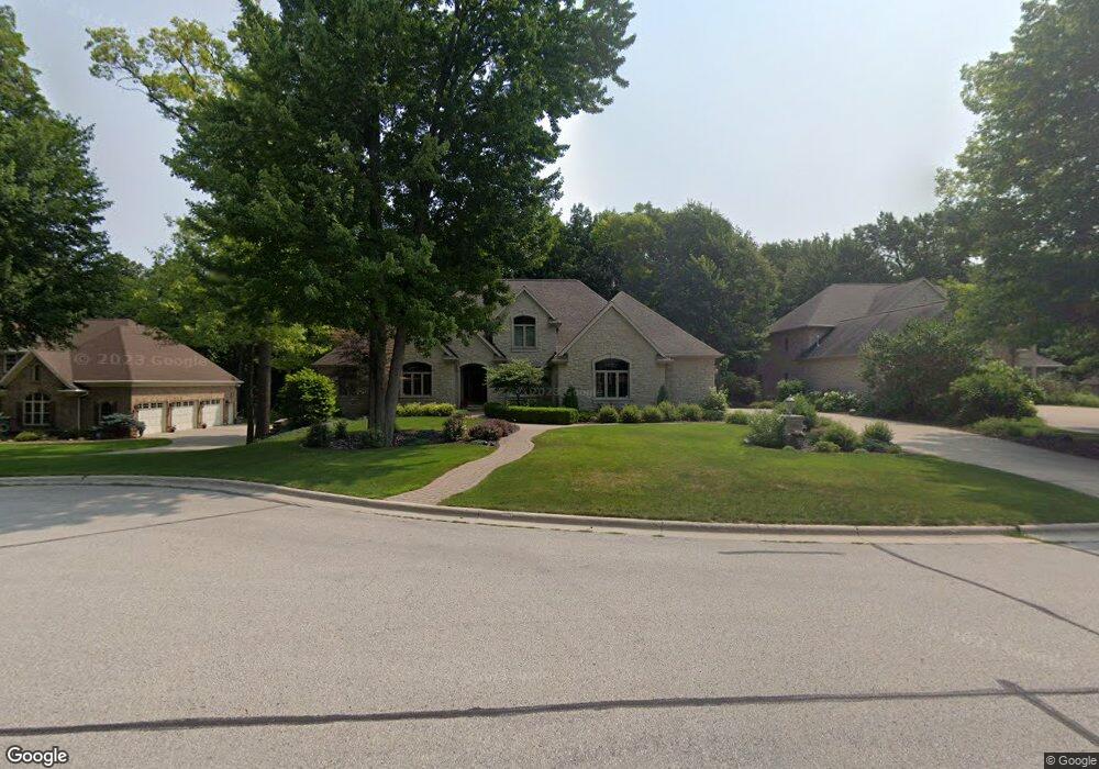
2053 Muirwood Ct Green Bay, WI 54313
Westside NeighborhoodEstimated Value: $782,019 - $905,000
6
Beds
5
Baths
4,938
Sq Ft
$174/Sq Ft
Est. Value
About This Home
This home is located at 2053 Muirwood Ct, Green Bay, WI 54313 and is currently estimated at $861,673, approximately $174 per square foot. 2053 Muirwood Ct is a home located in Brown County with nearby schools including King Elementary School, Lombardi Middle School, and Southwest High School.
Ownership History
Date
Name
Owned For
Owner Type
Purchase Details
Closed on
Mar 16, 2021
Sold by
Gerbers Terry J and Gerbers Kathleen E
Bought by
Gerbers Terry J and Gerbers Kathleen E
Current Estimated Value
Home Financials for this Owner
Home Financials are based on the most recent Mortgage that was taken out on this home.
Original Mortgage
$560,000
Interest Rate
2.73%
Mortgage Type
Credit Line Revolving
Create a Home Valuation Report for This Property
The Home Valuation Report is an in-depth analysis detailing your home's value as well as a comparison with similar homes in the area
Home Values in the Area
Average Home Value in this Area
Purchase History
| Date | Buyer | Sale Price | Title Company |
|---|---|---|---|
| Gerbers Terry J | -- | Mortgage Connect Lp |
Source: Public Records
Mortgage History
| Date | Status | Borrower | Loan Amount |
|---|---|---|---|
| Closed | Gerbers Terry J | $560,000 |
Source: Public Records
Tax History Compared to Growth
Tax History
| Year | Tax Paid | Tax Assessment Tax Assessment Total Assessment is a certain percentage of the fair market value that is determined by local assessors to be the total taxable value of land and additions on the property. | Land | Improvement |
|---|---|---|---|---|
| 2024 | $11,721 | $603,100 | $64,700 | $538,400 |
| 2023 | $11,312 | $603,100 | $64,700 | $538,400 |
| 2022 | $10,976 | $603,100 | $64,700 | $538,400 |
| 2021 | $15,381 | $632,600 | $164,200 | $468,400 |
| 2020 | $15,337 | $632,600 | $164,200 | $468,400 |
| 2019 | $14,963 | $632,600 | $164,200 | $468,400 |
| 2018 | $14,553 | $632,600 | $164,200 | $468,400 |
| 2017 | $14,225 | $632,600 | $164,200 | $468,400 |
| 2016 | $14,031 | $632,600 | $164,200 | $468,400 |
| 2015 | $14,032 | $632,600 | $164,200 | $468,400 |
| 2014 | $14,732 | $632,600 | $164,200 | $468,400 |
| 2013 | $14,732 | $632,600 | $164,200 | $468,400 |
Source: Public Records
Map
Nearby Homes
- 2768 Independence Dr
- 1940 Renaissance Ct
- 3023 Crusade Ln
- 1602 W Crusade Ln
- 3097 S Sandstone Ct
- 3096 S Sandstone Ct
- 1433 Baumgart Rd Unit 1435
- 1680 Cormier Rd
- 2060 Wintergreen Ct
- 1310 Sandstone Place
- 2993 Fleetwood Dr
- 2044 Ann Ln
- 2550 He Nis Ra Ln
- 3102 Sandstone Ct
- 2466 Parkwood Dr
- 1570 Mesa Dr
- 916 Square Terrace
- 1000 Rolling Green Dr
- 2441 Matchwood Ln
- 2439 W Point Rd
- 2063 Muirwood Ct
- 2051 Muirwood Ct
- 2060 Muirwood Ct
- 2073 Muirwood Ln
- 2083 Muirwood Ln
- 2080 Muirwood Ln
- 2964 N Muirwood Dr
- 2050 Sweetfern Dr
- 2060 Sweetfern Dr
- 2963 N Muirwood Dr
- 2930 Parkwood Dr
- 2044 Sweetfern Dr
- 2068 Sweetfern Dr
- 2094 Muirwood Ln
- 2920 Parkwood Dr
- 2070 W Muirwood Dr
- 2081 W Muirwood Dr
- 2074 Sweetfern Dr
- 2894 Sweetfern Dr
- 2057 Sweetfern Dr