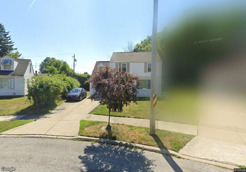
2057 Revere Rd Cleveland, OH 44118
Estimated Value: $172,000 - $211,990
4
Beds
2
Baths
1,550
Sq Ft
$123/Sq Ft
Est. Value
About This Home
This home is located at 2057 Revere Rd, Cleveland, OH 44118 and is currently estimated at $191,248, approximately $123 per square foot. 2057 Revere Rd is a home located in Cuyahoga County with nearby schools including Gearity Professional Development School, Monticello Middle School, and Cleveland Heights High School.
Ownership History
Date
Name
Owned For
Owner Type
Purchase Details
Closed on
May 9, 2018
Sold by
Penn Carolyn and Penn Carolyn Mack
Bought by
Penn Carolyn and Penn Carolyn Mack
Current Estimated Value
Purchase Details
Closed on
Mar 7, 1990
Bought by
Penn Carolyn
Purchase Details
Closed on
Nov 12, 1987
Sold by
Burkett Floyd
Bought by
Ohio Savings Bank
Purchase Details
Closed on
Jul 16, 1979
Sold by
Desatnik Mildred
Bought by
Burkett Floyd
Purchase Details
Closed on
Oct 13, 1977
Bought by
Desatnik Mildred
Purchase Details
Closed on
Aug 5, 1976
Bought by
Destnik Anne Tr
Purchase Details
Closed on
Jan 1, 1975
Bought by
Destnik Anne Tr
Create a Home Valuation Report for This Property
The Home Valuation Report is an in-depth analysis detailing your home's value as well as a comparison with similar homes in the area
Home Values in the Area
Average Home Value in this Area
Purchase History
| Date | Buyer | Sale Price | Title Company |
|---|---|---|---|
| Penn Carolyn | -- | None Available | |
| Penn Carolyn Mack | -- | None Available | |
| Penn Carolyn | $64,000 | -- | |
| Ohio Savings Bank | -- | -- | |
| Burkett Floyd | $42,900 | -- | |
| Desatnik Mildred | -- | -- | |
| Destnik Anne Tr | -- | -- | |
| Destnik Anne Tr | -- | -- |
Source: Public Records
Tax History Compared to Growth
Tax History
| Year | Tax Paid | Tax Assessment Tax Assessment Total Assessment is a certain percentage of the fair market value that is determined by local assessors to be the total taxable value of land and additions on the property. | Land | Improvement |
|---|---|---|---|---|
| 2024 | $4,805 | $66,500 | $14,980 | $51,520 |
| 2023 | $4,480 | $50,440 | $11,760 | $38,680 |
| 2022 | $4,502 | $50,440 | $11,760 | $38,680 |
| 2021 | $4,411 | $50,440 | $11,760 | $38,680 |
| 2020 | $3,748 | $40,670 | $9,490 | $31,190 |
| 2019 | $3,541 | $116,200 | $27,100 | $89,100 |
| 2018 | $3,543 | $40,670 | $9,490 | $31,190 |
| 2017 | $2,740 | $31,570 | $8,540 | $23,030 |
| 2016 | $2,734 | $31,570 | $8,540 | $23,030 |
| 2015 | $2,855 | $31,570 | $8,540 | $23,030 |
| 2014 | $2,855 | $33,950 | $9,170 | $24,780 |
Source: Public Records
Map
Nearby Homes
- 13765 Cedar Rd Unit 303C
- 3809 Warrendale Rd
- 13677 Cedar Rd
- 13726 Cedar Rd
- 13805 Cedar Rd Unit 203
- 3778 E Antisdale Rd
- 3733 E Antisdale Rd
- 3631 Cummings Rd
- 2192 Barrington Rd
- 1948 Staunton Rd
- 3781 Bushnell Rd
- 13605 Cedar Rd
- 2216 Barrington Rd
- 3797 Bushnell Rd
- 3621 Cedarbrook Rd
- 2203 Brockway Rd
- 3841 Washington Blvd
- 1913 Staunton Rd
- 2227 Cranston Rd
- 2244 Edgerton Rd
- 2063 Revere Rd
- 2051 Revere Rd
- 2064 Halsey Rd
- 2068 Halsey Rd
- 2069 Revere Rd
- 2058 Halsey Rd
- 2072 Halsey Rd
- 2045 Revere Rd
- 2054 Revere Rd
- 2054 Revere Rd
- 2052 Halsey Rd
- 2046 Revere Rd
- 2039 Revere Rd
- 2046 Halsey Rd
- 2061 Staunton Rd
- 2065 Staunton Rd
- 2040 Revere Rd
- 2069 Staunton Rd
- 2079 Staunton Rd
- 2053 Staunton Rd