Estimated Value: $334,000 - $355,000
3
Beds
2
Baths
2,326
Sq Ft
$149/Sq Ft
Est. Value
About This Home
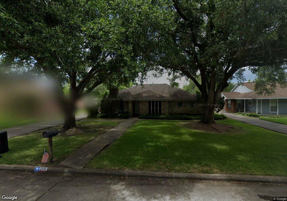
This home is located at 206 W Sherwood Dr, Alvin, TX 77511 and is currently estimated at $345,600, approximately $148 per square foot. 206 W Sherwood Dr is a home located in Brazoria County with nearby schools including R.L. Stevenson Primary School, Alvin Junior High School, and Alvin High School.
Ownership History
Date
Name
Owned For
Owner Type
Purchase Details
Closed on
Oct 31, 2014
Sold by
Phillips Alan A and Phillips Geri L
Bought by
Eubanks Charles R and Eubanks Maricela
Current Estimated Value
Purchase Details
Closed on
Jul 24, 2006
Sold by
Otto David Michael and Otto Diane Elizabeth
Bought by
Phillips Alan A and Phillips Geri L
Home Financials for this Owner
Home Financials are based on the most recent Mortgage that was taken out on this home.
Original Mortgage
$146,058
Interest Rate
6.66%
Mortgage Type
FHA
Create a Home Valuation Report for This Property
The Home Valuation Report is an in-depth analysis detailing your home's value as well as a comparison with similar homes in the area
Home Values in the Area
Average Home Value in this Area
Purchase History
| Date | Buyer | Sale Price | Title Company |
|---|---|---|---|
| Eubanks Charles R | -- | None Available | |
| Phillips Alan A | -- | Chicago Title Insurance Co |
Source: Public Records
Mortgage History
| Date | Status | Borrower | Loan Amount |
|---|---|---|---|
| Previous Owner | Phillips Alan A | $146,058 |
Source: Public Records
Tax History Compared to Growth
Tax History
| Year | Tax Paid | Tax Assessment Tax Assessment Total Assessment is a certain percentage of the fair market value that is determined by local assessors to be the total taxable value of land and additions on the property. | Land | Improvement |
|---|---|---|---|---|
| 2025 | $4,746 | $335,890 | $43,010 | $292,880 |
| 2023 | $4,746 | $277,980 | $43,010 | $297,960 |
| 2022 | $6,085 | $252,709 | $34,940 | $238,220 |
| 2021 | $5,762 | $234,000 | $33,600 | $200,400 |
| 2020 | $5,300 | $216,000 | $33,600 | $182,400 |
| 2019 | $4,976 | $189,500 | $29,570 | $159,930 |
| 2018 | $4,981 | $189,460 | $29,570 | $159,890 |
| 2017 | $5,371 | $202,150 | $30,910 | $171,240 |
| 2016 | $5,113 | $192,440 | $26,880 | $165,560 |
| 2015 | $4,161 | $186,270 | $26,880 | $159,390 |
| 2014 | $4,161 | $169,050 | $26,880 | $142,170 |
Source: Public Records
Map
Nearby Homes
- 201 W Timberlane Dr
- 3925 Larkspur St
- 111 Fairway Dr
- 204 Hillcrest Dr
- 1145 Westglen Dr
- 205 Hillcrest Dr
- 210 Hillcrest Dr
- 610 Linda Ln
- 3810 Westglen Dr
- 369 Windsor Square
- 3200 Fairway Dr
- 607 Debbie Ln
- 300 Mustang Rd
- 336 Paso Fino Dr
- 2518 County Road 160
- 817 Circle Way
- 3240 County Road 155
- 4003 Country Trails St
- 3111 Paso Fino Dr
- 394 Sherandoe Ln
- 210 W Sherwood Dr
- 202 W Sherwood Dr
- 214 W Sherwood Dr
- 207 W Larkspur Dr
- 114 W Sherwood Dr
- 203 W Larkspur Dr
- 211 W Larkspur Dr
- 113 W Larkspur Dr
- 218 W Sherwood Dr
- 207 W Sherwood Dr
- 115 E Larkspur Dr
- 211 W Sherwood Dr
- 203 W Sherwood Dr
- 215 W Sherwood Dr
- 115 W Sherwood Dr
- 219 W Larkspur Dr
- 104 W Sherwood Dr
- 105 W Larkspur Dr
- 222 W Sherwood Dr
- 219 W Sherwood Dr