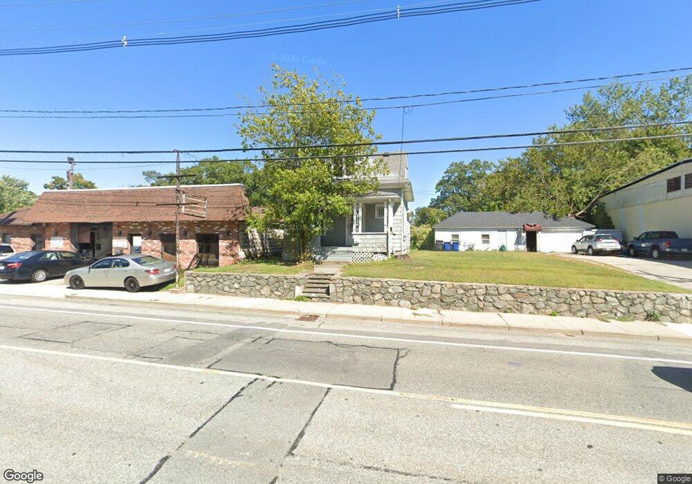
2064 Elmwood Ave Warwick, RI 02888
Lakewood NeighborhoodEstimated Value: $323,000 - $368,000
2
Beds
2
Baths
850
Sq Ft
$404/Sq Ft
Est. Value
About This Home
This home is located at 2064 Elmwood Ave, Warwick, RI 02888 and is currently estimated at $343,403, approximately $404 per square foot. 2064 Elmwood Ave is a home located in Kent County with nearby schools including St. Peter School and Saint Paul School.
Ownership History
Date
Name
Owned For
Owner Type
Purchase Details
Closed on
Nov 6, 2015
Sold by
Sorrell Robert B
Bought by
Elmwood Land Holdings
Current Estimated Value
Purchase Details
Closed on
Jan 30, 1997
Sold by
Russo Ronald H and Russo Mary
Bought by
Sorrell Robert B
Create a Home Valuation Report for This Property
The Home Valuation Report is an in-depth analysis detailing your home's value as well as a comparison with similar homes in the area
Home Values in the Area
Average Home Value in this Area
Purchase History
| Date | Buyer | Sale Price | Title Company |
|---|---|---|---|
| Elmwood Land Holdings | -- | -- | |
| Elmwood Land Holdings | -- | -- | |
| Sorrell Robert B | $70,000 | -- |
Source: Public Records
Mortgage History
| Date | Status | Borrower | Loan Amount |
|---|---|---|---|
| Previous Owner | Sorrell Robert B | $140,000 |
Source: Public Records
Tax History Compared to Growth
Tax History
| Year | Tax Paid | Tax Assessment Tax Assessment Total Assessment is a certain percentage of the fair market value that is determined by local assessors to be the total taxable value of land and additions on the property. | Land | Improvement |
|---|---|---|---|---|
| 2025 | $3,537 | $278,500 | $102,900 | $175,600 |
| 2024 | $3,272 | $226,100 | $89,400 | $136,700 |
| 2023 | $3,208 | $226,100 | $89,400 | $136,700 |
| 2022 | $3,075 | $164,200 | $58,700 | $105,500 |
| 2021 | $3,075 | $164,200 | $58,700 | $105,500 |
| 2020 | $3,075 | $164,200 | $58,700 | $105,500 |
| 2019 | $3,075 | $164,200 | $58,700 | $105,500 |
| 2018 | $2,490 | $119,700 | $58,700 | $61,000 |
| 2017 | $2,423 | $119,700 | $58,700 | $61,000 |
| 2016 | $2,423 | $119,700 | $58,700 | $61,000 |
| 2015 | $2,160 | $104,100 | $52,200 | $51,900 |
| 2014 | $2,088 | $104,100 | $52,200 | $51,900 |
| 2013 | $2,060 | $104,100 | $52,200 | $51,900 |
Source: Public Records
Map
Nearby Homes
- 447 Harrington Ave
- 1052 Post Rd
- 1153 Post Rd
- 341 Sumner Ave
- 35 Welfare Ave
- 63 Massasoit Dr
- 27 Frederick St
- 126 Fairfax Dr
- 396 Elm St
- 120 Gould Ave
- 35 Manson Ave
- 110 Heath Ave
- 208 Negansett Ave
- 158 Underwood Ave
- 93 Grotto Ave
- 110 Pilgrim Pkwy Unit 8
- 63 Benbridge Ave
- 169 Partition St
- 93 Easton Ave
- 150 Riverside Ave
- 2058 Elmwood Ave
- 2078 Elmwood Ave
- 2069 Elmwood Ave
- 2071 Elmwood Ave
- 2077 Elmwood Ave
- 2043 Elmwood Ave
- 2043 Elmwood Ave Unit 1
- 2083 Elmwood Ave
- 2053 Elmwood Ave
- 364 Harrington Ave
- 362 Harrington Ave
- 372 Harrington Ave
- 374 Harrington Ave
- 360 Harrington Ave
- 390 Harrington Ave
- 1074 Post Rd
- 394 Harrington Ave
- 2027 Elmwood Ave
- 342 Harrington Ave
- 371 Harrington Ave