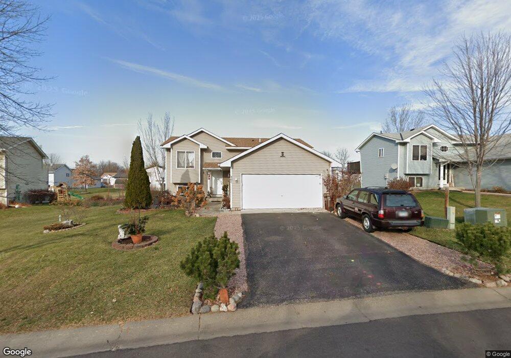
207 Crystal Ln Montrose, MN 55363
Estimated Value: $277,698 - $298,000
3
Beds
1
Bath
974
Sq Ft
$299/Sq Ft
Est. Value
About This Home
This home is located at 207 Crystal Ln, Montrose, MN 55363 and is currently estimated at $290,925, approximately $298 per square foot. 207 Crystal Ln is a home located in Wright County with nearby schools including Montrose Elementary School, Buffalo Community Middle School, and Buffalo Senior High School.
Ownership History
Date
Name
Owned For
Owner Type
Purchase Details
Closed on
Jan 30, 2020
Sold by
Estrada Fernando A
Bought by
Arancibia Francisco G Lopez
Current Estimated Value
Purchase Details
Closed on
Aug 8, 2003
Sold by
Forsman Adam P and Forsman Sally A
Bought by
Lopez Arancibia Francisco G and Estrada Fernando A
Purchase Details
Closed on
Jan 25, 2001
Sold by
Pilot Land Development Co
Bought by
Forsman Adam P and Forsman Sally A
Create a Home Valuation Report for This Property
The Home Valuation Report is an in-depth analysis detailing your home's value as well as a comparison with similar homes in the area
Home Values in the Area
Average Home Value in this Area
Purchase History
| Date | Buyer | Sale Price | Title Company |
|---|---|---|---|
| Arancibia Francisco G Lopez | -- | None Available | |
| Lopez Arancibia Francisco G | $167,000 | -- | |
| Forsman Adam P | $143,543 | -- |
Source: Public Records
Tax History Compared to Growth
Tax History
| Year | Tax Paid | Tax Assessment Tax Assessment Total Assessment is a certain percentage of the fair market value that is determined by local assessors to be the total taxable value of land and additions on the property. | Land | Improvement |
|---|---|---|---|---|
| 2025 | $3,048 | $247,200 | $50,000 | $197,200 |
| 2024 | $3,052 | $253,600 | $65,000 | $188,600 |
| 2023 | $3,068 | $274,500 | $81,000 | $193,500 |
| 2022 | $2,830 | $254,500 | $72,000 | $182,500 |
| 2021 | $2,726 | $204,500 | $40,000 | $164,500 |
| 2020 | $2,674 | $193,400 | $35,000 | $158,400 |
| 2019 | $2,312 | $186,700 | $0 | $0 |
| 2018 | $2,032 | $147,800 | $0 | $0 |
| 2017 | $1,828 | $130,000 | $0 | $0 |
| 2016 | $1,740 | $0 | $0 | $0 |
| 2015 | $1,704 | $0 | $0 | $0 |
| 2014 | -- | $0 | $0 | $0 |
Source: Public Records
Map
Nearby Homes
- 161 Mindy Ln Unit 9
- 149 Mindy Ln
- 517 2nd St S
- 305 Garfield Ave S
- 426 Dillon Ave N
- 301 Center Ave S
- 140 Garner Cir
- 151 Garner Cir
- 683 Aspen Ln
- 684 Aspen Ln
- 685 Aspen Ln
- 687 Aspen Ln
- 689 Aspen Ln
- 1766 US Highway 12 SW
- 690 Aspen Ln
- 691 Aspen Ln
- 692 Aspen Ln
- 693 Aspen Ln
- 137 Pheasant Ridge Dr
- 643 Fieldcrest Ave N