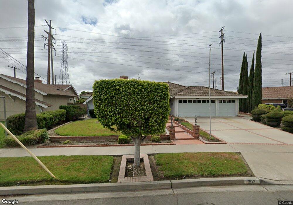
207 S Trojan St Anaheim, CA 92804
West Anaheim NeighborhoodEstimated Value: $971,000 - $1,040,000
4
Beds
2
Baths
2,054
Sq Ft
$493/Sq Ft
Est. Value
About This Home
This home is located at 207 S Trojan St, Anaheim, CA 92804 and is currently estimated at $1,013,147, approximately $493 per square foot. 207 S Trojan St is a home located in Orange County with nearby schools including Mattie Lou Maxwell Elementary School, Dale Jr High School, and Magnolia High.
Ownership History
Date
Name
Owned For
Owner Type
Purchase Details
Closed on
Oct 19, 2010
Sold by
Stevens Cecil D and Stevens Margret L
Bought by
Stevens Cecil D and Stevens Margret L
Current Estimated Value
Home Financials for this Owner
Home Financials are based on the most recent Mortgage that was taken out on this home.
Original Mortgage
$197,000
Outstanding Balance
$1,483
Interest Rate
4.31%
Mortgage Type
New Conventional
Estimated Equity
$1,011,664
Purchase Details
Closed on
Jun 16, 2004
Sold by
Stevens Cecil D and Stevens Margaret L
Bought by
Stevens Cecil D and Stevens Margaret L
Purchase Details
Closed on
Apr 2, 1996
Sold by
Neumayer Gerald A and Neumayer Phyllis M
Bought by
Stevens Cecil D and Stevens Margret L
Home Financials for this Owner
Home Financials are based on the most recent Mortgage that was taken out on this home.
Original Mortgage
$198,900
Interest Rate
7.8%
Create a Home Valuation Report for This Property
The Home Valuation Report is an in-depth analysis detailing your home's value as well as a comparison with similar homes in the area
Home Values in the Area
Average Home Value in this Area
Purchase History
| Date | Buyer | Sale Price | Title Company |
|---|---|---|---|
| Stevens Cecil D | -- | Accommodation | |
| Stevens Cecil D | -- | Lsi Title Company | |
| Stevens Cecil D | -- | -- | |
| Stevens Cecil D | $221,000 | Commonwealth Land Title Co |
Source: Public Records
Mortgage History
| Date | Status | Borrower | Loan Amount |
|---|---|---|---|
| Open | Stevens Cecil D | $197,000 | |
| Closed | Stevens Cecil D | $198,900 |
Source: Public Records
Tax History Compared to Growth
Tax History
| Year | Tax Paid | Tax Assessment Tax Assessment Total Assessment is a certain percentage of the fair market value that is determined by local assessors to be the total taxable value of land and additions on the property. | Land | Improvement |
|---|---|---|---|---|
| 2025 | $4,206 | $367,128 | $240,702 | $126,426 |
| 2024 | $4,206 | $359,930 | $235,982 | $123,948 |
| 2023 | $4,095 | $352,873 | $231,355 | $121,518 |
| 2022 | $4,053 | $345,954 | $226,818 | $119,136 |
| 2021 | $4,003 | $339,171 | $222,371 | $116,800 |
| 2020 | $3,980 | $335,694 | $220,091 | $115,603 |
| 2019 | $3,883 | $329,112 | $215,775 | $113,337 |
| 2018 | $3,834 | $322,659 | $211,544 | $111,115 |
| 2017 | $3,699 | $316,333 | $207,396 | $108,937 |
| 2016 | $3,680 | $310,131 | $203,330 | $106,801 |
| 2015 | $3,647 | $305,473 | $200,276 | $105,197 |
| 2014 | $3,466 | $299,490 | $196,353 | $103,137 |
Source: Public Records
Map
Nearby Homes
- 134 S Magnolia Ave Unit 4C
- 2770 W Lincoln Ave Unit 29A
- 2770 W Lincoln Ave Unit 40
- 2770 W Lincoln Ave Unit 58
- 199 N Magnolia Ave Unit B
- 2550 W Rowland Ave
- 507 S Shields Dr
- 2513 W Fulcrum Place
- 619 S Shields Dr
- 400 N Syracuse St
- 2709 W Madison Cir
- 2871 W Tyler Ave
- 2435 W Broadway
- 2432 W Transit Ave
- 2943 W Lincoln Ave
- 2955 W Lincoln Ave Unit 7
- 2625 W Cameron Ct Unit 121
- 2945 W Bridgeport Ave
- 605 N La Reina St
- Plan Two at Mason
- 211 S Trojan St
- 203 S Trojan St
- 2677 W Sereno Place
- 215 S Trojan St
- 2674 W Sereno Place
- 2673 W Trojan Place
- 2673 W Sereno Place
- 221 S Trojan St
- 2670 W Sereno Place
- 2669 W Trojan Place
- 2669 W Sereno Place
- 225 S Trojan St
- 2674 W Trojan Place
- 2664 W Sereno Place
- 2663 W Trojan Place
- 2665 W Sereno Place
- 2670 W Trojan Place
- 212 S Renoak St
- 2731 W Tola Ave
- 231 S Trojan St