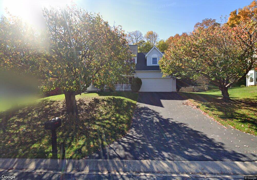
2073 Hammond Ave Marriottsville, MD 21104
Estimated Value: $640,000 - $746,000
--
Bed
3
Baths
2,542
Sq Ft
$267/Sq Ft
Est. Value
About This Home
This home is located at 2073 Hammond Ave, Marriottsville, MD 21104 and is currently estimated at $677,754, approximately $266 per square foot. 2073 Hammond Ave is a home located in Carroll County with nearby schools including Carrolltowne Elementary School, Oklahoma Road Middle School, and Liberty High School.
Ownership History
Date
Name
Owned For
Owner Type
Purchase Details
Closed on
Mar 19, 2021
Sold by
Smith Scott K and Smith Nancy A
Bought by
Smith Scott
Current Estimated Value
Home Financials for this Owner
Home Financials are based on the most recent Mortgage that was taken out on this home.
Original Mortgage
$200,000
Outstanding Balance
$179,888
Interest Rate
2.9%
Mortgage Type
New Conventional
Estimated Equity
$497,866
Purchase Details
Closed on
May 13, 1994
Sold by
Senate Carroll Inc
Bought by
Smith Scott K
Home Financials for this Owner
Home Financials are based on the most recent Mortgage that was taken out on this home.
Original Mortgage
$196,000
Interest Rate
7.93%
Purchase Details
Closed on
Dec 30, 1992
Sold by
Harvest Farm Joint Venture
Bought by
Senate Carroll Inc
Create a Home Valuation Report for This Property
The Home Valuation Report is an in-depth analysis detailing your home's value as well as a comparison with similar homes in the area
Home Values in the Area
Average Home Value in this Area
Purchase History
| Date | Buyer | Sale Price | Title Company |
|---|---|---|---|
| Smith Scott | -- | Accommodation | |
| Smith Scott K | $217,900 | -- | |
| Senate Carroll Inc | $632,500 | -- |
Source: Public Records
Mortgage History
| Date | Status | Borrower | Loan Amount |
|---|---|---|---|
| Open | Smith Scott | $200,000 | |
| Closed | Smith Scott K | $196,000 |
Source: Public Records
Tax History Compared to Growth
Tax History
| Year | Tax Paid | Tax Assessment Tax Assessment Total Assessment is a certain percentage of the fair market value that is determined by local assessors to be the total taxable value of land and additions on the property. | Land | Improvement |
|---|---|---|---|---|
| 2025 | $5,603 | $515,633 | $0 | $0 |
| 2024 | $5,603 | $480,400 | $180,000 | $300,400 |
| 2023 | $5,435 | $465,433 | $0 | $0 |
| 2022 | $5,268 | $450,467 | $0 | $0 |
| 2021 | $10,648 | $435,500 | $160,000 | $275,500 |
| 2020 | $5,048 | $428,900 | $0 | $0 |
| 2019 | $4,973 | $422,300 | $0 | $0 |
| 2018 | $4,856 | $415,700 | $160,000 | $255,700 |
| 2017 | $4,685 | $400,367 | $0 | $0 |
| 2016 | -- | $385,033 | $0 | $0 |
| 2015 | -- | $369,700 | $0 | $0 |
| 2014 | -- | $361,367 | $0 | $0 |
Source: Public Records
Map
Nearby Homes
- 7025 Macbeth Way
- 7010 Macbeth Way
- 6819 Ridge Rd
- 1714 Botanical Ct Unit 23
- 1712 Botanical Ct Unit 22
- 7090 Saddle Dr
- 6670 Slacks Rd
- 1809 Fallstaff Ct
- Lot 1 Carroll Highlands Rd
- 6565 Macbeth Way
- 6741 Quad Ln
- 2010 Rudy Serra Dr Unit C
- 2023 Rudy Serra Dr Unit 2D
- 1909 Lennox Dr Unit 90
- 2016 Rudy Serra Dr Unit A
- 2016 Rudy Serra Dr Unit C
- 7140 Brangles Rd
- 6515 Dundee Dr Unit 240
- 1822 Cassandra Dr Unit 117
- 1900 Lennox Dr Unit 41
- 2071 Hammond Ave
- 2075 Hammond Ave
- 1904 Canter Ln
- 1906 Canter Ln
- 1910 Canter Ln
- 1902 Canter Ln
- 2072 Hammond Ave
- 2074 Hammond Ave
- 1891 Blacksmith Dr
- 1881 Blacksmith Dr
- 2070 Hammond Ave
- 2076 Hammond Ave
- 1877 Blacksmith Dr
- 1921 Blacksmith Dr
- 2078 Hammond Ave
- 1900 Canter Ln
- 1875 Blacksmith Dr
- 1911 Canter Ln
- 2080 Hammond Ave
- 1901 Canter Ln